Introduction to Drone Realestate Photography
In recent years, drone technology has revolutionized the landscape of real estate marketing, providing a dynamic and immersive perspective that traditional photography simply cannot match. This innovative approach allows real estate professionals to showcase properties with aerial views, capturing the entire property footprint and its surroundings in a single shot. As a city known for its luxurious estates and vibrant neighborhoods, Miami has witnessed a significant surge in leveraging drone realestate photography to attract potential buyers and stand out in a competitive market.
Utilizing drones equipped with high-resolution cameras, real estate marketers can produce stunning visuals that highlight a property’s unique features, such as expansive gardens, waterfront access, or proximity to key amenities. These captivating images and videos create an emotional connection for viewers, making listings more memorable and engaging. The rapid adoption of drone technology in Miami's real estate sector underscores its effectiveness in enhancing online listings and providing a competitive edge for real estate agents and agencies.
Moreover, the integration of drone footage into virtual tours and marketing campaigns provides an interactive experience, allowing potential buyers to explore properties remotely with a comprehensive understanding of the property’s layout and surroundings. As Miami continues to grow as a real estate hub, drone photography stands out as a vital tool that not only elevates property presentation but also influences buyer engagement and decision-making processes.
In an era where visual content dominates digital platforms, the strategic use of drone technology has become indispensable for real estate professionals aiming to maximize exposure. It demonstrates a commitment to modern marketing techniques, appealing to a tech-savvy audience eager for innovative property viewing experiences. The expansive viewpoints afforded by drones make it possible to capture Miami’s diverse and vibrant neighborhoods uniquely, giving prospective buyers a clear and compelling reason to consider each listing.
Legal and Regulatory Considerations in Miami
When engaging in drone real estate photography within Miami, it is imperative to adhere to official guidelines that regulate drone operations to ensure safety and compliance. These protocols are established by authorities overseeing airspace management and aerial applications, emphasizing responsible drone use. Operators must obtain the necessary authorizations, such as registration with the Federal Aviation Administration (FAA), which involves providing detailed information about the drone and the intended activities.
Proper licensing is a fundamental step. Certified drone pilots with a current remote pilot certificate demonstrate proficiency in operating drones safely and understanding airspace regulations. This credential ensures that pilots are well-versed in maintaining operational standards, particularly when capturing property footage in densely populated urban areas like Miami.
Operators are also expected to respect privacy boundaries, avoiding intrusive flight paths that could infringe on private properties or violate personal privacy rights. Establishing clear flight zones and executing flight plans in collaboration with property owners reinforces ethical practices.
Furthermore, Miami's local ordinances may impose additional restrictions on drone flight, especially around airports, heliports, or other protected airspace. Prior consultation with relevant aviation authorities or local government agencies can help clarify permissible flight parameters, preventing potential disruptions and legal complications.
To maintain professional standards and avoid penalties, it is crucial for drone operators engaged in real estate photography to keep detailed records of all flight activities, including flight logs, authorization documents, and images captured. This documentation not only provides accountability but also demonstrates adherence to official requirements.
By following these structured, authority-approved procedures, real estate professionals and drone operators can effectively leverage aerial imagery to enhance property listings, while ensuring safety and professionalism in every flight. Strict adherence to these methods fosters a trustworthy relationship with clients and stakeholders, reinforcing a reputation for quality and responsible practice in Miami’s vibrant real estate market.
Legal and Regulatory Considerations in Miami
To execute drone real estate photography effectively and efficiently in Miami, understanding the framework that governs aerial operations is essential. Operating drones for commercial purposes, particularly in real estate, requires adherence to established policies that ensure safe airspace utilization and respect for local jurisdictions. Drone operators must secure appropriate permissions and adhere to operational protocols that facilitate smooth workflows while maintaining compliance with Miami’s specific guidelines.
One of the core practices involves obtaining necessary authorizations through formal submissions to relevant authorities. These applications typically include detailed flight plans, safety protocols, and purpose descriptions to demonstrate responsible usage. Engaging with local aviation agencies or overseeing bodies provides clarity on permissible operational parameters and helps avoid conflicts with other airspace uses.

While flying within these parameters, drone pilots should meticulously maintain records of each operation. These records generally encompass flight logs, data on payload weight, flight duration, and the specific areas traversed. Keeping detailed documentation supports accountability and provides a transparent audit trail that can demonstrate compliance with operational standards.
Miami also enforces specific zoning and flight restrictions, especially around sensitive zones such as airports, municipal buildings, or private properties. Operators should consult official charts and local regulatory updates regularly to stay informed about restricted zones and temporary flight restrictions, which may be in place during special events or certain times of the day.
Beyond acquiring permits, drone operators should ensure their equipment complies with technical standards — including GPS calibration, stabilization systems, and camera calibration — to facilitate high-quality imagery. Familiarity with relevant software for flight planning and data management also supports safe and precise operations.
Operational safety is paramount in drone real estate photography. This involves pre-flight risk assessments, establishing clear communication channels among team members, and performing regular equipment checks. By integrating these safety practices into the standard workflow, professionals uphold a high standard of operation that benefits clients and preserves the integrity of the Miami airspace.
Legal and Regulatory Considerations in Miami
Successfully leveraging drone technology for real estate in Miami requires a comprehensive understanding of the operational parameters set by local authorities. While certain zones may impose restrictions, there are established procedures for obtaining necessary clearances that facilitate seamless drone operations. Engaging with the official channels for permits often involves submitting detailed flight plans, including flight paths, intended altitudes, and specific mission objectives. Maintaining accurate records and adhering to prescribed operational limits help ensure your efforts are both compliant and efficient.
Miami's urban landscape, characterized by its dense architecture and proximity to airports and municipal facilities, necessitates meticulous planning. Drone operators routinely consult official geographic information systems (GIS) and aeronautical charts to identify areas with temporary or permanent restrictions. By staying updated on these overlays, you can modify flight plans proactively, avoiding airspace conflicts and ensuring unobstructed captures of properties.
Providing high-quality aerial imagery involves more than just capturing stunning visuals; it requires technical precision and adherence to operational standards. This includes calibrating drone equipment accurately, ensuring GPS systems function correctly to maintain stable flight paths, and configuring cameras for optimal imaging. Software tools used in flight planning enable operators to simulate routes, check for potential obstacles, and time missions to avoid conflicts with air traffic or local events.
Pre-flight checklists are indispensable, encompassing battery status, sensor calibration, communication system integrity, and emergency protocols. Conducting these checks systematically minimizes unforeseen issues during operations, safeguarding both the equipment and the surrounding environment. Proper documentation of each flight, including environmental conditions and technical parameters, underpins transparent workflows and supports ongoing compliance efforts.
Operational Safety and Responsible Use
Ensuring safety in drone real estate photography encompasses a comprehensive approach: conducting risk assessments to identify potential hazards, implementing clear communication strategies within the team, and enforcing stringent equipment checks before each flight. Establishing safety zones around critical infrastructure and sensitive sites reduces unintended disturbances, aligning with best practices in aerial operations.
Additionally, engaging with local authorities and community stakeholders promotes responsible use, fostering trust and facilitating productive collaborations. Maintaining open lines of communication about your projects minimizes disruptions and creates a positive environment for aerial photography activities in Miami's vibrant neighborhoods.
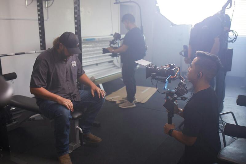
Essential Equipment and Techniques for Drone Photography
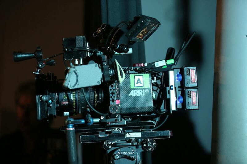
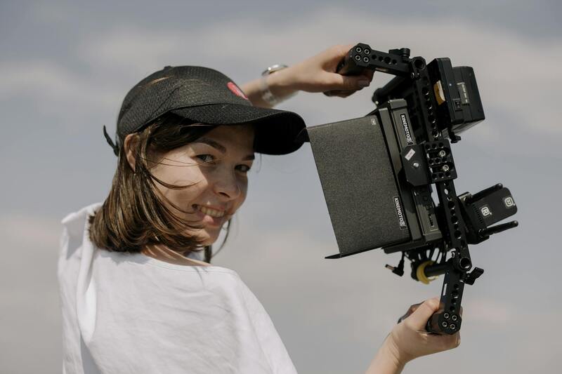
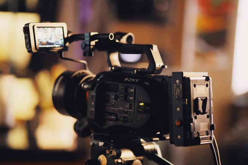
Achieving high-quality drone real estate imagery requires a combination of the right equipment and refined techniques. Professional-grade drones equipped with high-resolution cameras, such as those capable of capturing 4K or even 8K footage, are fundamental. These drones often feature advanced stabilization systems, ensuring clear, steady images even in windy conditions or during rapid maneuvers. Additionally, payload options like wide-angle lenses help capture expansive property landscapes, emphasizing the scale and beauty of the real estate being showcased.
Pre-configuration of camera settings is vital. Manual controls for ISO, shutter speed, and aperture allow for optimal exposure tailored to specific lighting conditions. Utilizing ND filters can mitigate excessive brightness, resulting in balanced imagery with rich color depth and minimal glare. Employing HDR (High Dynamic Range) techniques through automated bracketing can help produce images that capture the full range of details in both shadows and highlights.
Flight planning and execution are equally critical. Mission planning tools enable operators to set precise flight paths, ensuring comprehensive coverage of the property from perfect angles. Planning for different elevations offers diverse perspectives, highlighting features such as expansive lawns, rooftops, or architectural details. Flying at consistent altitudes and following predefined routes replicate the smooth, cinematic appearance that prospective buyers find appealing.

Operators should conduct thorough pre-flight checks. This includes verifying battery levels, calibrating sensors, assessing GPS signal strength, and ensuring communication systems are functioning properly. Maintaining a detailed flight log is essential for tracking performance, troubleshooting issues, and supporting compliance protocols. Incorporating weather assessments into pre-flight routines minimizes risks associated with sudden wind gusts or rain, which can compromise shot quality or drone stability.
Post-flight, careful review of footage allows for identifying the best captures. Utilizing software for color correction enhances vibrancy and detail, while stabilization tools smooth out any minor jitters. Combining multiple shots through stitching software can create comprehensive panoramic views, perfect for showcasing entire properties or neighborhood scenes. These professional techniques ensure each drone capture aligns with marketing goals, offering visually compelling content that appeals to prospective buyers and investors.
Compiling Professional and Effective Drone Imagery for Real Estate
When utilizing drone technology for real estate marketing, the focus extends beyond capturing stunning visuals to ensuring that those visuals meet high standards of quality and authenticity. High-caliber drone imagery plays a crucial role in creating an engaging, informative property presentation that resonates with prospective buyers and investors. To achieve this, professionals leverage several official and effective methods that prioritize safety, image quality, and compliance.
Methodical Flight Planning and Execution
Developing a detailed flight plan is vital for capturing consistent, high-quality footage. This process involves selecting optimal flight paths that maximize property coverage, including aerial shots that showcase the entire estate, unique architectural details, landscaping features, and the surrounding neighborhood context. By pre-defining flight routes, operators minimize abrupt maneuvers and maintain steady camera angles, resulting in smooth, cinematic footage.
Utilizing waypoint navigation systems within drone software allows precise control over the flight path, ensuring repeatability across multiple shoots or different properties. During planning, operators evaluate environmental conditions, such as wind speed and light levels, to determine the safest and most effective times for flight operations. This diligence reduces the risk of compromised footage quality and potential equipment issues.
Equipment Calibration and Settings Optimization
- Adjust camera parameters for optimal exposure, white balance, and resolution, tailored to the specific lighting conditions of each shoot.
- Use ND filters to manage reflections and enhance color vibrancy, especially in bright daylight scenarios.
- Implement stabilization settings and gimbal calibration to prevent jitter and ensure crisp imagery.

Post-Flight Data Management and Image Processing
Post-flight procedures are equally critical. Reviewing raw footage allows the identification of the best shots, which are then processed using professional editing software. These tools enable color correction, contrast enhancement, and stabilization adjustments to produce visually appealing content. Stitching multiple images can generate high-resolution panoramic views that effectively showcase entire properties or neighborhood landscapes.
Data management extends to maintaining detailed logs of flight parameters and recorded footage. This practice supports ongoing quality assurance and helps streamline future operations. For properties with complex landscaping or architectural features, capturing multiple vantage points ensures comprehensive visual coverage that can be tailored to specific marketing needs.
Authentic Representation and Compliance
It's essential that all drone captures accurately reflect the property's features without distortion. Operators should employ high-resolution cameras and avoid overly manipulated shots that could mislead viewers. Maintaining transparency in visual representation reinforces trust and supports informed decision-making among prospective buyers.
Integrating Drone Content into Broader Marketing Strategies
Once high-quality images and videos are produced, integrating these visuals into property listings, social media campaigns, and virtual tours amplifies their reach. Use platforms that support high-resolution media to preserve the integrity of the footage. Incorporating aerial views into virtual walkthroughs offers potential buyers a comprehensive perspective that static images cannot provide, enhancing engagement and interest.
Ensuring Compliance with Official Methods in Drone Realestate Photography
When incorporating drone technology into real estate marketing, it is paramount to adhere to recognized official practices that uphold safety, privacy, and operational standards. This approach not only ensures smooth execution of aerial imaging projects but also sustains the professional reputation of your services within the Miami real estate market.
One fundamental aspect involves obtaining appropriate authorizations from relevant authorities before conducting drone flights. This typically includes submitting detailed flight plans that specify the intended areas, altitudes, and times to ensure operations do not interfere with other airspace users. Engaging with authorized certification programs demonstrates a commitment to responsible drone management, which can be verified through official records and licensing bodies.
It is equally important to implement comprehensive risk assessment procedures. These involve analyzing the flight environment for potential obstacles, restricted zones, and sensitive areas that require heightened precautions. Explicitly documenting these assessments ensures that all operations adhere to established safety guidelines, fostering trust with clients and stakeholders.
Employing certified drone operators with proven track records offers additional assurance. These professionals are trained to manage safety protocols effectively and understand the nuances of aerial filming in urban settings like Miami. Their expertise minimizes potential disruptions and enhances image quality by ensuring stable, well-composed footage.
Maintaining detailed records of each flight, including location permits, flight logs, and footage batches, supports accountability and future reference. Such documentation can be crucial if any questions arise about operational standards or for periodic audits by regulatory agencies.
Utilizing geographically aware technology, such as geofencing and real-time flight monitoring, ensures deviations from designated zones are avoided. These measures are part of officially endorsed practices that contribute to secure and precise drone operations, resulting in superior visual content for property marketing.

Similarly, engaging with local authorities and professional associations promotes transparency and alignment with accepted standards. Staying informed about updates to airspace policies helps operators adapt to evolving regulations, thus safeguarding the integrity of drone-based real estate marketing efforts.
Implementing these recognized methods ensures that drone photography enhances property marketing while upholding the highest standards of responsibility and professionalism.
Precise Off-Official Methods for Drone Real Estate Photography in Miami
While exploring legitimate and officially sanctioned methods remains paramount for drone operators in Miami, there are a handful of additional strategies that can optimize drone real estate photography without stepping outside accepted practices. These approaches focus on leveraging advanced technology, meticulous planning, and continuous skill development to produce premium visual content that attracts potential buyers and enhances property visibility.
Utilizing Advanced Flight Planning Software
One essential component for professional drone photography involves sophisticated flight planning tools. These software platforms enable operators to meticulously map flight paths, set optimal camera angles, and simulate shoots before actual deployment. Such preparations minimize retakes, ensure comprehensive coverage of property exteriors, and help capture dynamic perspectives that highlight architectural features and landscaping details. Implementing professional-grade planning solutions also assists in adhering to airspace guidelines and maintaining consistent footage quality.
Applying High-Resolution and HDR Imaging Techniques
To maximize the allure of real estate visuals, drone pilots should employ high-resolution cameras equipped with HDR (High Dynamic Range) capabilities. These technical features ensure that images are sharp, color-rich, and capable of capturing subtle details in varying lighting conditions. When integrated with precise flight stabilization systems, these tools significantly improve image clarity, allowing potential buyers to appreciate property details as if they were viewing them in person. Regular calibration and maintenance of camera systems are vital to sustain optimal performance.

Employing Real-Time Data Monitoring and Adaptive Shooting
Modern drone platforms come equipped with real-time data feeds that allow pilots to adjust camera angles, altitude, and speed dynamically during flight. This adaptive approach ensures that each shot meets the desired framing and brightness levels, especially when lighting conditions change unexpectedly. Operators can pre-set parameters based on initial surveys and tweak them as needed, resulting in more refined footage and eliminating the need for multiple return trips to the property site.
Optimizing Post-Processing Workflow
Post-flight editing significantly elevates the quality of drone footage. Executing a disciplined workflow—using advanced editing software to correct color balances, stabilize shaky footage, and enhance contrast—ensures the final product looks polished and professional. Layering these improvements with sophisticated stitching and panorama techniques can produce stunning property showcases that stand out in the crowded Miami real estate market. Consistent training in editing tools helps operators refine their craft and deliver visually compelling content.
Adapting Content for Multiple Marketing Channels
Effective drone content isn't limited to high-resolution images alone; it also includes optimized videos suitable for social media, virtual tours, and broker websites. Utilizing snippets of aerial footage, 360-degree panoramas, and short walk-through videos tailored for different platforms enhances audience engagement. Aligning content formats with target audiences and channel specifications ensures the property gains maximum visibility across various digital channels.
Maintaining Focus on Compliance Through Education and Certification
Continual education is crucial for maintaining high standards and staying aligned with industry best practices. Attending workshops, training sessions, and certification courses related to drone operation and aerial imaging enhances skills, introduces new techniques, and fosters professional growth. These educational efforts also reinforce a comprehensive understanding of operational protocols, safety measures, and ethical considerations involved in drone real estate photography—contributing to sustained success and market reputation.