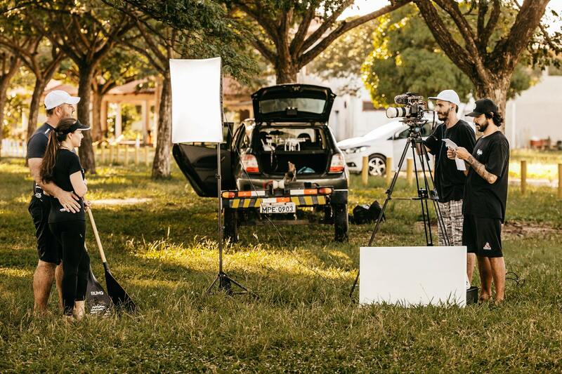
Overview of Commercial Real Estate Drone Services
In the dynamic landscape of Miami's commercial property market, the integration of drone technology has transformed the way real estate professionals showcase and analyze properties. Commercial real estate drone services involve the deployment of aerial unmanned aircraft systems (UAS) equipped with high-resolution cameras and advanced imaging tools to capture comprehensive visuals of property sites. These services facilitate the creation of detailed aerial photographs, videos, and 3D models, offering an immersive perspective that traditional ground-based photography cannot achieve.
Miami's vibrant economy, coupled with its significant commercial real estate transactions, makes drone services invaluable for providing prospective investors, tenants, and stakeholders with an accurate and compelling view of offered properties. From sprawling industrial complexes to sleek office towers and retail centers, drone services enable enhanced marketing strategies, precise site assessments, and efficient property management.
Using advanced camera stabilization and high-definition imaging, drone operators produce detailed footage that highlights property features, surrounding infrastructure, and accessibility. These tools are especially useful in Miami, where rapid urban development and the need for transparent, engaging property presentations are constantly evolving.
The ability to access hard-to-reach areas safely and efficiently makes drones a preferred solution for inspecting large-scale properties, monitoring construction progress, and conducting site evaluations. Additionally, drone services support real estate firms in generating accurate site plans, generating virtual walkthroughs, and providing investors with comprehensive market insights.
By integrating the latest in drone technology, real estate professionals are better equipped to meet the demands of Miami’s competitive commercial property sector. The use of aerial data analytics further refines decision-making processes, adds value to property listings, and accelerates sales cycles, making drone services an indispensable component in modern commercial real estate strategies.
Key Features and Technologies of Drone Services
Professional commercial real estate drone services leverage cutting-edge technological components that ensure high-quality outputs and comprehensive property analyses. Central to these capabilities are advanced high-resolution cameras, which capture crisp, detailed imagery and videos, allowing stakeholders to assess property features, surrounding infrastructure, and landscape with exceptional clarity. These cameras often incorporate gimbal stabilization systems that eliminate motion blur, ensuring steady footage whether capturing broad site views or intricate architectural details.
In addition to visual clarity, thermal imaging sensors are increasingly integrated into drone technology, providing valuable insights into aspects such as energy efficiency, insulation performance, and potential hotspots within large structures. These thermal capabilities are especially beneficial in identifying issues that are otherwise hidden from standard visual inspection, thus facilitating proactive maintenance and resource allocation.
Another significant technological advancement is the use of lidar (light detection and ranging) systems, which create precise, 3D models of the terrain and structures. These detailed models assist in planning, development, and renovation projects by providing accurate measurements of topography and existing structures. Implementing real-time data analytics, including geospatial mapping and site analytics, further enhances decision-making processes, allowing real estate professionals to visualize property attributes dynamically and make informed strategic choices.
Modern commercial drone services also utilize sophisticated flight control systems that facilitate autonomous flight paths, obstacle avoidance, and safe operation in complex environments like densely built urban areas such as Miami. These features enable seamless deployment over large or hard-to-access sites, ensuring comprehensive coverage without compromising safety or efficiency.
Legal and Regulatory Considerations
Implementing commercial real estate drone services requires meticulous adherence to established regulations that govern drone operations within Miami and broader jurisdictions. These regulations are designed to ensure safe and responsible drone use, especially in densely populated or sensitive urban environments. It is essential for service providers and clients alike to familiarize themselves with local guidelines, including no-fly zones, altitude restrictions, and operational limitations.
Operators must secure appropriate authorizations, which often involve registering drones with the relevant authorities and obtaining necessary permits for commercial use. This procedural compliance not only facilitates smooth operations but also minimizes risks associated with legal or administrative repercussions.
Furthermore, drone pilots engaged in commercial activities should hold certifications that demonstrate their proficiency in operating these sophisticated devices safely and effectively. Training that covers airspace navigation, emergency procedures, and privacy considerations ensures that operations align with best practices.
Maintaining data security and respecting privacy boundaries are also critical. Sensitive property details captured during drone flights should be handled with care, utilizing secure storage and access protocols to prevent unauthorized disclosures or misuse. Establishing clear operational boundaries and communication channels with local authorities or property owners further enhances compliance.
To optimize the integration of drone services into commercial real estate workflows, a comprehensive understanding of Miami's specific regulations and ongoing updates is vital. Regular coordination with regulatory bodies and adherence to evolving standards foster trustworthy and efficient drone operations.
Detailed Data Collection and Analysis for Commercial Real Estate
Utilizing drone services in commercial real estate in Miami significantly enhances data collection capabilities, allowing for comprehensive site analysis and detailed documentation. High-resolution aerial footage captured by drones provides stakeholders with precise visual information, which is essential for making informed decisions about property investments, renovations, and development projects.
Advanced imaging technologies, including multispectral and hyperspectral cameras, enable the analysis of land conditions, vegetation health, and potential environmental concerns without intrusive on-the-ground inspections. This detailed data supports sustainable development practices and helps identify site limitations or opportunities that may not be readily apparent through traditional assessment methods.
Effectively integrating drone technology involves meticulous planning and execution. Pre-flight surveys include planning flight paths that maximize coverage and ensure safety protocols. During the flight, real-time monitoring allows for adjustments to adapt to changing conditions, capturing the most relevant data while avoiding hazards such as power lines or other obstacles.
Post-flight, the collected data undergoes rigorous processing, including stitching aerial images into orthomosaic maps, creating 3D models, and extracting measurements. These outputs serve various purposes, from detailed site planning to marketing. They enable property managers, developers, and investors to visualize spatial relationships, assess development feasibility, and communicate project proposals effectively to clients and regulators.

The strategic use of drone-acquired data ensures that all stakeholders have access to accurate, current, and comprehensive information, streamlining decision-making processes and reducing the risk of costly errors or delays during project development phases.
Legal and Regulatory Considerations in Miami's Commercial Real Estate Drone Operations
When integrating drone services into commercial real estate activities in Miami, adherence to established regulations and guidelines is fundamental. Proper compliance ensures smooth operations, safety, and accountability across all projects involving drone technology. Operators must familiarize themselves with local, state, and federal requirements, which govern the usage of unmanned aerial vehicles (UAVs) for commercial purposes.
Miami-based drone service providers must obtain appropriate certifications and permits before conducting flights over private or public properties. This process typically involves registering the drone with relevant authorities, completing necessary safety training, and demonstrating operational competency. These measures not only promote responsible drone usage but also build confidence among clients and stakeholders in the professionalism of the service provider.
Moreover, understanding airspace regulations is critical, especially in urban environments like Miami where congested air traffic and restricted zones are prevalent. Certain areas may require special authorization or notice to air traffic control (ATC) before flight execution. This proactive approach minimizes potential conflicts and ensures that drone activities do not interfere with manned aircraft operations or emergency response efforts.
Establishing clear operational procedures forms a core part of legal compliance. These procedures include pre-flight risk assessments, establishing safe flight altitudes and distances, and implementing effective communication protocols among team members. Documentation of these steps aids in audit processes and demonstrates due diligence, fostering trust from clients and regulatory bodies alike.

In addition to federal and local regulations, drone operators should stay informed about evolving policies related to privacy and data protection. Respecting property rights and avoiding sensitive areas helps maintain ethical standards and prevents conflicts. Utilizing geofencing technology and real-time monitoring tools enhances operational safety and adherence to defined boundaries.
Overall, thoroughly understanding and implementing comprehensive legal and regulatory practices equips Miami's commercial real estate professionals to leverage drone services effectively. This diligence not only safeguards their investments and reputation but also fosters a secure environment for innovative marketing, detailed site analysis, and efficient project management.
Legal and Regulatory Considerations
When integrating drone technology into commercial real estate activities within Miami, adherence to established protocols is essential for smooth operation and ongoing compliance. Prior to conducting drone flights, thorough planning must encompass thorough risk assessments and meticulous review of local airspace regulations. This planning ensures that drone operations are executed with precision and respect for existing air traffic, vital in Miami’s busy commercial airspace.
Operators should develop and enforce comprehensive operating procedures. These include establishing predetermined flight paths, maintaining safe altitudes that avoid conflicts with manned aircraft, and ensuring effective communication protocols among team members. Such procedures are fundamental to safe mission execution and help in fulfilling the expectations set by regulatory best practices.

Documentation of these processes, including risk assessments and permit applications, is critical for demonstrating due diligence to oversight agencies. Maintaining detailed records supports transparency and fosters trust among clients, partners, and regulatory bodies, making compliance an intrinsic part of the operational workflow.
Airspace Restrictions and Permitting
Miami’s vibrant commercial sector presents diverse airspace considerations, including proximity to airports, helipads, and other sensitive zones. Drone operators must be aware of the classifications of the airspace where they intend to fly, whether it is controlled or uncontrolled. Acquiring necessary permits and authorizations from relevant authorities ensures legal operations and mitigates potential disruptions or penalties.
In addition to federal oversight by the FAA, local authorities may impose specific restrictions or guidelines that need to be followed. These can range from designated no-fly zones to special event-related curfews. Staying up-to-date with evolving policies related to privacy, data security, and operational boundaries is paramount to maintain ethical standards and operational integrity.
Utilizing features like geofencing technology, real-time monitoring, and automatic flight restrictions can enhance safety and compliance during drone missions. These tools help in preventing accidental incursions into prohibited zones and assist in maintaining operational boundaries throughout the flight process.

Understanding airspace restrictions and implementing strict operational protocols allow Miami’s commercial real estate professionals to maximize the benefits of drone services while safeguarding their investments and reputation. This disciplined approach promotes a secure environment for innovative pursuits, including detailed site analyses, marketing visuals, and project management practices, ultimately contributing to smoother project execution and strategic decision-making.
Legal and Regulatory Considerations
Implementing commercial real estate drone services in Miami involves understanding and adhering to a framework of operational guidelines designed to ensure safety, privacy, and responsible use. These protocols are established through collaboration between federal agencies, such as the Federal Aviation Administration (FAA), and local Miami authorities, creating a comprehensive environment for lawful drone operation.
Professionals seeking to utilize drone technology must familiarize themselves with the specific airspace classifications, which determine where and how they can fly. Controlled airspace requires prior authorization and adherence to strict guidelines, whereas uncontrolled airspace often allows for more flexible operation under visual line-of-sight rules. Acquiring the appropriate waivers or special use permits is critical to avoiding disruptions and ensuring smooth project execution.

Local considerations may include restrictions related to private property rights, proximity to airports, and special event restrictions. These are often subject to change, emphasizing the need for current, official information before attempting any drone flight. Implementing geofencing and automated flight limiters can further ensure compliance by preventing drones from entering restricted zones unintentionally.
Additionally, maintaining detailed records of flight paths, obtaining any necessary permissions beforehand, and following best practices for data security contribute to a professional and trustworthy operation. Staying informed about evolving policies related to privacy, aerial data collection, and operational boundaries helps safeguard stakeholder interests and uphold high standards of responsible drone usage in Miami’s thriving market.
Future Trends in Drone Technology for Commercial Real Estate
As technological advancements continue to shape the landscape of commercial real estate, drone technology in Miami is poised for significant evolution. Emerging innovations such as artificial intelligence (AI) integration and advanced 3D mapping are set to redefine how professionals visualize, analyze, and market properties. These developments facilitate more precise data collection, enabling detailed property assessments and comprehensive site analyses with unprecedented efficiency.
AI-powered drones are increasingly capable of autonomous flight, allowing for automated coverage of large or complex sites. This capability minimizes manual operation and maximizes data accuracy, providing real estate professionals with high-resolution images, thermal imaging, and detailed 3D models that can be utilized for marketing, planning, and development purposes.
Furthermore, 3D modeling technology, combined with drone-acquired data, is enabling virtual walkthroughs and interactive site plans. These tools help investors and tenants to explore properties remotely, offering a compelling way to assess commercial spaces without the need for physical visits. This not only enhances marketing strategies but also streamlines decision-making processes, making property transactions more efficient.
In Miami's vibrant real estate environment, these technological advancements are promising to increase the precision of market evaluations, improve asset management, and accelerate construction monitoring. As drones become more capable of recognizing and analyzing patterns through AI, professionals can gain predictive insights, optimize maintenance schedules, and identify potential issues early—ultimately leading to more informed investments and enhanced property management.
Another notable trend is the integration of drone data with geographic information systems (GIS), enabling highly detailed spatial analysis. This integration allows for accurate environmental and terrain assessments, crucial for large commercial developments and infrastructure projects in Miami’s diverse landscape.
Overall, the future of drone technology in commercial real estate is geared toward greater automation, smarter data utilization, and more immersive virtual experiences. Keeping abreast of these innovations ensures that Miami’s real estate professionals remain competitive, efficient, and responsive to market demands while adhering to established operational standards and best practices.
As these technologies mature, it is essential for users to stay updated with official resources, industry guidelines, and advancements to fully harness the potential of commercial real estate drone services and navigate the evolving landscape with confidence.