Understanding Commercial Property Aerial Photography
Commercial property aerial photography involves capturing high-altitude images of commercial real estate assets to provide comprehensive visual perspectives. This specialized form of imaging is essential in showcasing large-scale buildings, complexes, and land parcels from angles that are otherwise challenging to capture with traditional ground-level photography. Accurate and detailed aerial images serve as powerful tools in the marketing and assessment of commercial properties, offering potential buyers, investors, and stakeholders a vivid understanding of property layout, surrounding infrastructure, and landscape features.
The significance of commercial property aerial photography in Miami is increasingly evident due to the city's rapid urban development and vibrant real estate market. High-quality aerial imagery allows real estate professionals to highlight unique property features, proximity to key transportation hubs, waterfront views, and neighboring amenities. Such visuals enhance marketing campaigns, making properties more appealing and accessible to a wider audience.
In the context of Miami's bustling commercial real estate scene, aerial photography also plays a strategic role in site planning, land use analysis, and project visibility. Developers, investors, and city planners rely on detailed aerial images to evaluate property features and the surrounding environment efficiently. This method not only expedites decision-making processes but also provides a compelling visual narrative for stakeholders, helping to communicate complex property information effectively.
State-of-the-art aerial photography techniques involve a combination of advanced drone technology, high-resolution cameras, and sometimes helicopter or fixed-wing aircraft, depending on the scope and scale of the project. These methods ensure that the imagery captured is precise, detailed, and tailored to meet the specific needs of commercial real estate stakeholders.
Overall, commercial property aerial photography stands out as a vital component in the modern real estate marketing arsenal. Its ability to offer comprehensive visual insights significantly enhances the understanding of property assets, facilitating better marketing strategies and more informed investment decisions within Miami’s dynamic commercial property landscape.
Types of Equipment Used in Aerial Photography
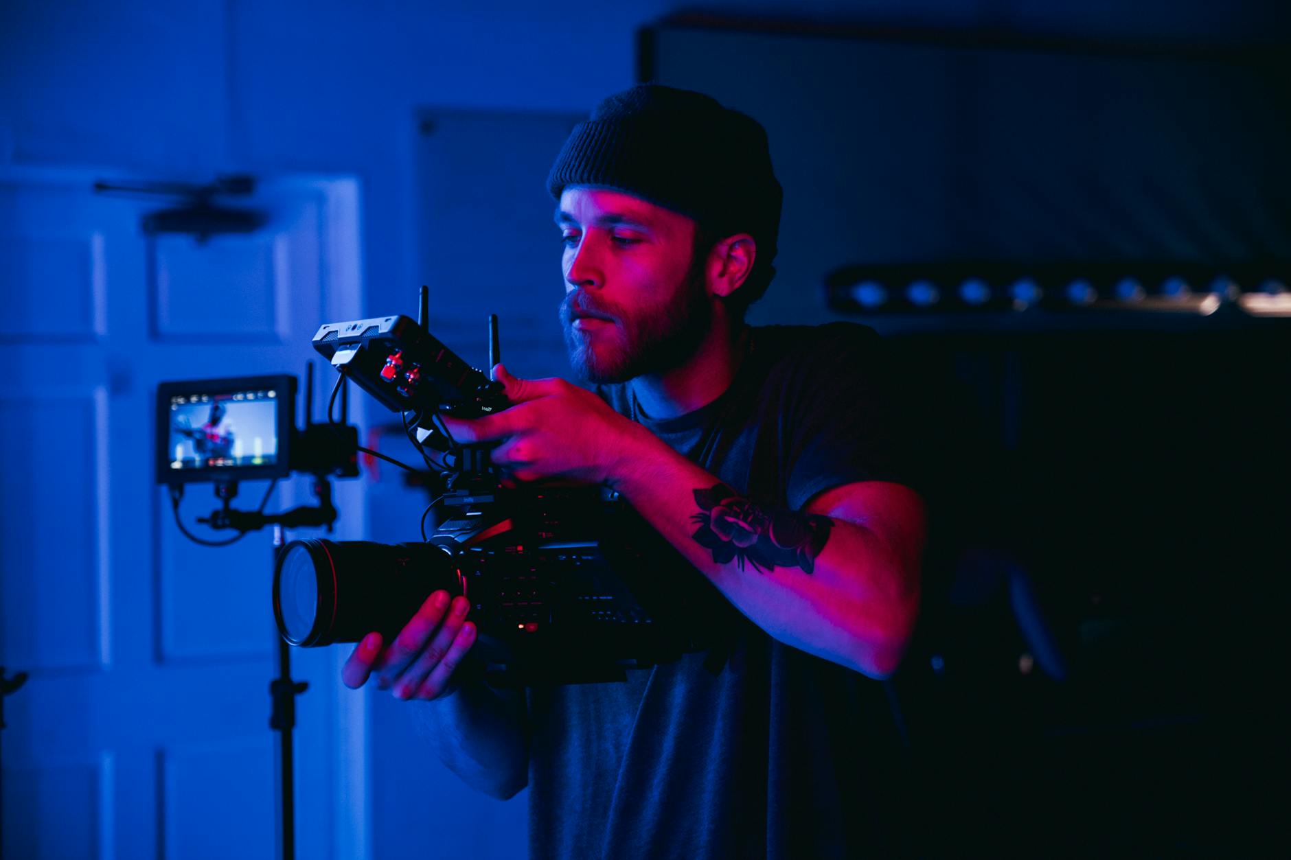
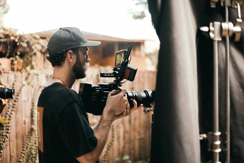
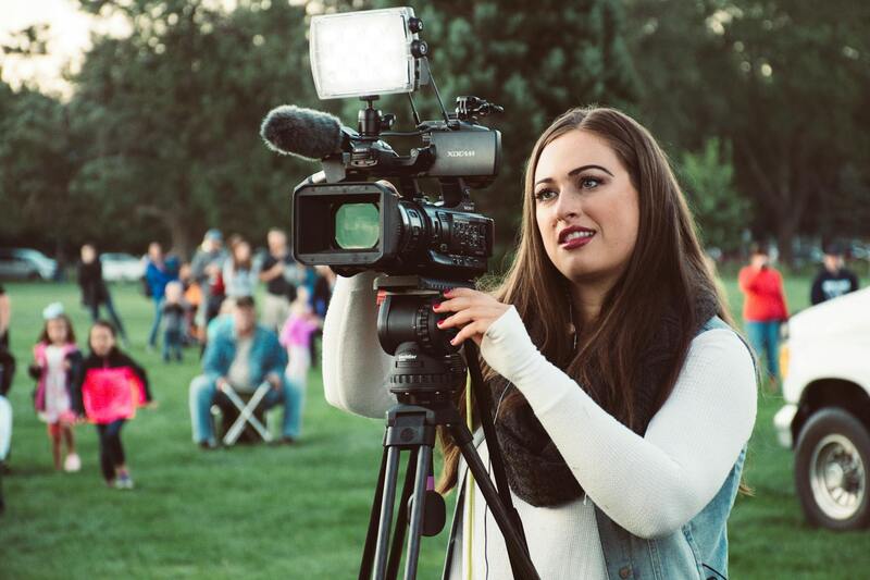
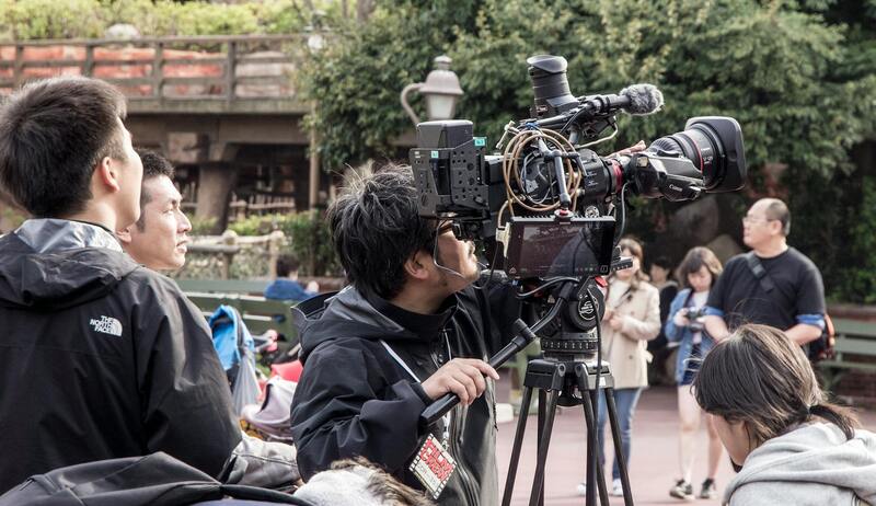
When it comes to capturing high-quality aerial images of commercial properties, the selection of equipment is crucial. The most common tools include drones equipped with advanced camera systems, helicopters, and fixed-wing aircraft, each suited to different project requirements. Drones, in particular, have revolutionized aerial photography due to their versatility, cost-effectiveness, and ability to access hard-to-reach areas. These unmanned aerial vehicles are fitted with high-resolution digital cameras capable of capturing detailed images from various altitudes and angles.
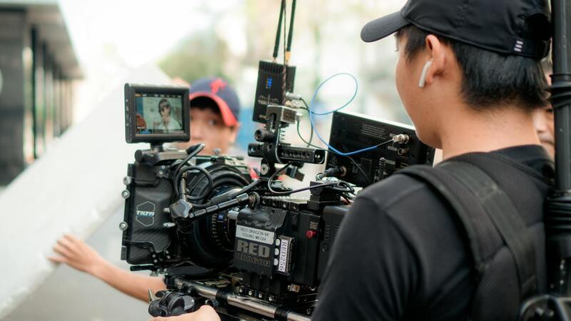
For larger-scale projects or those requiring broader coverage, manned aircraft such as helicopters or fixed-wing planes are employed. These aircraft can carry larger, high-end camera arrays, including 4K or higher resolution cameras, stabilized gimbals, and other sophisticated imaging equipment. Additionally, they facilitate prolonged shooting sessions over expansive areas, making them ideal for comprehensive site surveys and mapping.
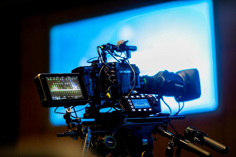
Camera technology plays a vital role in the quality of aerial images. Professional-grade, high-resolution cameras with wide-angle lenses are preferred for commercial real estate profiling. These systems often feature remote focusing capabilities, advanced stabilization, and the ability to shoot in various lighting conditions, ensuring sharp, clear images regardless of weather or time of day.
To support the equipment, specialized accessories such as GPS stabilizers, aerial imaging software, and image processing tools are integrated for precise navigation and post-capture refinement. This technological synergy enables stakeholders to obtain detailed, accurate visual data, critical for effective decision-making in Miami's competitive commercial property market.

Understanding Commercial Property Aerial Photography
Commercial property aerial photography has become an essential tool for real estate professionals, property developers, and investors seeking comprehensive visual representations of large-scale sites. Utilizing advanced imaging technology from aircraft and drones, this specialized form of photography provides a bird’s-eye perspective that enhances property listings, facilitates planning and development, and supports marketing efforts. The high-definition images captured from an elevated vantage point reveal spatial relationships, accessibility features, landscape integration, and surrounding infrastructure, offering stakeholders a complete view that ground-level photos alone cannot deliver.
Effective aerial imagery involves more than just having access to a camera and a flying platform. It requires precise planning, understanding of environmental conditions, and the deployment of equipment tailored to the specific needs of commercial real estate projects. Aerial shots can highlight key property features such as building footprints, parking layouts, easements, buffer zones, and neighboring land use. These images assist in visualizing potential developments, assessing site topography, and identifying integral connections between the property and its geographic context.

Moreover, aerial photography supports virtual tours and promotional campaigns, reaching potential buyers or tenants with compelling, detailed visuals that capture the scope and scale of the property. The clarity and depth provided by modern digital imaging allow for precise measurements and detailed inspections, further reducing the need for on-site visits during preliminary evaluation phases.
Technical Aspects and Equipment
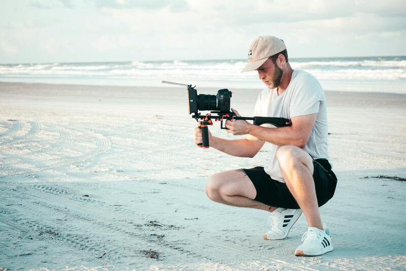
The quality of commercial property aerial photography hinges on the choice of equipment and flying techniques. Cameras used are often high-resolution digital models with wide-angle lenses, capable of capturing sharp images across various lighting conditions. These cameras are mounted on stabilized gimbals or aerial platforms that counteract motion and vibrations, ensuring steady, clear shots even in windy conditions.
- Drones: Unmanned aerial vehicles equipped with professional-grade cameras are popular for their maneuverability, affordability, and ability to access hard-to-reach places.
- Manned aircraft: For larger properties or when extensive coverage is needed, helicopters and fixed-wing planes equipped with advanced imaging systems are employed.
- Stabilization tools: Gimbal systems and GPS stabilization devices help maintain consistent framing and sharpness throughout the shoot.
Post-capture, images are processed using sophisticated software that enhances clarity, corrects lenses distortions, and provides georeferenced data that can be integrated into mapping or planning software. This synergy of hardware and software ensures stakeholders receive detailed, accurate visual data vital for decision-making in competitive markets such as Miami.
Practical Application of Equipment
Businesses in Miami utilize a combination of drone technology and traditional aircraft depending on project scope, site size, and accessibility. Professional operators ensure adherence to all operational protocols, maintaining safety and quality standards. The deployment of these methods allows developers, investors, and real estate agents to present properties with unparalleled visual context, supporting both sales and leasing strategies.
Techniques for Effective Aerial Commercial Photography
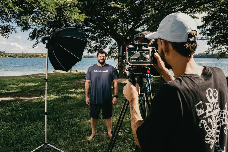
Achieving outstanding results in commercial property aerial photography requires mastery of various techniques that optimize visual impact and informational clarity. Professional photographers employ strategic shooting angles that showcase the property's best features while providing contextual surroundings. For instance, bird’s-eye views can emphasize the scale and layout of large developments, while angled shots help reveal depth and architectural details.
Lighting plays a crucial role in capturing high-quality images. Optimal timing often involves scheduling shoots during the golden hours—early morning or late afternoon—to utilize natural light that enhances textures, colors, and shadows. Such lighting conditions accentuate property features and create visually compelling images that stand out in marketing materials.
Timing is also essential to avoid potential obstructions such as busy construction activities or unfavorable weather conditions. Conducting shoots during clear, windless days ensures stability and sharpness in images, especially when using drones or aircraft-mounted cameras. Consistent planning and weather assessment are integral to maximizing the quality of aerial captures.
Angle selection should be deliberate to highlight key aspects of the property, such as entry points, parking facilities, green spaces, and surrounding infrastructure. Overhead shots that include neighboring features can provide valuable context for prospective investors or tenants. Avoiding crowded or cluttered backgrounds helps maintain focus on the property itself, ensuring viewers’ attention remains on its salient features.
Timing also involves considering seasonal changes that may impact theVisibility of the property. For example, capturing during a season when landscaping is lush can increase the visual appeal, while avoiding periods of construction or other disruptive activities can ensure a cleaner, more professional presentation.
Utilizing high dynamic range (HDR) imaging techniques allows for better detail in areas with high contrast, such as shadowed regions and brightly lit surfaces. Incorporating panoramic or stitched images can also provide comprehensive, 360-degree views of the property, offering a holistic perspective that is particularly valuable in large-scale development projects.

Additionally, post-processing plays a vital role in refining aerial images. Professionals utilize advanced editing software to enhance clarity, adjust color balance, and correct lens distortions, ensuring the final images meet high standards of presentation. Georeferencing data incorporated during editing allows integration with digital mapping platforms, facilitating precise location identification and analysis.
By employing these carefully crafted techniques, stakeholders can produce compelling aerial visuals that effectively communicate the unique selling points of commercial properties, support marketing campaigns, and assist in strategic planning efforts.
Understanding Commercial Property Aerial Photography
Commercial property aerial photography has become an essential component of modern real estate marketing, offering a unique perspective that ground-based images cannot replicate. Such imagery showcases the full scope of a property, including its size, layout, and surrounding infrastructure, giving potential buyers and investors a comprehensive understanding of the site at a glance. Accurate aerial visuals are crucial for highlighting features like landscaping, parking facilities, access routes, and neighboring developments, providing valuable context that supports strategic decision-making.
The quality of aerial images significantly impacts marketing effectiveness, with high-resolution captures helping to attract serious inquiries and facilitate competitive bids. When properly executed, aerial photography can reveal details that might be obscured or unnoticed in traditional images, emphasizing the property’s scale and its relationship with the larger urban landscape. This approach enhances transparency and confidence among stakeholders, fostering trust and engagement throughout the transaction process.
Types of Equipment Used in Aerial Photography
Successful commercial property aerial photography relies on a range of sophisticated equipment designed for optimal image capture. Manually piloted drones equipped with high-resolution cameras are now the most common tools, offering flexibility and access to challenging locations with minimal disturbance. These drones incorporate stabilizing gimbals that ensure sharp, clear images even in windy conditions, and are capable of capturing multiple angles and altitudes.
Beyond drones, manned aircrafts such as helicopters and small planes are used for larger or more complex sites, providing extensive coverage and high-altitude perspectives. These assets are fitted with advanced photographic systems, including ultra-high-definition cameras and multi-spectral sensors, to produce detailed images suitable for professional presentation and analysis. The integration of remote sensing technology can also facilitate the capturing of geospatial data, further enriching the utility of aerial imagery.
Techniques for Effective Aerial Commercial Photography
Implementing effective techniques ensures that aerial images serve their intended purpose of marketing, analysis, or planning with maximum impact. Planning flight paths carefully to include the property’s most attractive features and strategic angles is essential. Overlapping shots from multiple altitudes can be stitched together to create comprehensive panoramic visuals that offer a 360-degree view, making large or multi-faceted properties more compelling.
Timing is also critical; capturing images during optimal weather conditions—clear skies and low wind—ensures stability and clarity. Specialists often employ techniques such as HDR imaging to balance exposure across shadows and highlights, revealing intricate details and enriching the overall visual quality. Incorporating georeferenced data during post-processing enhances the integration of aerial visuals with geographic information systems, providing an accurate spatial context that benefits analysis and presentation.
Systematic use of high-interest vantage points, such as elevated angles that maximize the property's prominence, can produce striking visuals that stand out in marketing materials. Regular updates with new aerial images can also document development progress or assess property conditions over time, supporting ongoing operational and strategic decision-making.
Understanding Commercial Property Aerial Photography
Commercial property aerial photography involves capturing high-resolution images and videos from elevated vantage points to showcase the entirety of a property or complex. This approach provides a comprehensive perspective that ground-level photography cannot achieve, allowing investors, developers, and property managers to present their assets compellingly. Utilizing advanced aircraft, UAVs (unmanned aerial vehicles), and helicopters, professionals can access hard-to-reach angles and create visual content that highlights architectural features, site layouts, and surrounding infrastructure effectively.
Types of Equipment Used in Aerial Photography
Effective aerial imagery relies heavily on specialized equipment designed to deliver superior quality results. These include:
- Drones/UAVs: Compact and agile, drones equipped with high-definition cameras are increasingly preferred for their cost-efficiency and flexibility. They can maneuver around structures and capture detailed images from various angles.
- Helicopters and Small Aircraft: For larger-scale projects or expansive properties, manned aircraft provide smooth flight operations and stable platforms for high-altitude photography, often resulting in panoramic visuals.
- Camera Systems: High-resolution DSLR or mirrorless cameras with wide-angle lenses are standard, sometimes supplemented with stabilization gimbals to ensure blur-free images. Additionally, multispectral and thermal imaging sensors can be employed for specialized purposes such as environmental assessments or infrastructure analysis.
Techniques for Effective Aerial Commercial Photography
To maximize the impact of aerial imagery, professionals adopt precise methodologies that emphasize clarity and relevance. Key techniques include:
- Careful Planning of Flight Paths: Pre-mission planning ensures coverage of critical property features, including entrances, parking areas, landscaping, and neighboring infrastructure.
- Optimal Timing: Scheduling shoots during optimal weather conditions—clear skies, minimal wind, and ideal sunlight—improves image quality and minimizes post-processing corrections.
- Mosaic and Panorama Creation: Overlapping captures from different angles enable stitching images into expansive panoramas, providing comprehensive views of large sites.
- Using Georeferencing Techniques: Incorporating location data facilitates integration with geographic information systems (GIS), adding valuable context for analysis and planning.
- Post-Processing Enhancements: Techniques such as HDR imaging improve exposure balance, revealing intricate details in shadows and highlights, thus producing more compelling visuals.
Applications of Aerial Photography in Commercial Real Estate
High-quality aerial imagery offers numerous applications that enhance the valuation, marketing, and operational management of commercial properties:
- Marketing and Promotion: Striking visuals attract potential buyers and tenants, providing a unique perspective that sets listings apart.
- Site Planning and Development: Developers utilize aerial images for layout planning, assessing environmental impacts, and coordinating construction phases.
- Property Condition Monitoring: Regular aerial imaging helps track changes over time, identifying issues such as structural deterioration or landscaping needs.
- Border and Perimeter Surveillance: High vantage points facilitate detailed assessments of fencing, boundary lines, and security measures.
- Compliance and Regulatory Documentation: Aerial photos serve as official records for land use and zoning compliance with environmental and municipal standards.
Understanding Commercial Property Aerial Photography
Commercial property aerial photography plays a crucial role in modern property assessment, marketing, and management strategies. It involves capturing high-altitude images of commercial assets, such as office complexes, retail centers, industrial sites, and land parcels, using specialized equipment designed for aerial perspectives. These images provide a comprehensive visual overview that highlights property features, surrounding environments, and contextual details often inaccessible from ground level. Aside from aiding in property valuation and development planning, aerial photography also enhances marketing efforts by delivering striking visuals that draw attention to listings and projects. The ability to showcase a property from multiple angles, including entire sites, roads, and neighboring infrastructure, makes aerial imagery invaluable for stakeholders seeking accurate and compelling visual documentation.
Legal and Regulatory Considerations in Miami
In Miami, conducting aerial photography for commercial purposes involves adhering to specific operational standards that ensure safety, privacy, and compliance with aviation regulations. Operators typically need to secure permits from local authorities and coordinate with the Federal Aviation Administration (FAA) to navigate altitude restrictions, no-fly zones, and security guidelines. Prior consultation with municipal planning departments can also help navigate land use restrictions and zoning laws relevant to aerial survey activities. It is essential to work exclusively with licensed professionals who understand the nuances of Miami’s airspace regulations. These experts are adept at planning flight paths that avoid restricted zones, safeguarding the project from potential setbacks. Additionally, respecting privacy boundaries and property rights is paramount; operators should obtain necessary permissions from property owners and ensure their workflows avoid intrusive behavior.
Types of Equipment Used in Aerial Photography
- Multirotor Drones: Suitable for close-up, high-detail shots with agile maneuverability and ease of deployment.
- Fixed-Wing Aircraft: Used for covering larger areas efficiently, often flying at higher altitudes for wide-angle shots.
- Helicopters and Light Aircraft: Ideal for extensive site surveys requiring stable, high-quality imagery from higher altitudes.
- High-Resolution Cameras: Equipped with stabilized gimbals to capture sharp, distortion-free images in various lighting conditions.
- LiDAR and Infrared Sensors: Applied for detailed topographical mapping and vegetation analysis, supporting infrastructure planning and environmental assessments.
Techniques for Effective Aerial Commercial Photography
Achieving high-quality imagery in commercial aerial photography hinges on meticulous planning and execution. Pre-flight surveys include assessing weather conditions, choosing optimal flight paths, and ensuring legal clearances. During flights, operators focus on stable camera mounting, precise positioning, and consistent lighting conditions. Post-flight, images undergo processing with advanced software for color correction, HDR merging, and distortion removal to produce visually appealing and accurate representations of properties. Implementing overlapping shots allows for seamless stitching in panoramic views, broadening the perspective and providing comprehensive visual documentation. Strategic timing, such as capturing images during a property’s optimal lighting or avoiding shadow interference, further enhances visual clarity and appeal.
Applications of Aerial Photography in Commercial Real Estate
High-quality aerial imagery supports numerous facets of commercial property development and management:
- Marketing and Promotional Activities: Engaging visuals attract investors, tenants, and buyers by showcasing properties' scope and surroundings effectively.
- Site Planning and Development: Developers utilize aerial images to assess land features, identify environmental constraints, and optimize layout designs efficiently.
- Property Condition Monitoring: Regular aerial surveys help detect structural issues, landscaping deterioration, or unauthorized modifications over time.
- Perimeter and Security Assessments: Elevated vantage points allow detailed inspections of fencing, gates, and security infrastructure.
- Regulatory Compliance: Aerial photographs serve as official visual records supporting zoning, environmental reviews, and land use documentation.
Advanced Techniques and Equipment Integration in Commercial Property Aerial Photography
To achieve high-quality aerial imagery that accurately captures the intricacies of commercial properties, professionals employ sophisticated techniques coupled with cutting-edge equipment. The integration of drone technology, stabilized camera systems, and advanced imaging software significantly enhances the quality and efficiency of aerial photography projects.
Utilizing stabilizing gimbals mounted on drones ensures that footage remains steady and clear even in challenging wind conditions. This stabilization is vital in maintaining image sharpness, especially when capturing expansive views of large commercial sites. Additionally, high-resolution cameras equipped with wide-angle and telephoto lenses facilitate detailed and comprehensive documentation, allowing viewers to assess property features with clarity.
One of the key innovations involves the use of multi-spectral and thermal imaging cameras. These tools enable the detection of surface temperature variations and material differences that are not visible to standard cameras. Such capabilities are invaluable for assessing property conditions, identifying areas of concern, and monitoring changes over time.
Further, mapping techniques such as photogrammetry and LiDAR (Light Detection and Ranging) leverage laser scanning and overlapping imagery to produce highly accurate 3D models. These models assist in site planning, renovation projects, and infrastructure inspections by providing detailed topographical data and structural overlays. This fusion of traditional drone photography with advanced data collection methods enables precise analysis and strategic decision-making.
Optimizing Aerial Photography Strategies for Business Success
- Timing and Light Conditions: Capturing images during optimal sunlight hours minimizes shadows and enhances color accuracy, which is essential for marketing visuals and documentation.
- Flight Path Planning: Precise flight planning ensures maximum coverage and avoids redundant overlaps, saving time and resources while capturing comprehensive data.
- Data Management and Security: Employing secure storage solutions and efficient data processing pipelines ensures that sensitive property information remains protected and accessible for future use.

By integrating these advanced techniques and equipment, aerial photography becomes an essential asset in the commercial real estate arena. The ability to produce precise, detailed, and visually compelling imagery supports more effective marketing, diligent property management, and strategic planning—key elements that drive success in Miami’s competitive commercial property market.