Benefits of Aerial Photography in Real Estate Marketing
In the highly competitive Miami real estate market, utilizing aerial photography can significantly elevate a property’s visibility and appeal. High-quality aerial images provide a comprehensive perspective that ground-level photos often cannot capture, showcasing the full extent of a property and its surroundings. This visual advantage can make listings stand out in crowded online platforms, attracting more potential buyers and investors.
Aerial photography enables real estate professionals to present properties with a fresh, engaging perspective. For estate agents, this technique offers a compelling way to highlight key features such as expansive grounds, waterfront access, nearby amenities, and the overall landscape context. Buyers gain a clearer understanding of property dimensions and layout, fostering a more informed shopping experience.
Furthermore, aerial images enhance the storytelling aspect of property marketing. They allow agents to craft a visual narrative that emphasizes lifestyle potentials—including proximity to recreational areas, scenic views, and neighborhood characteristics. As a result, listings with aerial content tend to generate higher engagement levels and faster closing times.

Adopting aerial photography in marketing strategies also improves online presence. Listings featuring captivating aerial images often perform better in search engine rankings and on real estate portals, increasing reach and exposure. The clarity and scale provided by such imagery can convey professionalism and trustworthiness, essential qualities that influence buyer confidence.
Moreover, aerial photography can serve as a differentiating factor in a competitive market, making properties appear more exclusive and desirable. For estate agents aiming to present properties in the best possible light, this approach offers a substantial advantage—highlighting property features that might otherwise go unnoticed and creating a memorable impression for prospective buyers.
Types of Aerial Photography Equipment and Techniques
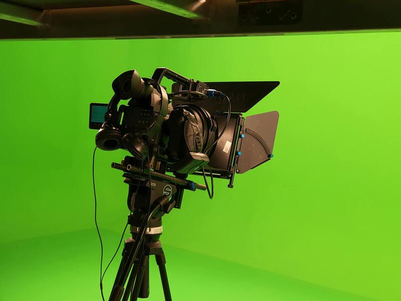
To achieve high-quality aerial imagery that effectively showcases Miami properties, specialized equipment and advanced techniques are employed. Predominantly, professional-grade drones equipped with high-resolution cameras are the tools of choice for estate agents aiming to produce crisp, detailed visuals. These drones are designed with stabilizing gimbals that minimize vibrations, ensuring sharp images even in challenging wind conditions frequently encountered in coastal areas like Miami.
Aside from drones, traditional aircraft such as helicopters and small planes have historically been used to capture expansive property views, especially for large estates or entire neighborhoods. While these methods provide broad perspectives, they are typically reserved for projects requiring extensive coverage due to higher costs and logistical complexity.
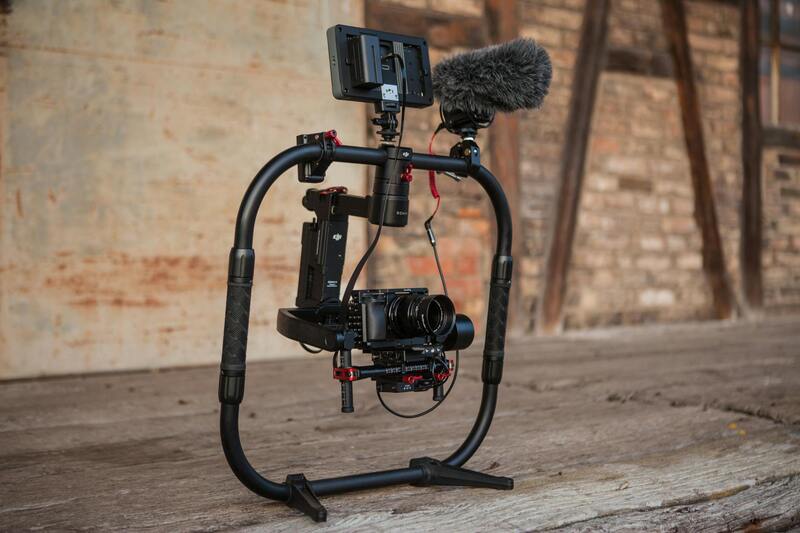
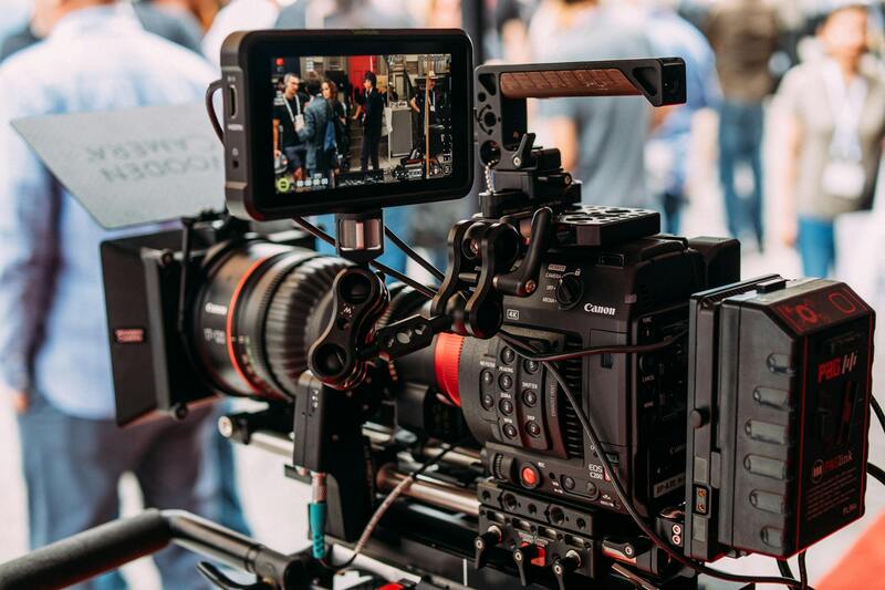
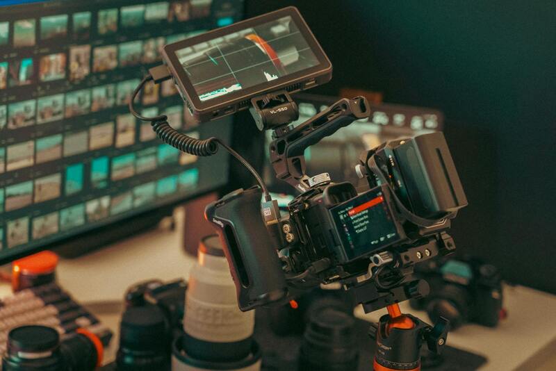
Camera selection plays a vital role in the quality of aerial photos. Cameras with high megapixel counts, wide dynamic ranges, and the ability to shoot in RAW format are preferred. These specifications allow for superior clarity, color accuracy, and post-processing flexibility, which are critical when emphasizing property details such as architectural features and landscape elements.
Techniques for aerial photography involve specific flight planning, including optimal altitude levels, angles, and lighting conditions. Planning flights during the golden hour—shortly after sunrise or before sunset—maximizes natural lighting, resulting in warm, inviting images that highlight the property's best features. Additionally, utilizing panoramic shots or creating 3D aerial models can provide prospective buyers with immersive virtual tours, further elevating marketing effectiveness.
Post-processing also plays a significant role. Professional editing software helps enhance images through color correction, perspective adjustments, and removing any unwanted elements, all of which contribute to creating a polished and compelling listing presentation.
Effective Integration of Aerial Imagery into Property Listings
When adding aerial imagery to real estate listings, the focus should be on creating a seamless visual narrative that highlights the property’s unique features and surrounding environment. High-resolution aerial photos do more than just showcase the property—they serve as visual anchors that attract potential buyers and set the property apart from competing listings.
Including a variety of aerial shots, such as wide-angle views of the entire estate, close-up details of landscaping, and images capturing the property's proximity to local amenities, enriches the overall presentation. These images should be arranged strategically within the listing to create an engaging story that guides viewers through the property’s key selling points.
Utilizing metadata and descriptive captions for each image enhances search engine visibility, making it easier for prospective buyers or other industry professionals to discover the listings through online searches. Carefully optimized descriptions should incorporate relevant keywords without appearing forced, ensuring they support the listing’s SEO strategy while providing context for the images.
It's also beneficial to embed aerial photos within virtual tours or interactive 3D models. This integration allows viewers to explore the property and its surroundings dynamically, providing a comprehensive understanding of the estate’s scale and features from various angles. When this multimedia content is combined with detailed property descriptions, it significantly elevates the listing's appeal and engagement levels.
Ensuring consistent branding across all visual content is essential. Professional editing that preserves the property’s natural colors and highlights architectural details guarantees a polished presentation. High-quality images, properly formatted for various devices and viewing platforms, help maintain a professional, credible appearance that encourages inquiries and viewings.
Furthermore, incorporating aerial photos into print materials, such as flyers and brochures, can expand the reach to potential buyers who prefer offline resources. Complementing these with digital channels—including property websites, social media platforms, and email campaigns—maximizes the exposure and impact of the marketing strategy.
Strategies for Capturing High-Quality Aerial Images
Achieving exceptional aerial photography for estate listings relies on employing precise techniques and professional-grade equipment. Stable drone operation and optimal flight angles are essential to produce sharp, detailed images that highlight both the property and its surroundings. Using high-resolution cameras mounted on drones allows for capturing crisp, vibrant visuals that revealProperty details often missed from ground level.
Before initiating a shoot, agents and photographers should conduct a comprehensive site assessment. This step ensures that flight paths are planned to avoid obstacles such as trees, power lines, or neighboring structures, which could compromise image quality or safety. Factoring in natural lighting conditions, particularly the golden hours of early morning or late afternoon, enhances image warmth, depth, and overall appeal.
Utilizing flight planning software can automate routes, optimize shooting angles, and ensure consistent coverage of property features. This systematic approach results in a cohesive portfolio of images that effectively showcase the estate’s unique selling points. Incorporating multiple perspectives—such as aerial shots of the entire estate, detailed shots of the landscape, and close-ups of architectural features—creates a comprehensive visual story for potential buyers.
Post-processing plays a significant role in elevating aerial visuals. Adjustments to contrast, brightness, and color saturation should be subtle, preserving the natural appearance of the property. Correctly editing images ensures that they translate well across various marketing channels, whether for online listings, printed brochures, or social media campaigns.
Considerations for Timely and Cost-Effective Aerial Shoots
Scheduling aerial photography during optimal weather windows is crucial. Clear skies and minimal wind conditions contribute to stable drone flights and sharp images. Avoiding windy days prevents camera shake and potential safety risks. Planning shoots during non-peak hours reduces airspace congestion and provides more flexibility for optimal lighting and angles.
Cost efficiency can be achieved by bundling aerial photography with other marketing services such as cinematic video tours or virtual staging, maximizing return on investment. Moreover, establishing relationships with local drone operators or service providers can streamline scheduling and ensure high-quality results within budget constraints.
From a logistical standpoint, clear communication regarding desired outcomes and property features helps photographers deliver images that align with marketing objectives. Providing detailed briefs aids in capturing content that highlights the estate’s best aspects and caters to targeted buyer demographics.
Best Practices for Capturing and Incorporating Aerial Photos in Property Listings
To maximize the impact of aerial photography in real estate marketing, it is essential to adopt precise capturing techniques and thoughtful integration strategies. High-quality aerial images serve as a compelling visual hook, drawing prospective buyers into the property's unique features and surrounding environment.
Proper planning begins with understanding the property's key selling points. For estate agents, this means identifying aspects such as expansive landscapes, proximity to amenities, access routes, and outdoor recreational areas. These elements can be accentuated through carefully composed aerial shots taken at the optimal time of day, often during the golden hours, when sunlight adds warmth and depth to the visuals.
Drone operators should utilize a combination of flight modes and camera settings suited to the property type and local conditions. For instance, capturing high-resolution images with a steady gimbal stabilizer ensures clarity and sharpness, especially when highlighting architectural details or expansive land parcels. Multiple angles—such as overhead, oblique, and panoramic views—should be captured to provide a comprehensive visual story of the estate.

When editing images, subtle adjustments in contrast, saturation, and brightness help enhance visual appeal without compromising authenticity. Consistency in editing style across listings maintains a professional appearance and reinforces branding identity. Additionally, integrating aerial photos seamlessly into online property listings enhances user engagement, providing immersive visuals that encourage potential buyers to explore further.
For digital platforms, consider creating a visual hierarchy where aerial images serve as the initial introduction to the property, followed by interior shots and detailed close-ups. Implementing interactive features, such as 360-degree views or virtual tours that incorporate aerial footage, can significantly elevate the listing experience.
Moreover, leveraging aerial photography for marketing collateral, including print brochures and social media campaigns, ensures that property highlights are communicated consistently across channels. High-quality aerial visuals help establish a premium perception of the estate, appealing to discerning buyers and investors alike.

Incorporating aerial photos requires attention to strategic placement within marketing materials. Positioning aerial images at the beginning of a listing significantly increases viewer interest. Supplementing them with detailed floor plans and interior photographs creates a balanced presentation that addresses both the exterior appeal and internal amenities.
Overall, the effective capture and integration of aerial photography demand a combination of technical skill, creative vision, and strategic marketing insight. When executed properly, aerial imagery becomes a powerful tool for differentiating listings in a competitive Miami real estate market and communicating the true potential of each property.
Legal Considerations and Permits in Miami
Engaging in aerial photography within Miami necessitates adherence to established procedures that ensure the safety and privacy of all parties involved. Securing proper authorization involves understanding the specific regulations governing drone operations and aerial imaging in the region. This frequently includes obtaining necessary permits from local authorities and complying with guidelines set forth by relevant agencies.
Before initiating any aerial photography project, estate agents and service providers should conduct thorough research to identify the correct permits required for the specific location and scope of their shoot. This process might involve submitting detailed flight plans and demonstrating adherence to safety protocols, especially when operating in proximity to populated areas, private property, or sensitive infrastructure.
Additionally, it is crucial to inform property owners and neighbors about upcoming aerial activities to foster transparency and cooperation. Even when official permits are not explicitly mandated, maintaining clear communication helps prevent misunderstandings or disputes. Employing licensed and insured drone operators further reinforces best practices and demonstrates commitment to responsible aerial imaging.
In areas with high regulatory density, working with experienced local providers who understand the nuances of Miami’s aerial photography rules can streamline the process. They can handle permit applications efficiently and ensure that all operational parameters are met, thereby minimizing risks associated with violations. This proactive approach secures the integrity of the project while maximizing the value that aerial imagery adds to property marketing efforts.
Ensuring Proper Licensing and Insurance for Aerial Photography in Miami
When selecting aerial photography services, it is vital to verify that providers employ licensed operators who hold the appropriate certifications for drone operations in Miami. Certified pilots are trained to adhere to operational standards that ensure safety and compliance with local guidelines. Additionally, choosing a provider with comprehensive insurance coverage for their equipment and liability helps protect against unforeseen incidents that could impact property colleagues or the surrounding community.
Experienced aerial photography firms maintain a rigorous safety protocol, including pre-flight risk assessments and controlled flight plans specially designed for urban environments like Miami. This approach minimizes potential disturbances and coordinates efficiently with property owners and stakeholders.
Furthermore, reputable operators utilize high-grade equipment approved for commercial use, which can produce high-resolution images and videos suitable for sophisticated real estate marketing campaigns. Their knowledge of Miami’s diverse geographic and infrastructural landscape ensures that aerial shoots comply with local operational standards, facilitating smooth project execution.
Streamlining the Selection Process for Miami Aerial Photography Providers
To identify a qualified service, estate agents should focus on providers with demonstrable experience in Miami’s specific environment. An established local company will have a clear understanding of the unique challenges posed by the city’s skyline, weather patterns, and restricted flight zones. Reviewing portfolios and client testimonials can offer insight into their reliability and quality of work.
It is beneficial to request detailed proposals that outline the scope of work, safety practices, and projected timelines. A professional provider will also handle the entire process of obtaining necessary approvals and coordinating flight plans, alleviating administrative burdens for estate professionals.
By engaging with providers familiar with Miami’s aerial photography landscape, estate agents can ensure timely project completion with high-quality results, ultimately enhancing the visual appeal of their property listings and improving marketing effectiveness.
Emerging Technologies and Future Trends in Aerial Photography for Estate Agents
As the landscape of real estate marketing continues to evolve, aerial photography is expected to integrate increasingly sophisticated technologies to enhance visual storytelling and engagement. Professional estate agents and aerial photographers in Miami are adopting innovative tools and platforms that redefine the scope and impact of aerial visuals, ensuring their listings stand out in a competitive market.
Advancements in Drone Technology
- Higher-Quality Imaging: Modern drones are equipped with cameras that feature 4K, 8K, or higher resolution capabilities, allowing for ultra-detailed images that capture minute architectural details, landscaping intricacies, and overall property ambiance.
- Extended Flight Duration: Battery innovations now enable longer flight times, facilitating comprehensive coverage of sprawling estates or complex developments without interruption.
- Enhanced Stability and Precision: Gimbal stabilization systems improve image clarity by minimizing camera shake, even in windy conditions, common in Miami’s coastal areas.
Automation and Artificial Intelligence in Aerial Imaging
- Autonomous Flight Planning: AI-driven flight planning tools allow for pre-programmed, precise flight routes. This ensures consistent coverage, reducing manual errors and increasing repeatability for ongoing listings or promotional campaigns.
- Real-Time Data Processing: Advanced software can analyze aerial footage in real time, aiding in dynamic editing and immediate deployment across marketing platforms.
- Image Enhancement Algorithms: Machine learning algorithms optimize lighting, color accuracy, and image sharpness, delivering professional-grade visuals that captivate potential buyers.
Integration of Virtual and Augmented Reality
The combination of high-quality aerial imagery with virtual reality (VR) and augmented reality (AR) components opens new horizons for property presentations. Potential buyers can virtually tour estates from remote locations, experiencing the property’s spatial attributes through immersive visualizations integrated with aerial perspectives.
Drones with Specialized Capabilities
- Thermal Imaging: Useful for assessing property energy efficiency or identifying structural issues, thermal drones can add a layer of diagnostic value to real estate marketing.
- Nighttime Photography: Low-light or night-capable drones allow imagery sessions during dusk or night, unveiling a property’s ambiance and lighting schemes that appeal to buyers seeking a distinctive living environment.
Data Management and Cloud-Based Solutions
Advancements in cloud storage facilitate seamless management and sharing of large aerial datasets. Real estate professionals can access high-resolution images instantly, annotate, and distribute them across multiple channels swiftly, maintaining a competitive edge in Miami’s dynamic market.