Overview of 3D Property Photography
3D property photography has revolutionized the way real estate professionals showcase properties, especially within thriving markets like Miami. This innovative visual technology involves capturing comprehensive, immersive images of a property's interior and exterior, enabling prospective buyers to explore spaces virtually as if they were physically present. Unlike traditional photos, 3D property photography provides a detailed and accurate representation of the property’s layout, size, and spatial relationships, fostering a deeper understanding of the property's features.
In Miami's dynamic real estate landscape, where waterfront condos, luxury estates, and modern city apartments dominate the market, 3D property photography serves as a powerful tool to highlight property attributes with precision and clarity. It enables agents and sellers to present properties in a compelling way that appeals to a broad audience, including international buyers who might not have the opportunity to visit in person. By delivering an engaging virtual experience, 3D photography enhances the appeal of listings and accelerates the decision-making process for prospective buyers.
Beyond mere visualization, 3D property photography also supports detailed floor plans and virtual walkthroughs, providing a holistic view of a property's layout. This detailed approach helps buyers assess space and features more accurately, reducing misunderstandings or surprises during in-person visits. For Miami's real estate sector, which often features high-value properties with intricate layouts and luxurious finishes, this technology offers a precise, accessible, and aesthetically pleasing way to showcase homes. As a result, agents can reach a more extensive audience, including international clients, and facilitate faster, more informed transactions.
Methodologies and Technologies Used in 3D Property Photography
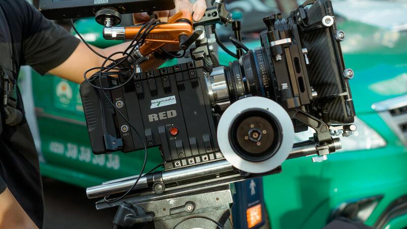
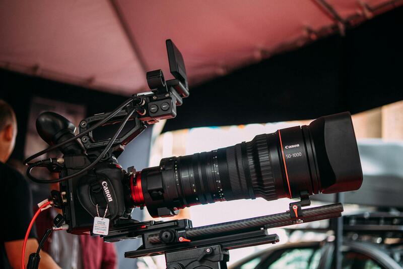
To produce compelling and accurate 3D property images, professionals utilize a variety of advanced methodologies and technologies. The core of 3D property photography involves capturing comprehensive spatial data that can be transformed into immersive virtual representations. This process typically encompasses the use of high-resolution 3D scanners, specialized camera systems, and sophisticated software to create precise models of interior and exterior spaces.
One predominant approach is the use of laser scanning technology, which employs LiDAR (Light Detection and Ranging) to measure distances with high accuracy. Laser scanners emit laser beams that reflect off surfaces, capturing millions of points per second to generate detailed point clouds. These point clouds serve as the foundation for constructing true-to-scale 3D models, capable of showcasing intricate architectural details and spatial relationships.
Complementing laser scanning, panoramic and 360-degree camera systems are frequently used for rapid image acquisition. These cameras capture spherical images that are stitched together to create seamless virtual walkthroughs. When integrated with software platforms, the panoramic visuals are mapped onto 3D models, enabling viewers to navigate freely within the property environment.
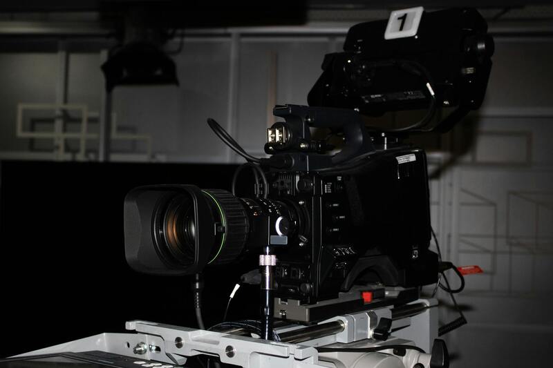
Image processing and rendering software are crucial for refining raw data into polished virtual assets. These tools allow professionals to add textures, lighting adjustments, and environmental elements, enhancing realism and visual appeal. Software platforms also facilitate the creation of interactive elements such as clickable hotspots, virtual furniture, and detailed floor plans, enriching the user experience.
Incorporating drone technology for exterior shots further broadens the scope of 3D imaging. Drones equipped with high-definition cameras and stabilization systems can capture comprehensive aerial views, providing context and a sense of scale that complements interior virtual tours. This multi-angle approach ensures that potential buyers gain a complete understanding of the property’s location, surroundings, and architectural design.
Emerging Trends and Innovations
As technology advances, new tools and methodologies continue to emerge in the field of 3D property visualization. Artificial intelligence (AI) algorithms are increasingly used to automate complex processing tasks such as segmentation, object recognition, and predictive modeling. These innovations improve efficiency and enable faster turnaround times for property listings.
Virtual reality (VR) and augmented reality (AR) integrations are also gaining prominence. These immersive technologies allow clients to experience a property in a highly interactive manner, often through VR headsets or mobile applications. Such enhancements not only elevate the viewing experience but also facilitate remote decision-making, making the real estate process more accessible and engaging.
Overall, the combination of sophisticated hardware, powerful software, and emerging technological trends underpins the effectiveness of modern 3D property photography. These methodologies ensure high-quality, immersive representations that cater to the evolving needs of sellers, agents, and buyers in Miami's vibrant real estate market.
Methodologies and Technologies Used
Implementing high-quality 3D property photography relies on a suite of advanced methodologies and cutting-edge technologies. Central to this process are specialized 3D scanning devices and software that facilitate the creation of detailed, accurate virtual models of properties. These tools typically include laser scanners, which capture spatial data with remarkable precision, allowing for comprehensive 3D walkthroughs that replicate real-world navigation. Additionally, high-resolution panoramic cameras are employed to gather detailed visual data from multiple angles, ensuring that every aspect of the property’s interior and exterior is represented with clarity.
Professional Miami-based real estate agencies and visual content providers often utilize advanced imaging equipment such as drone-mounted cameras and handheld 360-degree cameras. Drones are particularly effective for capturing expansive outdoor areas, aerial views, and difficult-to-reach spaces, enhancing the overall presentation of the property. Inside, 360-degree camera setups enable seamless virtual tours by capturing entire rooms in a single shot, which can be transformed into interactive virtual experiences.
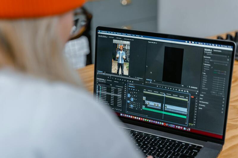
To process and develop these raw data inputs, industry-standard software solutions come into play. These applications construct accurate 3D renderings, enable virtual staging, and support customization features that facilitate tailored presentation experiences. The integration of photogrammetry, which converts multiple two-dimensional images into detailed 3D models, further enhances the realism and depth of visualizations. Advances in artificial intelligence also streamline workflows by automating tasks such as object recognition, segmentation, and scene optimization, resulting in faster turnaround times without sacrificing precision.
In Miami's competitive real estate market, leveraging such methodologies ensures that property visuals stand out. By combining powerful hardware with sophisticated software, agents and property owners can provide immersive tours and high-quality virtual representations that resonate with modern homebuyers.
Best Practices for Capturing 3D Property Images
To achieve high-quality 3D property images that truly impress potential buyers and provide an authentic representation of the space, attention to detail in the capturing process is essential. Proper lighting is fundamental; natural light is preferable during daytime, as it reveals true colors and enhances depth, but supplemental artificial lighting can fill shadows and highlight key features in darker areas. Ensuring that the lighting setup is evenly distributed across rooms minimizes glare and shadows that can distort perception.
Room preparation is equally important. Clutter and personal items should be minimized to create a clean, neutral environment that allows viewers to focus on the space itself. Furniture arrangements should be organized to demonstrate the room’s functionality and potential, with moveable pieces strategically positioned to showcase the full extent of the layout. It is advisable to remove any distracting elements or reflective surfaces that could interfere with the imaging process.
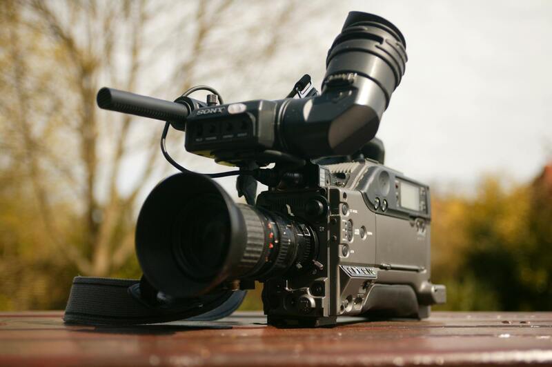
Choosing the right equipment is paramount. High-resolution 3D cameras or 360-degree setups must be calibrated correctly to ensure accurate capturing of spatial dimensions. It is crucial to use stable mounts or tripods to prevent motion blur and maintain consistent framing. When scanning, slow and deliberate movements help capture detailed textures and contours, resulting in more precise renders.
Additional considerations include the use of consistent camera settings and positioning techniques across all shots. Overlapping scans from different angles aid in creating seamless, cohesive virtual environments. Properly spaced and aligned scans prevent stitching issues, thereby improving the overall quality and realism of the digital model.
Weather conditions and outdoor lighting should also be taken into account for external shots. Overcast days often yield more evenly distributed light outdoors, while direct sunlight may cause harsh shadows or reflections. Scheduling shoots during optimal lighting conditions ensures that the virtual tour is bright, inviting, and true to life.
Furthermore, post-processing plays a significant role in refining the images. Software tools can correct color discrepancies, enhance clarity, and remove minor imperfections. The goal is to produce visually compelling images that accurately represent the property’s features without exaggeration, thus maintaining trustworthiness and helping buyers make informed decisions.
Additional Techniques and Considerations in 3D Property Photography
Implementing high-quality 3D property photography requires meticulous attention to detail and adherence to specific technical standards. Beyond the basic capturing process, there are supplementary methods that enhance the accuracy and visual appeal of the final digital models. For example, utilizing HDR (High Dynamic Range) imaging techniques allows photographers to capture a broader spectrum of light and shadow within each shot. This results in images that mirror real-life viewing conditions more closely, ensuring that both dark corners and bright highlights are represented clearly in the virtual environment.
Another critical aspect involves the use of precise calibration tools and software. Regular calibration of cameras and scanners prevents distortion and ensures measurements derived from the images remain reliable. For indoor spaces, deploying laser scanning devices with high precision capabilities enables the creation of detailed point clouds, which serve as the foundation for realistic 3D models. These devices can capture minute architectural details, textures, and spatial relationships, offering potential buyers a thorough understanding of the property without physical visitation.
Lighting remains a cornerstone of effective 3D imaging. Consistent lighting setups prevent unwanted shadows and reflections that can distort the model. For outdoor shots, choosing days with diffuse lighting conditions—such as overcast weather—ensures uniform illumination, reducing glare and stark shadows. When capturing interior spaces, diffuse light sources or daytime window light help maintain a balanced exposure, which is crucial for realistic renderings. Post-processing also plays a pivotal role in elevating image quality. Software that aligns and stitches multiple scans ensures seamless transitions and accurate spatial relations between different parts of the property. When adjustments are needed, color correction, noise reduction, and minor retouching sharpen the visual clarity and fidelity. Maintaining an authentic representation of the property builds trust and aligns expectations for prospective buyers. Integrating 3D property images into marketing workflows requires systematic organization. Linking high-resolution models to virtual tours, 3D floor plans, and interactive elements enhances user engagement and helps differentiate listings in a competitive market. Ensuring these assets load efficiently across devices and with minimal latency maintains a professional presentation, fostering confidence among potential buyers.
Best Practices for Capturing 3D Property Images
To produce high-quality 3D property images that effectively showcase a space, it is essential to adhere to specific best practices throughout the capturing process. Proper planning and execution not only enhance the visual appeal but also ensure that the models accurately represent the property's real-world dimensions and details.
- Optimal Equipment Selection: Use advanced laser scanners, such as LiDAR or structured-light devices, capable of capturing detailed spatial data with high resolution. Additionally, investment in cameras with high dynamic range (HDR) capabilities ensures that both bright and shadowed areas are accurately rendered.
- Controlled Lighting Conditions: Proper lighting minimizes shadows, glare, and reflections that could distort the 3D model. For indoor shoots, diffuse lighting or softboxes help create even illumination. For outdoor environments, overcast weather conditions are ideal to prevent harsh sunlight from introducing unwanted shadows and highlights.
- Strategic Scanning Angles and Coverage: Plan the scanning sequence to cover all critical viewpoints, including tight corners and difficult-to-reach spaces. Overlapping scans from multiple angles contribute to a seamless and detailed 3D model, ensuring no areas are missed.
- Consistent Camera and Scanner Settings: Maintain uniform settings across all scans to facilitate easier stitching and alignment during post-processing. Consistent exposure, focus, and distance parameters prevent discrepancies that could compromise model accuracy.
- Minimal Movement During Scanning: Instruct occupants and avoid unnecessary movements during the scanning process. Movement can cause mismatched points in the 3D reconstruction, resulting in distorted images or gaps in the model.
- Post-Processing Rigor: After capturing, utilize specialized software to align, stitch, and refine the scans. Techniques such as noise reduction, color correction, and bisecting unnecessary data streamline the final output. Accurate alignment ensures that spatial relationships between rooms and features are preserved, offering a reliable virtual experience.
Integrating 3D Photography into Property Listings
Once high-quality 3D images are obtained, the next step involves strategically integrating these assets into property listings. This integration enhances the visibility of the property and provides potential buyers with a comprehensive view that static photos cannot offer.
- Embedding Interactive 3D Tours: Embed 3D walkthroughs directly into online listings, allowing prospective buyers to navigate the property at their own pace. Interactive tours facilitate a realistic experience, helping buyers assess spatial relationships and interior design choices more effectively.
- Enhancing Virtual Floor Plans: Combine 3D models with detailed floor plans to give buyers a clearer understanding of space layouts. This combination aids in visualizing furniture placement and understanding the flow between rooms.
- Optimizing for Multiple Devices: Ensure that 3D models load efficiently on desktops, tablets, and smartphones. Compatibility across devices guarantees that all potential clients can access the visual content without frustration, expanding reach and engagement.
- Marketing and Social Media Engagement: Share snippets or interactive previews of 3D models on social media platforms. Engaging content increases viewer interest and directs traffic toward the main listing, creating more opportunities for inquiries and visits.
- Analytics and Feedback Integration: Utilize tracking tools to analyze user interactions with 3D content. Insights gathered can help refine presentation strategies and enhance future virtual tours, ensuring continuous improvement in marketing efforts.
Optimal Equipment and Software for 3D Property Imaging
Implementing high-quality 3D property photography requires specialized equipment and advanced software solutions. Professionals use high-resolution 360-degree camera systems that enable capturing comprehensive panoramic images with precision. These cameras often come with built-in stabilization features to ensure clarity and consistency across shots, even in challenging lighting conditions.
Alongside hardware, robust software platforms are essential for stitching images, creating seamless 3D models, and managing data. Applications such as Matterport, Cupix, or iGuide allow for detailed processing of raw images and generate interactive virtual tours that can be embedded into property listings. These software solutions also provide capabilities for editing, annotating, and customizing tours to align with branding or specific client needs.
Steps in the 3D Property Photography Workflow
- Site Assessment: Before shooting, assess the property to determine the optimal angles, lighting, and areas that highlight key features.
- Preparation: Clear clutter, adjust lighting, and arrange furniture if necessary to ensure the space appears inviting and well-defined in the imagery.
- Image Capture: Use a 3D camera system to perform a comprehensive scan of each room, ensuring overlap between shots for accurate stitching.
- Processing: Upload raw images into dedicated software to generate an interactive 3D model or virtual tour. This step involves stitching, alignment, and rendering.
- Quality Control: Review the generated models for accuracy, completeness, and visual appeal. Make necessary adjustments to improve clarity or correct artifacts.
- Integration: Embed the final 3D tour into the property’s listing platform, ensuring compatibility and smooth functionality across devices.
Legal and Ethical Considerations in 3D Property Photography
When creating 3D images of properties, it is vital to respect privacy boundaries and obtain necessary permissions from property owners or representatives before conducting scans. Professional agencies adhere to established standards to ensure that all imagery accurately represents the property without misrepresentation or distortion.
Maintaining transparency about the origin and editing of 3D content helps preserve trust among clients and viewers. Clear documentation of the process, including consent forms and usage rights, fosters a professional environment where all involved parties understand their rights and responsibilities.
- Ensure all areas captured are approved by property owners.
- Use consistent, truthful representation to prevent misleading impressions.
- Maintain secure storage and handling of the visual data collected.
This disciplined approach upholds the integrity of the visual marketing, ensuring that potential buyers receive an accurate depiction of the property environment.
Future Trends in 3D Property Photography
As the realm of 3D property photography continues to evolve, emerging technologies are set to redefine how real estate professionals and prospective buyers interact with property visuals. Innovations in virtual reality (VR) and augmented reality (AR) are leading the charge, providing immersive experiences that deepen engagement and understanding of a property.
Virtual Reality Integration
The integration of VR into 3D property photography offers an unparalleled level of immersion. Buyers can virtually walk through a home from anywhere in the world, experiencing the space as if they were physically present. This technology relies on high-fidelity 3D models that can be navigated through VR headsets, creating a realistic and interactive environment. Enhancements such as spatial audio and interactive hotspots further enrich the virtual experience, allowing users to explore features, view detailed textures, or even simulate furniture placement within the space.

Augmented Reality Features
Augmented reality is transforming how prospective buyers visualize a property by overlaying digital information onto physical spaces. AR applications enable users to project 3D models directly onto their device screens, allowing real-time interaction with the virtual environment. This includes visualizing interior design changes, furniture placement, or renovation ideas directly within the actual space. Such capabilities provide a tangible sense of how alterations might look, facilitating more informed decision-making.
Furthermore, AR can assist agents during walkthroughs, providing contextual information about features, materials, or recent upgrades. The seamless blending of digital data with the physical environment enhances transparency, making property presentations more engaging and informative.
Enhanced Data Management and Visualization
Advancements in data processing are enabling more detailed and accurate representations of properties. AI-driven algorithms improve model accuracy, reduce rendering times, and facilitate faster uploads and updates. Interactive dashboards and visualization tools allow clients to explore property data dynamically, comparing different layouts, materials, or design options within a single interface.
Impact on Marketing and Sales Strategies
Looking ahead, the integration of immersive 3D visuals into marketing campaigns will become increasingly standard. Realtors and developers who leverage cutting-edge technology can stand out in competitive markets, offering prospective buyers a comprehensive, engaging view of properties without physical visits. This shift not only enhances the overall buyer experience but also accelerates decision-making processes, leading to quicker sales and higher satisfaction levels.