Overview of Drone Photography in Real Estate
Professional drone real estate photography has transformed the way properties are showcased to potential buyers. By capturing stunning aerial visuals, real estate professionals can present properties in a compelling manner that highlights their unique features and surrounding environments. Unlike traditional ground-level photographs, drone images provide a comprehensive perspective of a property’s layout, proximity to nearby amenities, and overall neighborhood context, making listings more attractive and informative. In the competitive real estate market, captivating imagery is crucial for attracting interest and accelerating sales. Aerial photography delivers a broader view, allowing prospective buyers to visualize the property’s scale, outdoor spaces, and strategic positioning within its locale. This form of visual storytelling is highly effective in differentiating listings from others on the market. Leveraging the advancements in camera technology and flight stability, professional drone operators produce high-resolution images that are rich in detail and clarity. These visuals are integral to digital marketing strategies, enhancing online listings, social media campaigns, and virtual tours. The ability of drone photography to provide dynamic, wide-angle shots and cinematic footage has made it an industry standard for premium real estate presentation. Moreover, drone photography can reveal aspects of a property that are difficult to capture with conventional photography, such as expansive land parcels, waterfront views, expansive gardens, or multi-acre estates. Such perspectives not only improve listing quality but also help buyers understand the property's full potential. In summary, drone photography plays a vital role in the modern real estate marketing toolkit by offering immersive, high-quality aerial visuals that increase visibility, showcase property features effectively, and ultimately support faster sales. Its integration into marketing strategies is now essential for real estate professionals seeking to maximize property appeal and reach a broader audience.
Equipment and Technology for Drone Real Estate Photography
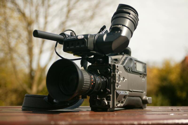
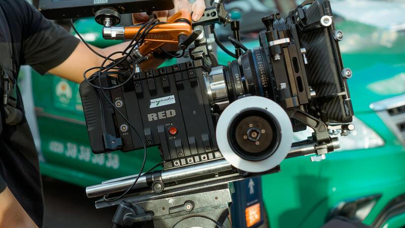
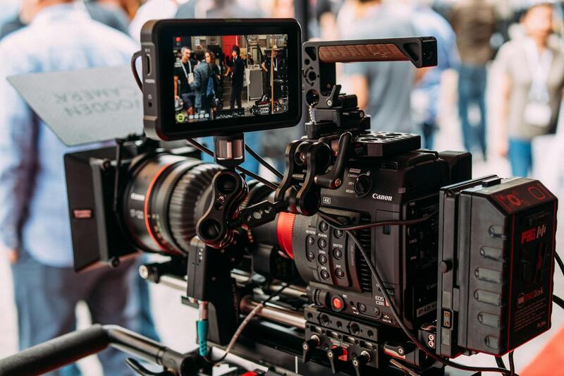
The foundation of exceptional professional drone real estate photography lies in the selection of advanced equipment and technology. High-end drones equipped with stabilized gimbal systems are essential for capturing sharp, smooth footage with minimal vibration or jitter, which is vital for producing professional-grade images and videos. These drones typically feature high-resolution sensors, often 20 megapixels or more, to ensure detail-rich visuals suitable for large-format prints and virtual tours.
Latest technological advancements have introduced features such as obstacle avoidance, automated flight paths, and intelligent flight modes, which enhance safety and allow for complex shot compositions. These capabilities enable aerial photographers to execute precise maneuvers and capture unique angles that emphasize the property’s best features. Additionally, integrated GPS and stabilization systems help maintain consistent altitude and positioning, resulting in balanced, professional imagery.
In terms of camera accessories, professional-grade lenses, ND filters, and high-capacity batteries optimize image quality and flight duration. ND filters are particularly useful in bright outdoor conditions, allowing for controlled exposure and smoother video footage. Extended flight times facilitated by high-capacity batteries ensure comprehensive coverage of larger properties without interruption.
Complementing the drone hardware, sophisticated imaging software and stabilization technology play a pivotal role in post-flight processing. These tools assist in color correction, image sharpness enhancement, and stabilization of footage, helping to produce awe-inspiring visuals that captivate potential buyers.
Best Practices and Techniques for Drone Photography
Executing professional drone real estate photography involves meticulous planning and adherence to best practices. Pre-flight preparation includes assessing weather conditions, checking equipment functionality, and planning flight paths that maximize property coverage while maintaining safety.
Optimal flight techniques include maintaining consistent altitude to showcase property contours and landscaping effectively. Shooting during the golden hour — shortly after sunrise or before sunset — can add warmth and depth to images, creating inviting virtual visuals. Using multiple angles and high vantage points ensures comprehensive property representation, from expansive land plots to intricate architectural details.
Furthermore, employing smooth, controlled drone movements and avoiding rapid directional changes results in cinematic footage that enhances listings. Post-flight, careful editing and color grading refine the visuals, ensuring they meet professional standards and highlight the property’s unique features.
By combining technical expertise with adherence to best practices, real estate professionals can leverage drone photography to produce compelling visual narratives that captivate viewers and facilitate faster property sales.
Legal and Regulatory Considerations in Miami
Operating drones for real estate photography in Miami requires adherence to specific protocols defined by local authorities. Ensuring compliance involves understanding the local regulations that govern drone flight, such as restrictions on altitude, proximity to airports, and designated no-fly zones. These rules are designed to promote safety and minimize disruptions to other airspace users.
Before any shooting session, professional drone operators perform thorough pre-flight assessments. This includes verifying that the intended flight path avoids restricted areas and obtaining necessary clearances for flights near sensitive infrastructure or crowded areas. Knowledge of local airspace regulations is essential for planning safe and efficient aerial shoots.
Operatives should also be familiar with the Miami-Dade County ordinances that specify operational limitations within city limits, including times of day when drone flights are permitted and rules regarding privacy. Respect for private property rights is crucial, necessitating clear communication with property owners before launching drone operations.
Additionally, operators often utilize geofencing technology integrated into modern drones to automatically restrict flying into prohibited zones. This technological safeguard helps uphold compliance effortlessly, reducing the risk of inadvertent violations during busy or complex property shoots.
Staying up to date with the evolving legal landscape in Miami ensures that drone photography efforts are conducted smoothly, efficiently, and responsibly, providing clients with high-quality visuals while maintaining exemplary operational standards.
Legal and Regulatory Considerations in Miami
Harnessing the power of professional drone real estate photography in Miami requires adherence to established operational protocols. While the technologies and techniques enable stunning aerial visuals, understanding the frameworks that govern drone usage ensures smooth and responsible execution. Local authorities have established comprehensive guidelines to balance the benefits of drone imagery with the privacy and safety concerns of residents and property owners.
In Miami, operators must be well-versed in specific parameters surrounding flight operations, including designated no-fly zones, altitude restrictions, and operational hours. These rules are designed to facilitate a harmonious integration of drone activities within the urban and coastal landscape. Drone pilots are encouraged to conduct careful pre-flight assessments, utilizing detailed maps and updated airspace charts that highlight restricted areas and points of interest.
Furthermore, obtaining necessary permissions and clearances from relevant municipal offices is an essential step before any aerial shoot. This proactive communication guarantees that all planned flights are aligned with city ordinances and local policies. Respect for private property rights is also paramount; drone operators should seek authorization from property owners, especially when capturing areas that are not publicly accessible.
Recent advancements, such as geofencing technology integrated into modern drones, assist operators in maintaining compliance by automatically restricting flights into designated no-fly zones. Combined with detailed planning and real-time monitoring, these features help avoid inadvertent violations that could disrupt ongoing activities or infringe on sensitive locations.
Operators must remain cognizant of the dynamic nature of regulations, especially in a vibrant city like Miami where airspace rules can evolve rapidly. Continuous education and staying informed about updated policies, new restrictions, or changes in local ordinances are crucial components of responsible drone operation. This diligence ensures high-quality visuals are captured without compromising compliance, ultimately providing clients with exceptional representations of their properties while respecting the community standards and safety norms.
Legal and Regulatory Considerations in Miami
When conducting professional drone real estate photography in Miami, it is vital to adhere to a comprehensive framework of guidelines and procedures that ensure responsible and effective operations. These practices encompass understanding the specific requirements for drone usage within the city’s airspace, including obtaining necessary permits and approvals that facilitate smooth flight activities. Obtaining the appropriate documentation involves coordination with municipal authorities, which helps align drone operations with local policies designed to manage air traffic and public safety.
Operators should familiarize themselves with Miami's zoning laws and aerial photography policies to avoid inadvertent disruptions, especially in sensitive or restricted areas. Prior approval from property owners should be secured when capturing footage over private lands—this approach not only fosters trust but also supports ethical standards essential for professional excellence in the industry.
To support compliance, modern drone systems often incorporate advanced features such as geofencing, which automatically restricts flights into designated zones like airports, government buildings, or protected ecological sites. These technological safeguards, paired with meticulous flight planning, help practitioners navigate Miami’s complex airspace efficiently and responsibly.
Continual education is a cornerstone of professional operation, particularly given the dynamic nature of regulations in a vibrant urban environment like Miami. Staying updated on amendments to local ordinances, new flight restrictions, or safety requirements is crucial. Participating in industry workshops, subscribing to official updates, and maintaining communication with local authorities all contribute to a thorough understanding of compliance standards. Non-compliance can lead to operational delays, financial penalties, or reputational harm; therefore, proactive engagement with regulatory protocols forms the backbone of trusted drone services within the Miami real estate market.
Ensuring adherence to FAA regulations is equally important, as these federal guidelines govern drone usage across the United States. They specify operational altitude limits, flight restrictions over crowds or critical infrastructure, and requirements for pilot certification. Incorporating these federal standards into local practice safeguards against legal complications and promotes the legitimate growth of drone-based real estate marketing.
By integrating these considerations into their workflow, real estate professionals and drone operators can deliver high-quality visual content that accurately portrays property features while respecting Miami's regulatory landscape. This disciplined approach bolsters their reputation for reliability and professionalism, essential qualities for advancing in this competitive sector.
Legal and Regulatory Considerations in Miami
Operating professional drone real estate photography services within Miami requires a thorough understanding of the official guidelines established by local authorities and federal agencies. Compliance involves adhering to protocols designed to ensure safe and responsible drone use, particularly in a bustling urban environment characterized by diverse architecture, high-rise structures, and busy public spaces. Routine reviews of municipal ordinances facilitate the identification of specific restrictions that might affect drone flight paths, permissible altitudes, and designated no-fly zones. Implementing these regulations into operational practices minimizes the risk of inadvertent violations that could disrupt scheduled shoots or lead to operational delays.
Keeping up-to-date with any amendments or updates to local ordinances is essential. Miami's vibrant cityscape consistently evolves, often prompting adjustments in drone operation guidelines. Professionals engaged in aerial photography must subscribe to official city bulletins or participate in industry workshops that address local drone policies. This proactive approach enables photographers to adapt swiftly to new requirements, ensuring ongoing compliance and seamless workflow continuity.
Safe operation also involves understanding restrictions over certain areas such as airports, government buildings, and densely populated zones. Establishing clear communication with city officials and obtaining any necessary permits well ahead of scheduled shoots form integral components of responsible drone use. These steps help maintain trust and cooperation with local authorities, reinforcing the professional reputation of drone service providers in the Miami real estate sector.

Federal aviation standards, governed by the Federal Aviation Administration (FAA), complement local rules by establishing a uniform framework for drone operations across the country. These include restrictions on flying above certain altitudes, avoiding operation over crowds, and restrictions near critical infrastructure. Drone pilots engaged in real estate photography must secure appropriate certifications and continually update their knowledge of FAA regulations to ensure their flights are compliant. Incorporating these federal standards into overarching operational procedures not only promotes safety but also guarantees the legitimacy of marketing content produced for Miami real estate listings.
Part of responsible drone management involves having clear flight plans, risk assessments, and safety protocols tailored to urban settings. These measures are often documented within standard operating procedures, which serve to guide pilots during shoots and reduce the likelihood of inadvertent violations. Using tools such as flight planning applications that incorporate real-time data about restricted zones further enhances operational integrity.
For drone operators and real estate professionals, establishing relationships with local authorities and maintaining thorough documentation of flight permits and operational plans aid in demonstrating compliance. These practices bolster confidence among clients, authorities, and the public, affirming that drone-based marketing is conducted responsibly and within the bounds of the law. Additionally, staying informed about emerging guidelines and participating in continuous education ensures that drone services remain aligned with best practices for aerial real estate photography in Miami's dynamic environment.
Legal and Regulatory Considerations in Miami
Ensuring compliance with local drone operation standards is a critical aspect of executing professional drone real estate photography in Miami. Operators must be familiar with the specific airspace restrictions, no-fly zones, and altitude limitations that apply within the urban landscape of Miami and its surrounding areas. These parameters are designed to promote safe aerial operations while protecting residential, commercial, and government interests.
When planning a drone shoot, professional operators employ advanced flight planning tools that incorporate real-time data about Miami’s airspace restrictions. These tools provide detailed maps and alerts, allowing pilots to adjust flight paths proactively. This approach minimizes the risk of unauthorized entry into restricted areas and ensures that all flights are conducted within permitted zones.
Maintaining proper documentation is also essential. This includes obtaining flight permits when necessary, recording flight plans, and keeping logs of all drone activities. Such records demonstrate responsible operation and help address any inquiries from authorities or clients regarding the nature and scope of the drone flights.
Additionally, establishing good rapport with local authorities and planning ahead for any potential restrictions in specific neighborhoods contributes to a smooth workflow. Staying updated on any changes in Miami’s drone policies and participating in ongoing educational programs are best practices that help keep services aligned with current standards and safety procedures. Ultimately, following these procedures facilitates high-quality imaging that respects local regulations and enhances the credibility of drone services within the Miami real estate market.
Ensuring Quality and Consistency in Drone Real Estate Photography
Maintaining high standards in drone real estate photography requires a systematic approach to various operational and technical aspects. Consistency in image quality and framing is essential for building trust with clients and presenting properties in the best possible light. To achieve this, professional drone operators invest in regular equipment maintenance and calibration, which helps prevent image degradation caused by technical issues or wear and tear. Routine checks on drone propellers, cameras, and batteries ensure reliable performance during shoots, thereby reducing the likelihood of missing critical shots or experiencing technical failures.
Effective image composition and framing are fundamental skills for drone photographers. Professionals employ techniques such as aerial rule of thirds, strategic use of natural light, and optimal altitude selection to enhance the visual appeal of each property. Using high-resolution cameras paired with stabilization gimbals results in clear, sharp images free of blurriness, even in challenging wind conditions. Photographers often capture multiple angles, including panoramic views, to provide potential buyers with comprehensive perspectives that showcase the property's unique features.
Quality Control and Standardization
- Implementing consistent color grading and exposure settings across all images ensures uniformity, making marketing materials visually cohesive.
- Pre-define shot lists tailored to each property type, whether residential or commercial, to capture vital features such as landscaping, rooftops, and exterior facades.
- Utilize tethered shooting or real-time image review to verify shot quality on-site, minimizing the need for reshoots and safeguarding project deadlines.
Additionally, professional drone operators often adhere to an established workflow that includes pre-flight planning, safe execution, and post-processing. This disciplined process guarantees that the final images meet industry standards and client expectations while remaining compliant with regional guidelines.
Ultimately, consistency in drone imagery amplifies the property’s marketability, ensuring that every visual aspect aligns with strategic marketing objectives and elevates the property's perception in a competitive real estate landscape.