Overview of Drone Realty Photography
Drone realty photography has revolutionized the way properties are showcased in the Miami real estate market. Utilizing unmanned aerial vehicles equipped with high-resolution cameras, this technology captures expansive visuals that traditional photography methods cannot achieve. The unique aerial perspective offers potential buyers a comprehensive view of a property’s layout, surrounding landscape, and neighborhood context, providing invaluable insights that enhance marketing efforts.
In Miami's competitive real estate scene, standout imagery is crucial. Drone photography enables realtors and property owners to differentiate their listings by highlighting features such as spacious yards, waterfront access, architectural details, and scenic views. This dynamic imagery helps to generate increased interest, shorten sales cycles, and support premium pricing.
The role of drone realty photography extends beyond simple visual enhancement. It integrates seamlessly into digital marketing strategies, appearing on websites, social media platforms, and virtual tours. The ability to capture multiple angles and perspectives in a single session makes drone photography an invaluable tool for real estate professionals aiming to maximize property exposure.
Key features of drone realty photography include the capability to produce detailed, stable shots even in challenging weather conditions, and the flexibility to access hard-to-reach areas safely. As technology advances, resolutions and flight control systems continue to improve, further elevating the quality of the visual content created.
This strategic use of aerial imagery has become a cornerstone of innovative real estate marketing, helping agents and property owners tell compelling stories about properties. As Miami continues to grow as a vibrant hub of luxury and waterfront developments, the importance of captivating drone visuals will only increase, making it an essential tool in real estate promotion.
Key Equipment and Techniques for Effective Drone Photography
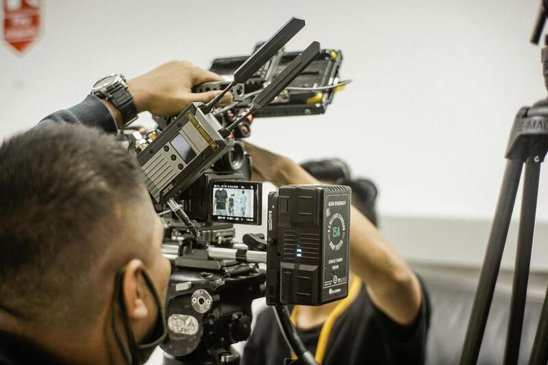
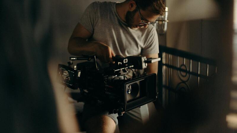
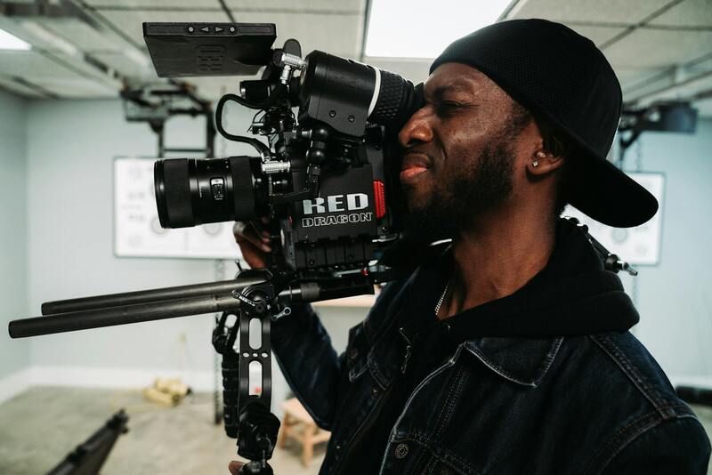
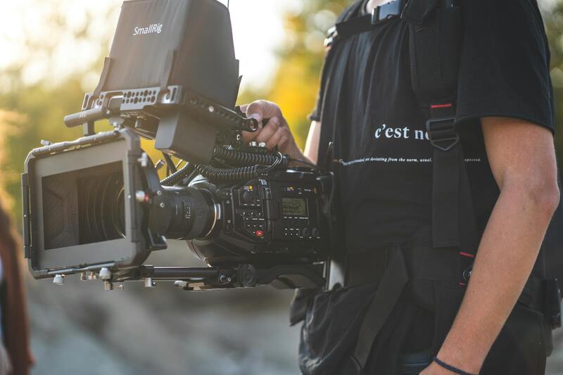
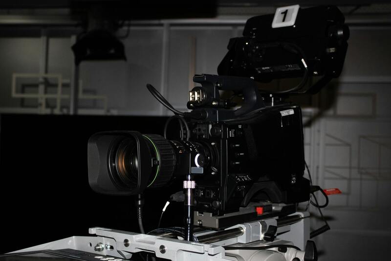
Achieving exceptional drone realty photography relies heavily on selecting the right equipment and employing precise techniques. High-resolution cameras mounted on professional-grade drones are essential for capturing sharp, detailed images that can highlight the unique features of Miami properties. Modern aerial cameras typically offer 20MP or higher sensors, ensuring crisp visuals with rich color accuracy and dynamic range. These cameras are often capable of 4K video recording, providing versatile content for marketing campaigns.
Beyond camera quality, stability is crucial for producing professional-grade images. Drones equipped with advanced gimbal stabilization systems minimize vibrations, ensuring steady shots even in windy conditions or when capturing panoramic views. Flight control systems with GPS-enabled autopilot functions enable smooth, precise movements along predetermined flight paths, reducing human error and ensuring consistent coverage of properties.
Proper flight planning is vital. It involves pre-mapping flight routes, setting optimal altitudes, and determining camera angles to maximize property visibility. For instance, higher vantage points offer sweeping vistas of the property and its surroundings, highlighting neighborhood features, waterfront views, or nearby amenities. Flying during optimal lighting conditions, typically early morning or late afternoon, enhances image quality through softer shadows and warmer tones.
Additionally, understanding and implementing specific photography techniques can dramatically improve the final imagery. Techniques such as HDR (High Dynamic Range) imaging combine multiple exposures to capture both shadowed and brightly lit areas, enhancing overall detail. Panoramic stitching allows for wide-angle shots that showcase the entire property or its impressive surroundings.
Utilizing proper camera settings, including appropriate shutter speed, aperture, and ISO, ensures optimal exposure and image clarity. For example, lower ISO settings reduce noise, while appropriate shutter speeds prevent motion blur during flight. Post-flight, images should be meticulously reviewed for distortion, blurring, or exposure issues, with adjustments made during editing to ensure consistency and high quality.
Additional Considerations
- Pre-flight safety checks and calibration of drone systems
- Utilizing flight planning apps to optimize routes and avoid obstacles
- Regular maintenance and updates of drone firmware and camera equipment
Legal Regulations and Permits in Miami for Drone Use
When engaging in drone realty photography within Miami, adherence to official operational procedures and obtaining the appropriate authorizations are essential to ensure smooth and compliant operations. The process begins with understanding the specific geographic and airspace regulations that govern drone activities across different parts of Miami. These rules are designed to facilitate safe and responsible drone utilization, especially in densely populated or sensitive areas like residential neighborhoods, commercial districts, parks, and waterfronts.
To legally operate a drone for real estate purposes, professionals must acquire relevant permits and register their equipment with the appropriate authorities. Registration typically involves providing details about the drone’s specifications, manufacturer, and flight parameters to national aviation agencies, which oversee airspace management. The Federal Aviation Administration (FAA) in the United States mandates that drones weighing 0.55 pounds (250 grams) or more be registered and marked with a unique identifier. This process is straightforward but requires diligent recordkeeping and compliance documentation.
Besides registration, obtaining a Special Flight Authorization or Waiver is often necessary for conducting commercial drone operations, especially in urban settings or areas with congested airspace. These authorizations ensure that drone flights are coordinated with other aerial activities and that safety protocols are maintained throughout the operation. Applicants typically submit detailed flight plans, explain the purpose of the shoot, and outline measures for avoiding disturbances or accidents.
Local authorities in Miami may have additional guidelines or restrictions, such as altitude limits, zonal restrictions, or time-of-day operations. Engaging with local aviation officials or consulting a knowledgeable drone service provider helps clarify specific requirements and avoid inadvertent violations. It is also advisable to stay updated on any changes to policies, as drone regulations are continuously evolving based on technological advancements and safety considerations.
Operational safety measures, including pre-flight inspections, calibration of sensors, and maintaining visual line-of-sight (VLOS), are emphasized by regulatory bodies. Proper planning ensures that drone flights are conducted within permitted zones and under conditions that guarantee the safety of people, property, and airspace integrity.
By strictly following official guidelines and maintaining thorough documentation, real estate professionals can demonstrate their commitment to responsible drone operation. This not only allows for uninterrupted workflow but also enhances the credibility and reputation of their real estate marketing efforts, ultimately leading to more effective property showcases and client trust.
Key Equipment and Techniques for Effective Drone Photography
Achieving stunning and professional-grade real estate images via drone photography requires a combination of reliable equipment and refined techniques. The choice of drone models significantly impacts the quality of aerial shots, with focus on camera resolution, stabilization systems, and flight capabilities. High-end drones equipped with 4K or higher resolution cameras, combined with gimbal stabilization, ensure the capture of crisp, steady images that showcase properties in the best light.
Camera settings play a vital role in producing vibrant and detailed visuals. Adjusting parameters such as ISO, shutter speed, and aperture according to daylight conditions helps prevent overexposure or underexposure, delivering balanced images with rich color fidelity. Manual focus can be especially useful in capturing sharp details of architectural features or landscape elements.
Operational techniques are equally important. Planning flight paths prior to shoots allows for comprehensive coverage of the property, highlighting key features such as landscaping, unique architecture, and surrounding amenities. Gentle, deliberate movements during flight prevent blurred images and help maintain the professional aesthetic expected in real estate marketing.
Flying at optimal altitudes—commonly between 50 and 150 feet—strikes a balance between capturing wide property views and maintaining image detail. Incorporating multiple angles and perspectives, including aerial panoramas and close-up shots of distinctive elements, creates a compelling visual story that appeals to potential buyers.
Further, managing lighting conditions is crucial. Golden hour—shortly after sunrise or before sunset—provides soft, warm lighting that enhances property features and minimizes harsh shadows. Overcast days can also be beneficial, delivering even lighting that reduces glare and shade contrasts. Ensuring the drone is configured correctly and operated skillfully allows real estate professionals to produce engaging, high-resolution images that distinguish their listings in a crowded market.
Post-flight procedures are essential to maintain equipment longevity and optimize image quality. Conducting thorough checks after each flight, including battery health assessments and sensor cleaning, prepares the drone for subsequent shoots. Utilizing software tools for initial image selection and basic adjustments streamlines the editing process, enabling a quick turnaround and consistent output.
Integrating advanced photographic techniques like HDR imaging, which combines multiple exposures to enhance detail in both shadows and highlights, further refines the final visuals. By mastering these equipment choices and technical strategies, drone operators can deliver compelling, professional real estate imagery that enhances marketing efforts and accelerates property sales.
Legal Regulations and Permits in Miami for Drone Use
Securing the appropriate permits and adhering to established regulations are critical steps for conducting drone photography in Miami's real estate sector. UAS (Unmanned Aircraft System) operations are subject to specific guidelines designed to ensure safety, privacy, and operational efficiency. Real estate professionals and drone operators must familiarize themselves with these requirements to execute their projects smoothly and to maintain compliance with local standards.
One fundamental aspect involves registering the drone with the Federal Aviation Administration (FAA) if the aircraft exceeds certain weight thresholds or is used for commercial purposes. Registration is a straightforward process that assigns a unique identifier to the drone, which must be displayed visibly on the aircraft during operation. This step establishes accountability and aligns drone activities with national airspace management policies.
In addition to registration, operators are required to obtain an FAA Remote Pilot Certificate, also known as Part 107 license. This certification demonstrates an understanding of safe flight operations, airspace rules, and operational limitations. To acquire this license, candidates must pass a comprehensive aeronautical knowledge exam, which covers topics such as weather interpretation, emergency procedures, and airspace classifications.
Miami-specific regulations further influence drone activity. These local ordinances often restrict drone flights around certain areas, such as airports, government facilities, and densely populated zones. It is essential for real estate professionals to conduct pre-flight assessments and utilize available resources, such as local airspace maps and notification systems, to ensure no restrictions are inadvertently violated.
Pre-flight planning also includes securing permissions from property owners and coordinating flight schedules to minimize disruptions. Establishing clear communication channels with local authorities and property managers can help mitigate unforeseen issues, facilitate smooth access, and uphold high safety standards throughout the project.
Failure to adhere to these official procedures may result in operational interruptions, fines, or other disciplinary measures, which could impact ongoing marketing efforts. Proper understanding and compliance with all applicable regulations foster a professional environment that supports the strategic use of drone realty photography to showcase Miami's unique properties effectively.
Overview of Drone Realty Photography
Drone realty photography has transformed the landscape of property marketing by providing unique, high-altitude perspectives that traditional ground-based photography cannot achieve. Leveraging unmanned aerial vehicles (UAVs), real estate professionals can capture expansive views of properties, surrounding neighborhoods, and key geographic features, offering potential buyers a comprehensive visual understanding of the property's context. These aerial images and videos serve as dynamic tools in marketing campaigns, enabling listings to stand out in a competitive Miami real estate market. Drone footage enhances storytelling by illustrating property layouts, outdoor amenities, and access points, thereby creating an immersive experience that draws prospective buyers' attention and fosters emotional engagement.
Precision, clarity, and the ability to capture wide areas make drone photography an invaluable asset in modern real estate marketing strategies. Professional-grade drone footage not only highlights the property itself but also features surrounding landscapes, nearby attractions, and community features, providing potential buyers with a holistic view. This comprehensive visual approach can significantly influence buyer perception and decision-making, creating a more compelling and effective listing.
Advantages of Using Drones for Real Estate Marketing
- Enhanced Visual Appeal: Drone shots generate captivating imagery that distinguishes property listings from competitors, especially in a visually driven market like Miami.
- Extended Reach: Aerial footage captures extensive property exteriors and neighborhood features, providing context that ground photography alone cannot offer.
- Time Efficiency: Rapidly obtaining multiple angles and high-quality visuals reduces the need for extensive on-site photo shoots, saving time and resources.
- Virtual Tours Enhancement: Incorporating drone footage into virtual tours offers immersive experiences, facilitating remote engagement with potential buyers.
- Marketing Versatility: Drone imagery can be used across various platforms, including websites, social media, and print advertising, maximizing exposure.
Key Equipment and Techniques for Effective Drone Photography
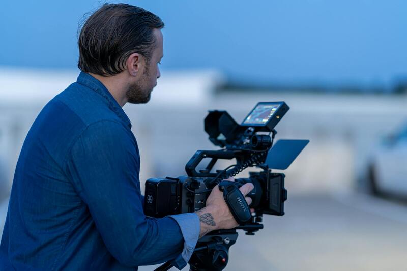
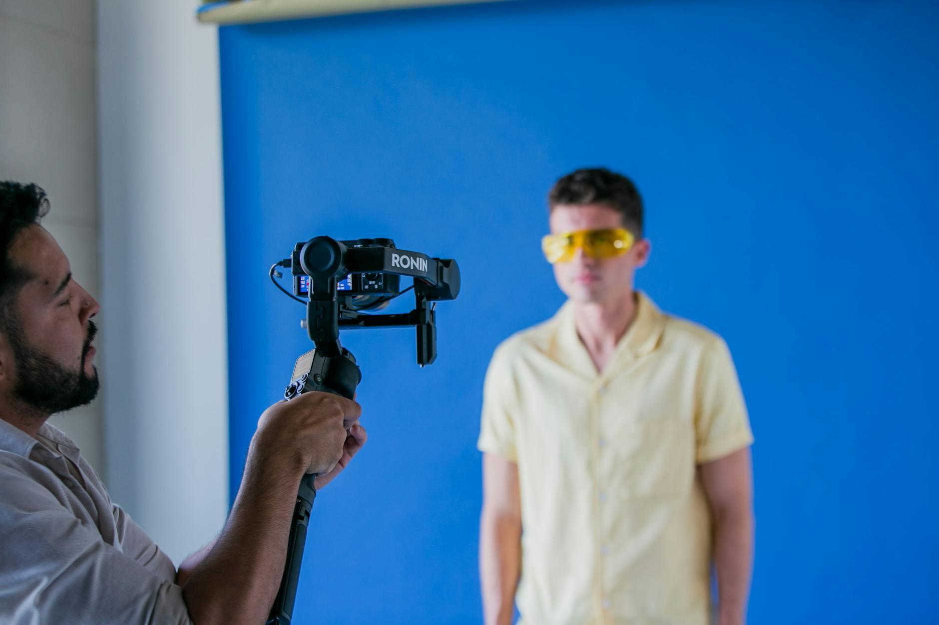
Producing professional-grade drone photos necessitates the use of advanced equipment and proven techniques. High-resolution cameras mounted on stable gimbals ensure sharp, jitter-free images. Multi-rotor drones with GPS capabilities enable precise flight stabilization and automated flight paths, facilitating consistent shots from predetermined angles. Optimal shoot conditions often involve shooting during golden hours—early morning or late afternoon—to leverage natural lighting that enhances textures and minimizes shadows. Employing polarized filters can reduce glare, especially over water or reflective surfaces prevalent in Miami's coastal areas.
Post-processing plays an essential role in refining drone visuals. Techniques such as color correction, contrast enhancement, and image stabilization help optimize the final output. When creating promotional videos, capturing smooth, deliberate movements and maintaining proper flight altitude contribute to cinematic quality footage that appeals to viewers. Advanced drone pilots also employ aerial mapping software to generate detailed site plans or 3D models, providing additional value for prospective buyers interested in planning or development.
Key Equipment and Techniques for Effective Drone Photography
To capture compelling imagery that elevates real estate listings, the selection of appropriate equipment is crucial. High-resolution cameras, capable of capturing detailed images, are paired with stabilizing gimbals to ensure clarity and minimize any motion blur. These gimbals are essential in maintaining image stability during flight, especially when navigating around complex property landscapes or tight spaces.
Advanced multi-rotor drones equipped with GPS and telemetry capabilities allow for precise flight control and repeatability. Such features ensure that shots are consistent across multiple sessions, enabling comparison and detailed analysis of property features over time. Automated flight modes, like waypoint navigation, streamline the process by enabling planned flight paths that cover all essential angles without manual interference.
Optimal photographic outcomes are often achieved under specific environmental conditions. Shooting during natural lighting peaks—namely early morning and late afternoon—maximizes the use of sunlight to highlight textures, exterior details, and landscape features. The soft, diffused light during these hours reduces harsh shadows and glare, producing more appealing visuals.
Polarizing filters are integral in reducing reflective surfaces' glare, such as pools, glass facades, and water bodies. These filters enhance color saturation and contrast, rendering images more vibrant and realistic.

Post-processing is the final step that transforms raw aerial footage into polished marketing material. Techniques like color grading adjust the visual tone to complement branding strategies, while contrast enhancements make property features stand out. Image stabilization software can be used to correct any residual jitters, ensuring smooth, cinematic-looking visuals.
When producing such content, it's vital to maintain consistent camera angles and flight altitudes. This uniformity ensures that serial images and videos align well, creating a cohesive and professional presentation. Additionally, employing software for creating detailed site maps or interactive 3D models adds an extra layer of depth and engagement for prospective buyers.
Effective Use of Drone Realty Photography: Equipment and Techniques
Deploying drone technology for real estate marketing demands a keen understanding of both the equipment and the techniques that yield compelling results. To capture high-quality visuals, professionals typically utilize advanced multi-rotor drones equipped with high-resolution cameras capable of capturing detailed imagery from various angles and altitudes. Stabilization gimbals are critical, ensuring that footage remains steady even in windy conditions, which is essential for smooth, professional-quality videos and photos.
Optimal shot composition involves meticulous planning of flight paths, camera angles, and elevations. Drones should be programmed to follow predetermined routes that encompass the property's main features, showcases of surrounding landscapes, and key vantage points. Employing automated flight planning software helps maintain consistent survey areas, ensuring uniformity across different shooting sessions.
The choice of camera settings is equally important. Utilizing high-resolution sensors allows for capturing detailed images that can be enlarged or cropped without loss of quality. Shooting in RAW format provides greater flexibility during post-processing, enabling adjustments to exposure, color balance, and sharpness while preserving image integrity.
Technical Techniques to Maximize Visual Impact
- Golden Hour Shooting: Capturing imagery during early morning or late afternoon offers softer, more natural lighting, reducing shadows and glare that can obscure property features.
- Polarized Filters: Attaching polarizing filters minimizes reflections on surfaces like glass and water, resulting in clearer, richer images that accurately depict the property's exterior elements.
- HDR Photography: High Dynamic Range techniques combine multiple exposures to ensure that both shadows and highlights are properly represented, especially in scenes with high contrast.
- Varied Altitude Shots: Collecting aerial images at different heights provides diverse perspectives, showcasing both expansive landscapes and detailed architectural elements.
Staying current with evolving drone technology, such as obstacle avoidance sensors and enhanced battery life, allows for more sophisticated and efficient shooting operations. Coupling these tools with precise flight control ensures safety and maximizes coverage quality, ultimately reinforcing the visual appeal and informational richness of the property portfolio.