Importance of Aerial Photography in Real Estate Marketing
Aerial photography has revolutionized the way real estate properties are showcased, offering a unique perspective that ground-level images simply cannot provide. This form of imaging captures the full scope and scale of a property, highlighting not only the structure but also the surrounding landscape, neighborhood amenities, and geographical features. Such comprehensive visual presentation is instrumental in creating an impactful listing that stands out in a competitive market.
High-quality aerial images significantly boost a property's appeal by providing potential buyers with a detailed view of the exterior, layout, and overall context within its environment. These images can reveal aspects like landscaping design, proximity to parks or bodies of water, and accessibility to major roads, all of which influence a buyer’s decision. Moreover, aerial photography fosters greater transparency and trust, as it presents an honest and thorough perspective of the property, reducing uncertainties during the decision-making process.
Investing in aerial imagery enhances a listing's visibility across various marketing channels, including online portals, social media platforms, and digital advertising. The captivating overhead views attract more viewers, resulting in increased traffic and engagement. Empirical data indicates that properties with compelling aerial visuals tend to receive more inquiries, schedule more showings, and ultimately sell faster than those relying solely on conventional images.
Beyond individual listings, aerial photography plays a strategic role in overall branding for real estate agencies. It demonstrates a commitment to high-quality marketing and attention to detail, positioning the agency as a professional and innovative figure in the local real estate market. Over time, this results in higher client trust and a stronger reputation.
In bustling markets like Miami, where market dynamics are intensely competitive, leveraging aerial photography can be the differentiating factor that elevates a property's appeal. It provides a comprehensive view that appeals to both local and international buyers, many of whom rely heavily on visual cues to make quick investment decisions. The ability to vividly showcase the property's position within the broader neighborhood ecosystem makes aerial images indispensable for effective real estate marketing today.

Legal and Regulatory Considerations
When planning to incorporate aerial imagery into real estate marketing strategies, it is essential to understand the comprehensive frameworks governing aerial photography practices. This process involves adherence to specific operational standards designed to ensure safety, privacy, and responsible use of aerial devices. Regulations typically cover aspects such as designated flight zones, altitude restrictions, and the necessary operational permits for drone use in various locales.
Operators must familiarize themselves with local airspace classifications, which determine where and how unmanned aircraft systems (UAS) can be flown safely. For example, restricted zones around airports, government buildings, and other sensitive areas require special clearance or are entirely off-limits. Understanding the defined boundaries prevents accidental violations that could disrupt operations or lead to penalties.
Data protection also plays a vital role in aerial photography. It is crucial to respect the privacy rights of neighbors and bystanders, which involves avoiding capturing personal activities or private property without consent. This respect for privacy not only aligns with ethical standards but also preserves the reputation of professionals involved in aerial real estate marketing.
Prior to any shooting session, professionals typically review local regulations, obtain necessary authorizations, and prepare detailed flight plans. This proactive approach mitigates risks and ensures operations proceed smoothly. Additionally, many jurisdictions require maintaining detailed logs of flight activities, which serve as proof of compliance in case of audits.
Staying updated with evolving regulations is critical, as authorities frequently revise policies relating to drone operations and aerial data collection. Industry organizations and official government sources are reliable channels to stay informed. Incorporating legal compliance into the planning phase enhances credibility and protects the investment in aerial marketing assets.
Advanced Techniques and Equipment for High-Quality Aerial Imagery
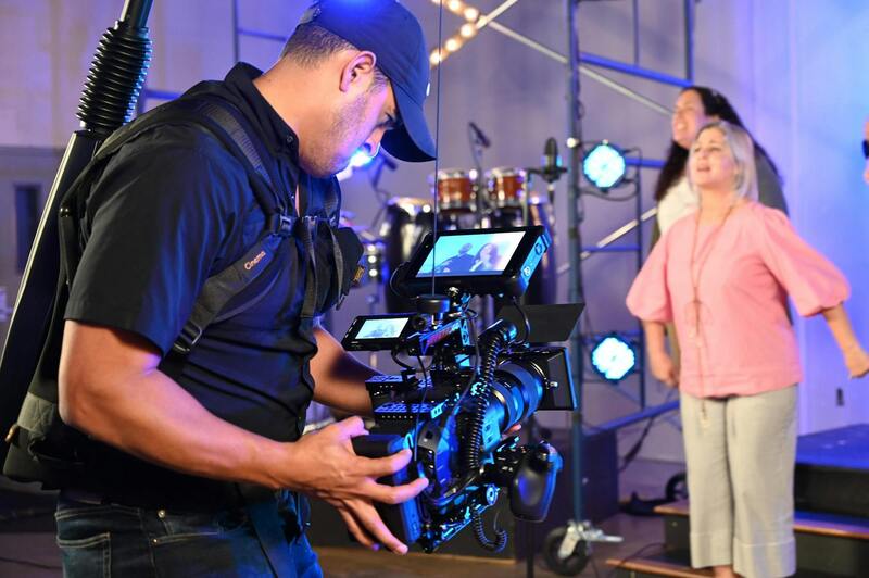
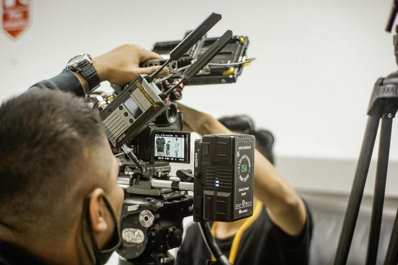
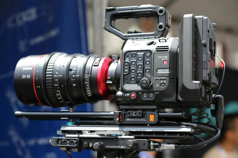
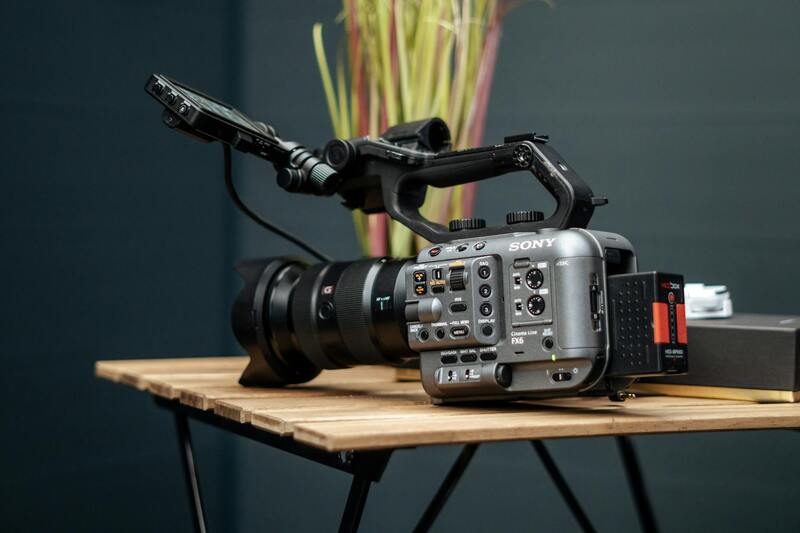
Achieving compelling aerial imagery in the realm of real estate demands the utilization of state-of-the-art equipment and sophisticated techniques. High-resolution cameras, stabilized gimbals, and advanced drone platforms are essential tools that enable professionals to capture crisp, detailed images that showcase property features with precision. The choice of drone model significantly influences the quality of the final imagery, with popular options including models equipped with 4K or higher resolution cameras, multi-axis gimbals for stabilization, and obstacle avoidance systems for safer operation.
One of the key techniques in aerial real estate photography involves optimal flight planning. Professionals meticulously plan flight paths to ensure comprehensive coverage of the property, including panoramic views, surrounding landscape, driveways, and unique architectural elements. Utilizing waypoint-based flight systems allows for precise, repeatable shots, which are invaluable when creating consistent marketing material or virtual tours.
Camera settings also play a crucial role. Professionals adjust exposure, aperture, and ISO to adapt to lighting conditions, ensuring images are neither overexposed nor underexposed. Employing ND filters can further enhance image quality during bright daylight, minimizing glare and maintaining color accuracy. Additionally, the use of HDR imaging techniques combines multiple exposures to produce well-balanced photographs that highlight both shadows and highlights, providing a comprehensive visual narrative of the property.
Effective composition and aerial framing also contribute significantly to the appeal of real estate visuals. Professionals apply principles of photography, such as the rule of thirds and leading lines, to create engaging images that guide viewers’ attention toward key property features. Moreover, shooting during optimal times of day — typically early morning or late afternoon — adds warm natural lighting and reduces shadows, enhancing the overall aesthetic.
Post-capture, image stabilization and color correction methods are deployed to optimize visuals, making them more vibrant and true-to-life. Employing software like Adobe Photoshop or Lightroom allows for strategic adjustments without compromising authenticity. For instance, subtle enhancements to contrast, sharpness, and saturation can elevate the images' attractiveness without crossing into artificial enhancement.
Besides stills, high-quality aerial video footage is pivotal in dynamic property presentations. Combining smooth drone flyovers with detailed panning shots provides potential buyers with an immersive experience, giving a holistic view of the property from every angle. The integration of 4K video footage into virtual tours elevates online listings, making them stand out in a competitive real estate market.
Legal and Regulatory Considerations
Employing aerial real estate photography requires adherence to specific guidelines that govern airspace usage and drone operations. Professionals specializing in this field utilize established protocols to navigate these regulations seamlessly, ensuring that every flight plan complies with local airspace standards. This includes securing necessary permissions, understanding restricted zones, and operating within designated altitudes to prevent overlap with manned aircraft or sensitive areas. Operational planning involves thorough pre-flight assessments, which encompass checking weather conditions to guarantee safe flying conditions and optimal image capture. Flight paths are meticulously mapped out to maximize coverage of the property while maintaining a safe distance from neighboring structures or other airspace restrictions. A comprehensive understanding of airspace classifications is vital. Certified operators are well-versed in the distinctions between controlled and uncontrolled zones, enabling them to obtain the required authorizations efficiently. This preparation ensures a smooth workflow that respects all boundaries and adheres to the guidelines set forth by aviation authorities. Additionally, drone operators must keep detailed flight logs and adhere to ongoing training standards. This documentation not only supports operational transparency but also enhances safety and accountability throughout each project. Using specialized software to plan and monitor flights further streamlines the process, reducing the likelihood of procedural oversights. Equipment choice is also influenced by these considerations, with the selection of drones and camera systems often dictated by regulatory constraints as well as the desired outcome. By employing state-of-the-art technology, professionals can deliver high-quality, compliant imagery that elevates real estate listings and enhances property promotion efforts. In essence, integrating responsible flying practices with advanced aerial photography techniques results in compelling visual narratives that resonate with potential buyers while maintaining adherence to relevant standards.
Legal and Regulatory Considerations
Professional aerial real estate photography requires adherence to specific operational standards that ensure safety, efficiency, and quality. Operators must be familiar with airspace classifications, which define the permissible altitudes, flight zones, and restrictions over certain areas. For example, controlled airspace near airports or urban centers might require prior authorizations or coordination with relevant air traffic control entities. This process involves submitting detailed flight plans, including intended paths, times, and safety measures, to secure approvals before flight. Such preparation minimizes disruptions and ensures compliance with established guidelines.
Equally important is maintaining meticulous flight logs, which document each mission’s details, including flight duration, location, equipment used, and any anomalies encountered. These records serve as reference points for future operations and demonstrate responsible management of aerial activities. Continuous training for drone operators helps uphold high standards of safety and procedural knowledge. Staying updated on technological advances and regulatory changes is essential, as it allows operators to refine their techniques and adapt to evolving requirements.

Utilizing specialized flight planning software not only streamlines the process but also enhances the precision of the flight paths, enabling comprehensive coverage of the property while safeguarding against airspace violations. This integration of technology ensures that every aerial shot meets high-quality standards and adheres to safety protocols.
The selection of drones and camera systems is influenced by regulatory constraints and the desired visual outcome. State-of-the-art equipment, such as high-resolution cameras with stabilized gimbals, ensures sharp, professional-grade imagery that captures the property’s best features from multiple angles. The ability to operate within permitted flight parameters enhances the consistency and reliability of results, providing real estate professionals with compelling visual assets.
Equipment and Technology for Aerial Photography
When engaging in aerial real estate photography, the choice of equipment and technology plays a crucial role in achieving high-quality results that effectively showcase property features. Advanced drones equipped with high-resolution cameras, stabilized gimbal systems, and intelligent flight modes enable operators to capture crisp, detailed images from various angles and altitudes. These tools allow precise control over flight paths, ensuring comprehensive coverage of the property, including difficult-to-reach areas such as rooftops and expansive landscapes.
Camera specifications are vital, with many professional-grade drones supporting 20-megapixel sensors or higher, capable of capturing ultra-high-definition images suitable for large-format printing and detailed online listings. The stabilization provided by gimbals minimizes motion blur, resulting in sharp imagery even in breezy conditions. Additionally, features like automatic exposure, focus adjustments, and HDR capabilities enhance image quality by balancing light levels and capturing rich detail in both shadows and highlights.
Recent advancements in drone technology also include obstacle avoidance systems, GPS waypoint navigation, and intelligent flight planning, which contribute to safer operations and more efficient shoots. These features allow operators to automate flight paths precisely, reducing the margin for error and ensuring consistent results across multiple shooting sessions. The integration of real-time image transmission enables immediate review of captured images, allowing for on-the-spot adjustments and ensuring that every shot meets the desired standards.
To maximize the value of aerial imagery, professionals select equipment that complies with the latest standards for safety, resolution, and maneuverability, tailored to the specific requirements of each property. Investing in top-tier hardware and software tools ensures that the visuals produced can truly elevate a real estate listing in a competitive market.
Best Practices for Capturing Aerial Real Estate Photos
Executing effective aerial photography involves strategic planning and adherence to best practices designed to maximize visual appeal and informational content. Proper pre-shoot assessment begins with analyzing the property layout, surrounding environment, lighting conditions, and weather forecasts. Scheduling shoots during optimal lighting hours, such as early morning or late afternoon, ensures natural lighting that enhances the property's features without harsh shadows or glare.
The altitude at which images are captured significantly impacts the perspective and context provided to potential buyers. Typically, multiple shots from varying heights—from wide-angle views to closer, detailed angles—offer a comprehensive visual story of the property. Using consistent framing and angles throughout the shoot helps maintain visual coherence and enables seamless integration into marketing materials.
Attention to safety protocols and airspace regulations is fundamental to successful aerial shoots. This includes verifying the flight permissions, avoiding restricted zones, and maintaining line-of-sight operation to ensure safe and compliant flights. Conducting test flights prior to the main shoot allows operators to troubleshoot issues with equipment or flight plan adjustments, preventing potential disruptions or subpar imagery.
Post-collection flight review and image review are vital steps to identify any gaps or inconsistencies in coverage. Retaking shots when necessary guarantees that the final collection of images presents the property in its best light, with clear, distortion-free visuals that accurately represent its spatial attributes. Combining these images with professionally calibrated editing techniques further enhances their visual impact, ensuring that each listing is optimized for maximum engagement and interest. Ultimately, meticulous planning and execution in aerial photography enable real estate professionals to produce compelling visual narratives that resonate with prospective buyers and elevate property listings above competitors.
Legal and Regulatory Considerations
Ensuring compliance with established procedures when conducting aerial real estate photography is crucial for the smooth execution of aerial shoots. This involves obtaining necessary permissions from relevant authorities and adhering to established guidelines for drone operation. Proper coordination with local aviation agencies or municipal offices can facilitate the approval process, facilitating a seamless shoot timeline and avoiding disruptions.
Maintaining precise operational protocols helps prevent issues related to restricted airspace and ensures safe distances from populated areas, airports, or sensitive infrastructure. Experienced aerial photographers or operators are familiar with updated airspace maps and restrictions, enabling them to plan flight paths that respect all operational boundaries.
Operational safety and adherence to flight parameters are reinforced through comprehensive pre-flight planning, which includes checking weather conditions, assessing wind speeds, and verifying equipment functionality. These steps contribute to shot quality and reduce the risk of accidents or equipment failure.

Respecting airspace regulations and safety measures is a critical component of professional aerial photography. It ensures that property images are captured efficiently and responsibly, laying the groundwork for exceptional marketing assets that showcase properties effectively without compromising safety or operational integrity.
Advanced Techniques and Emerging Trends in Aerial Real Estate Photography
To stay at the forefront of aerial real estate photography, professionals are increasingly integrating cutting-edge technologies and innovative techniques into their workflows. These advancements not only elevate the visual impact of property images but also enhance their informational value, providing potential buyers with comprehensive perspectives of the property and its surroundings.
One of the most significant developments is the adoption of high Dynamic Range (HDR) imaging in drone photography. HDR allows capturing multiple exposures of the same scene, which are then merged to produce images with a greater range of luminance. This technique delivers strikingly vivid photos that effectively showcase the property's exterior features, landscape details, and architectural nuances, even under challenging lighting conditions.
Moreover, the integration of 360-degree panoramic imaging is revolutionizing how properties are presented online. By capturing immersive spherical views, agents enable prospective buyers to virtually explore the entire property and its surroundings as if physically present. Such immersive imagery can significantly increase engagement, providing a comprehensive spatial understanding that static images may not convey fully.
Additionally, some practitioners are employing multispectral or thermal imaging to highlight specific features like landscape health, energy efficiency, or infrastructure diagnostics. While traditionally used in specialized industries, these technologies are now being adapted for select real estate applications, offering added value for development projects or luxury properties with intricate landscape or energy considerations.
Drone technology continues to evolve with enhanced stabilization systems and obstacle avoidance features, enabling smoother footage and safer operations in complex environments. These improvements allow for capturing complex architectural details or difficult-to-reach angles that would be challenging with conventional methods, ensuring comprehensive coverage of the property from every possible vantage point.
Furthermore, artificial intelligence (AI) and machine learning are increasingly being used to automate aspects of image processing and analysis. AI-powered editing software can rapidly improve image quality, correct distortions, and even generate optimized marketing assets based on predefined criteria—saving time and ensuring consistency in visual branding.
Emerging camera systems with higher resolution sensors also play a pivotal role, delivering ultra-sharp images that reveal fine details crucial for buyers assessing spaciousness, design intricacies, or construction quality. As image quality improves, so does the potential for creating compelling virtual tours, high-quality print materials, and online listings that stand out in a competitive market.
The effective use of these advanced tools and techniques requires an in-depth understanding of both the technology and the unique demands of real estate marketing. Professionals who embrace continual learning and technological innovation can produce imagery that significantly enhances marketing efforts, appeals to discerning buyers, and ultimately facilitates faster property turnover.