Introduction to Aerial Real Estate Photography
Aerial real estate photography has revolutionized the way properties are showcased in today’s competitive market. By capturing images from elevated viewpoints, this method provides a comprehensive perspective that ground-level photography simply cannot achieve. The use of drones and other aerial platforms enables real estate professionals to present properties in a manner that emphasizes their unique features, surrounding landscapes, and overall spatial relationships.
This form of imaging plays a vital role in marketing strategies, especially when aiming to attract potential buyers or investors. High-quality aerial shots highlight a property’s proximity to key amenities, showcase large estates with expansive grounds, and depict the overall aesthetic appeal from a bird's-eye view. As technology advances, these images become increasingly detailed and engaging, fostering a stronger visual connection between the property and prospective clients.

Employing aerial photography not only increases the visibility of real estate listings but also contributes to a more comprehensive understanding of the property’s layout and context within its environment. As a result, it has become an indispensable tool in real estate marketing, especially in vibrant markets like Miami, where views of the coastline, cityscapes, and sprawling estates can significantly influence buyer interest.
Moreover, as the demand for immersive and dynamic property presentations grows, real estate professionals are increasingly integrating aerial shots into their marketing campaigns. This approach ensures listings stand out in a crowded marketplace, providing potential buyers with an engaging and informative visual experience that showcases the full potential and appeal of each property.

High-quality aerial imagery is crucial for creating compelling narratives around property listings. When viewers can see the entire property, its landscape, and surrounding attractions, they gain a clearer understanding of its value and unique features. This holistic view often translates into faster sales and higher perceived value, confirming the importance of aerial real estate photography as a strategic asset in the modern real estate landscape.
Latest Drone Technology and Equipment
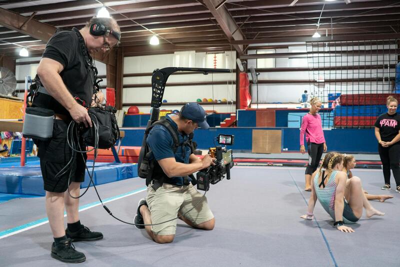
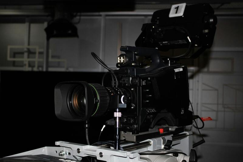
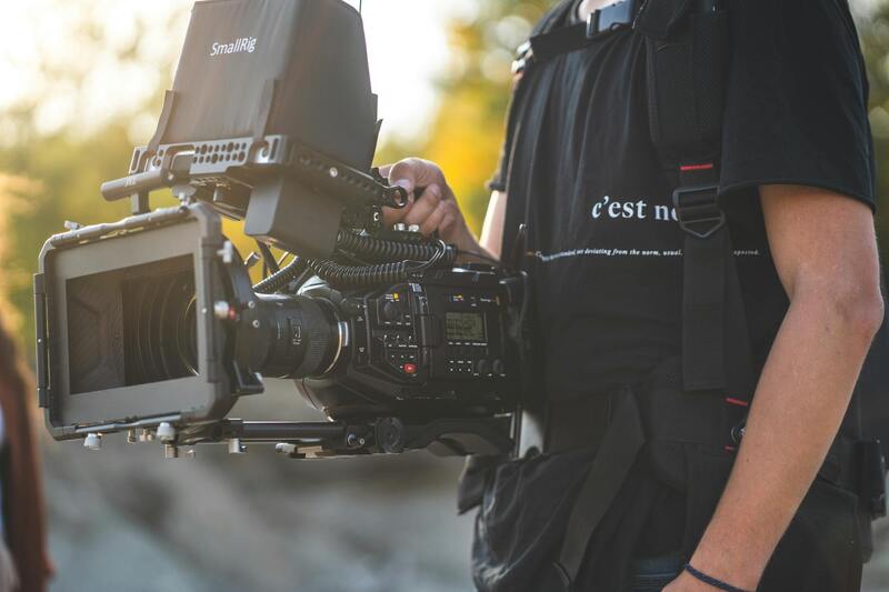
Utilizing the most advanced drone technology ensures the production of high-resolution aerial images that vividly capture a property's details and surrounding environment. Modern drones equipped with 4K cameras, stabilized gimbal systems, and obstacle avoidance sensors enable operators to obtain crisp, stable shots from various angles while navigating complex terrains such as waterfronts, mountain ranges, and urban landscapes. These technological capabilities allow real estate professionals to showcase properties with cinematic quality, heightening visual engagement.
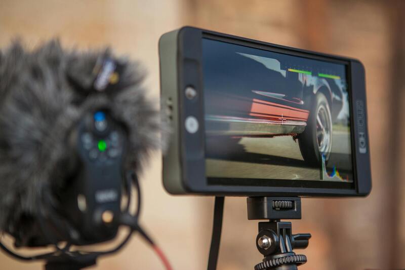
In addition to camera specifications, the development of intelligent flight planning software has revolutionized aerial photography workflows. Pre-programmed flight paths enable precise and repeatable shots, reducing human error and ensuring consistent coverage of large properties or expansive estates. Real-time data transmission allows pilots to monitor footage during flights, making on-the-fly adjustments for optimal results.
Battery technology has also progressed significantly, allowing for longer flight times that facilitate comprehensive coverage of extensive properties without interruptions. This translates into fewer flight sessions, better image consistency, and efficiency in project completion. Furthermore, the advent of lightweight materials and compact drone designs allows for easier transport and setup, making aerial shoots more accessible for various property types and locations.
Investing in the latest drone innovations enables real estate professionals to maintain competitive advantages by delivering exceptional visual content that resonates with prospective buyers and investors alike. High-quality imagery becomes a pivotal element in crafting compelling property narratives, especially within dynamic markets such as Miami, where panoramic views and scenic landscapes command premium attention.
Latest Drone Technology and Equipment
Advancements in drone technology continue to expand the capabilities and quality of aerial real estate photography. Modern drones are equipped with high-resolution cameras, often exceeding 4K and even 8K video capabilities, ensuring crisp, detailed imagery that captures the finest features of a property. This high level of detail allows potential buyers to explore a property virtually with an immersive experience, highlighting architectural intricacies and landscape features effectively.
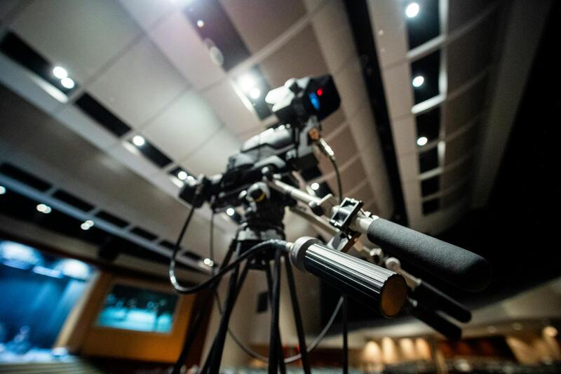
Stabilization systems are integral to achieving smooth, professional footage. Gimbal stabilizers, which counteract drone movements and vibrations, produce stable shots regardless of wind conditions or drone motion. These systems are especially beneficial in capturing panoramic views or sweeping landscape shots, contributing to a polished, cinematic presentation of listings.
Safety features integrated into current drone models play a crucial role in maintaining operational control and reducing risk during flights. Obstacle avoidance sensors help navigate around trees, buildings, and other hazards, enabling safer and more precise flight paths. Return-to-home functions, geofencing, and real-time telemetry data further enhance drone operation safety, ensuring smooth and reliable aerial shoots in complex environments like urban and coastal areas.

These technological innovations allow real estate professionals to produce exceptional visual content that stands out in competitive markets. The combination of high-definition imagery, stabilization for smooth footage, and safety features enables comprehensive and attractive property presentations that attract buyers and investors alike.
Best Practices for Aerial Real Estate Photography in Miami
To maximize the impact of aerial imagery, several key practices should be observed. Strategic planning is essential; this involves understanding the property layout, ideal flight paths, and lighting conditions to achieve optimal shots. Early morning or late afternoon often provides the most flattering natural light, casting soft shadows and enhancing textures.
Weather considerations are critical in coastal environments like Miami. Wind speed, precipitation, and cloud cover can influence drone stability and image clarity. Monitoring weather forecasts prior to scheduled shoots helps prevent cancellations or subpar footage, ensuring that each session yields high-quality results.
Navigating the visually appealing aspects of Miami’s real estate—such as beachfront resorts, upscale condos, and sprawling estates—requires a tactful approach to framing. Elevating the drone to capture sweeping vistas, oceanfront angles, or the lush landscape surrounding properties can create compelling visual narratives that resonate with prospective buyers.
Pre-Shoot Preparation
- Secure necessary permissions or permits for drone flights in specific areas.
- Conduct site reconnaissance to identify potential obstacles or hazardous zones.
- Coordinate flight timing with the best natural lighting conditions.
- Ensure all equipment is thoroughly checked and calibrated prior to flight.
- Communicate with property owners and stakeholders to align aerial shoot objectives.
Post-Processing Tips
- Use professional editing software to enhance brightness, contrast, and color fidelity.
- Stitch panoramic shots seamlessly for expansive landscape views.
- Integrate branding elements subtly within the visuals for marketing consistency.
- Create virtual tours or 360-degree views to elevate online listings.

Effective implementation of these best practices results in compelling and visually striking listings, ultimately elevating a property's perceived value and appeal in the bustling Miami real estate market.
Legal and Regulatory Considerations in Miami
When engaging in aerial real estate photography within Miami, adhering to established procedures and standards is essential for a smooth experience. It is critical to thoroughly understand the specific regulations governing drone operations in Miami to ensure that each shoot is conducted within authorized boundaries. This includes obtaining the necessary clearances from relevant municipal authorities or agencies responsible for airspace management and public safety. Proper documentation and compliance with local ordinances help avoid potential interruptions or penalties that could affect project timelines.
Operators should prioritize pre-flight planning, which involves assessing airspace restrictions, particularly in proximity to airports, helipads, or sensitive zones. Conducting detailed site reconnaissance is vital to identify potential obstacles such as tall structures, power lines, or dense foliage that might interfere with flight paths. Additionally, scheduling flights during optimal weather conditions—characterized by clear skies and low wind speeds—ensures safety and the quality of captured footage.
Engaging with property owners and local authorities during the planning phase helps establish clear permissions for drone flights over private property or restricted zones. This communication fosters transparency and ensures all parties are aligned regarding the scope and purpose of the imagery collection. Furthermore, keeping detailed records of permits and approvals can streamline the process for future projects and provide assurance of adherence to established standards.
In addition to regulatory compliance, drone operators should regularly update their equipment and software to incorporate the latest safety features and technological advancements. This proactive approach can reduce the risk of operational issues and enhance image quality. By following a disciplined, responsible methodology in aerial real estate photography, professionals can deliver visually compelling results that meet high industry standards while respecting Miami’s specific airspace requirements.
Legal and Regulatory Considerations in Miami
Navigating the landscape of aerial real estate photography in Miami requires a thorough understanding of the operational guidelines set forth for drone usage within the city. Operators must be aware of specific permits that may be necessary prior to conducting any aerial imaging activities. These permits typically involve submitting detailed flight plans and demonstrating adherence to safety protocols mandated by local authorities. Ensuring compliance with these standards not only facilitates smooth operations but also upholds the professional integrity of service providers.
Furthermore, privacy considerations are paramount when capturing aerial footage over private properties. Consent from property owners can expedite the shooting process and foster trust within the community. It is essential for aerial photographers to establish clear communication channels with all stakeholders involved, including property managers and local agencies. This proactive approach helps prevent misunderstandings and supports the seamless integration of aerial imagery into marketing materials.
Safety measures extend beyond obtaining permits; they encompass operational procedures that safeguard both the drone operators and the surrounding environment. Pre-flight assessments should include weather evaluations, obstacle identification, and flight path planning to mitigate potential risks. Continuous education about evolving regulations and technological updates support responsible operations, reinforcing the reputation of professionals dedicated to high standards.
Strategic Integration of Aerial Imagery into Real Estate Marketing Campaigns
Use of aerial imagery enhances a property’s online presentation, offering prospective buyers a comprehensive view that ground images cannot provide. This method allows real estate agents to showcase the property's surroundings, neighborhood amenities, and unique features, creating a compelling narrative that can dramatically influence buyer interest. Incorporating high-resolution aerial shots into digital listings, virtual tours, and social media posts can lead to increased engagement. Using dynamic visuals, including videos and 360-degree panoramas, enables potential buyers to virtually explore the property from multiple angles, creating an immersive experience that can accelerate decision-making. For maximum impact, aerial imagery should be strategically timed and consistent with the overall branding and marketing objectives. Highlighting key selling points through aerial perspectives can differentiate listings in a competitive market, ultimately contributing to faster sales cycles and potentially higher market value for the property.

Legal and Regulatory Considerations in Miami
When incorporating aerial imagery into real estate marketing, adherence to local operational guidelines in Miami is essential. While drone technology offers extraordinary advantages for showcasing properties, professionals must navigate the city’s specific regulations to ensure seamless integration of aerial shots into their marketing strategies. These guidelines typically outline permission protocols, altitude restrictions, and operational zones, which are designed to balance innovative marketing with safety and privacy concerns.
To maintain compliance, real estate agents and aerial photographers should obtain any necessary authorizations prior to deploying drones for property shoots. This often involves submitting flight plans to relevant city authorities or private property owners where applicable. Also, understanding designated no-fly zones, such as near airports or sensitive infrastructure, helps prevent unauthorized flights that could disrupt operations or lead to logistical challenges.
Technological platform updates continuously improve operational safety and efficiency. Advanced GPS stabilization, obstacle avoidance, and automated flight paths facilitate safe, precise aerial captures during property shoots. Additionally, integrating real-time monitoring tools provides a layer of oversight, allowing operators to adjust flight paths dynamically and avoid unintended incursions or disturbances.
Communication with property owners is also critical. Properly managing expectations and providing detailed briefings about drone operations for aerial real estate shoots foster transparency and cooperation. Many successful campaigns in Miami leverage these official methodologies, ensuring a professional, high-quality presentation that respects the locality’s standards and contributes to the trusted reputation of the property listing.
Furthermore, staying informed about updates in drone policies and emerging best practices in aerial photography guarantees that real estate professionals remain compliant and can leverage the latest advancements. This proactive approach enhances the quality and reliability of aerial imagery, reinforcing a property’s appeal while safeguarding operational integrity.
Legal and Regulatory Considerations in Miami
Operating aerial photography missions over Miami's real estate properties involves meticulous adherence to established operational protocols that are designed to safeguard both citizens and property interests. It is essential that aerial photographers utilize officially sanctioned platforms and methodologies to capture aerial imagery.
In Miami, this includes obtaining appropriate authorizations from relevant authorities, which may encompass scheduling during designated time frames, requesting permits for specific zones, and complying with local airspace guidelines. These procedures ensure that each drone operation aligns with city-specific standards, minimizes potential disturbances, and maintains high safety levels during property shoots.
One key aspect of these official processes involves pre-flight planning where flight paths are carefully mapped out to avoid prohibited zones such as near airports, military bases, or sensitive infrastructure. This foresight helps in preventing unintended incursions into restricted airspace, which could cause operational delays or necessitate rescheduling.
Furthermore, drone operators are often required to submit comprehensive flight plans that account for environmental conditions, property proximity, and other logistical factors—ensuring smooth and compliant execution of aerial captures. These detailed plans are reviewed by local authorities, and approval is granted only when safety standards are fully met.
In addition to planning, maintaining detailed operational logs and adhering to the prescribed altitude and distance limits contribute to compliant drone operations. This rigorous documentation fosters transparency and allows for swift resolution of any inquiries related to aerial data collection.
Another facet integral to these official methodologies involves continuous education and training for drone pilots. Staying informed about updates to operational policies, changes in airspace usage, and emerging best practices in aerial photography enables professionals to adapt swiftly and uphold the highest standards in their work.
Ultimately, leveraging official, legitimate avenues for aerial real estate photography not only sustains operational integrity but also enhances the professional reputation of real estate agents and photographers. This disciplined approach supports the delivery of high-quality, legally compliant imagery that elevates property listings in Miami’s competitive market, making them more appealing and trustworthy to prospective buyers.
Legal and Regulatory Considerations in Miami
Engaging in aerial real estate photography within Miami requires adherence to specific official protocols established by local aviation authorities and municipal agencies. To maintain compliance, professionals must follow designated procedures for flight authorizations, which often involve submitting detailed flight plans that specify aircraft type, operational altitude, flight paths, and safety measures. These plans are meticulously reviewed to ensure they meet standards designed to safeguard both public safety and property.
Furthermore, drone operators are typically mandated to acquire formal permits or certificates of authorization issued by relevant authorities. These certifications affirm that pilots possess the necessary training, skills, and understanding of Miami’s airspace regulations. Ongoing education and periodic re-certification are essential components of responsible operation, ensuring that operators stay current with evolving policies and technological advancements.

Operational boundaries, including altitude limits, distance from populated areas, and restrictions around protected zones, are explicitly outlined in official guidelines. Maintaining precise adherence to these parameters is crucial for legal continuous operation. Maintaining detailed flight logs not only supports transparency but also facilitates audits and inquiries, demonstrating that all aerial activities align with prescribed standards.
To further support responsible aerial photography, Miami’s authorities often require drone operators to participate in official training programs focused on airspace management, safety procedures, and data privacy considerations. This training ensures that professionals are well-equipped to conduct shoots efficiently while respecting the community’s interests.
Implementing these official methods not only demonstrates a commitment to safety and security but also elevates the credibility of the content produced. Real estate firms and photographers who meticulously follow these protocols position themselves as trustworthy consultants committed to delivering high-quality visuals within regulated standards. This approach fosters positive relationships with community stakeholders and paves the way for smoother project execution.
Constructing a Reputable Aerial Real Estate Portfolio
Building a portfolio of compliant aerial imagery enhances brand reputation, attracting discerning clients who value professionalism and adherence to local standards. By consistently utilizing legitimate techniques, professionals can effectively demonstrate their capability to produce stunning visuals while operating responsibly within the regulatory framework.