Overview of Aerial Property Photography
Aerial property photography involves capturing high-quality images of real estate and other properties from elevated perspectives using specialized equipment. This approach provides a comprehensive view of the property and its surroundings, enabling potential buyers and investors to appreciate the full scope of the property’s features, layout, and associated amenities. In the Miami real estate market, where waterfront views, sprawling estates, and intricate architectural designs are prominent, aerial photography plays a crucial role in property marketing strategies.
The primary purpose of aerial property photography is to showcase property details that are often not visible from ground level. It helps highlight the property's footprint, landscaping, proximity to key local landmarks, and neighborhood features, all of which influence purchasing decisions. For real estate professionals, this visual enhancement can significantly improve listing appeal, increase online engagement, and expedite sales processes.
In Miami’s dynamic market, aerial footage serves as a powerful differentiator, allowing listings to stand out amid numerous competing properties. Whether used in marketing brochures, virtual tours, or online portals, aerial images provide a compelling, immersive experience that can translate into faster sales and higher property valuations.

Utilizing aerial imagery not only benefits residential real estate but also commercial properties, luxury estates, and development projects. This technique's versatility makes it an essential component of comprehensive marketing campaigns aimed at reaching a broad audience and attracting serious buyers.
Types of Aerial Photography Equipment
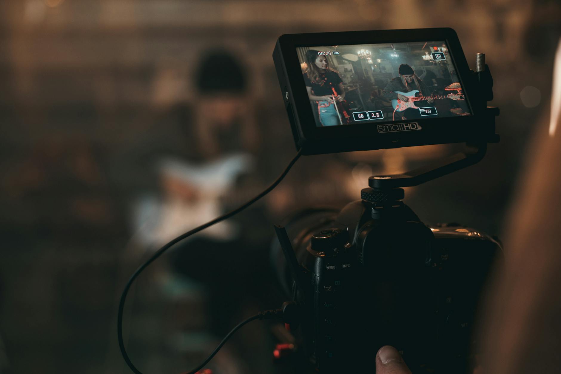
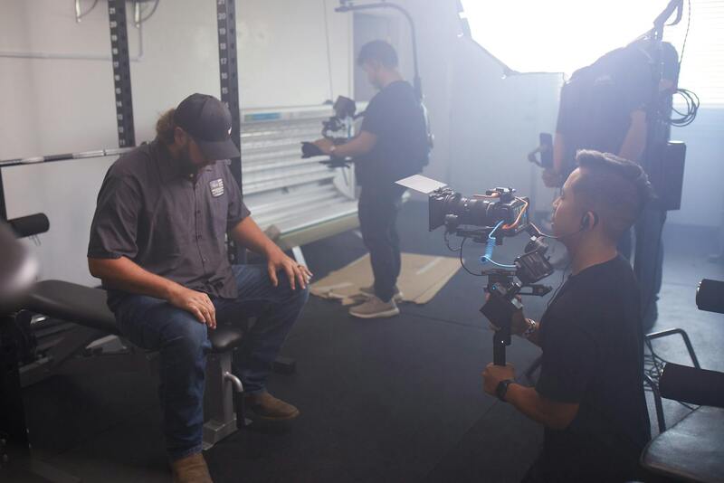
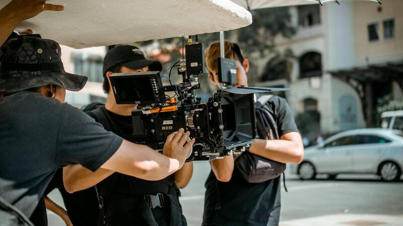
In the realm of aerial property photography, selecting the appropriate equipment is paramount to achieving exceptional image quality and capturing comprehensive property details. Professional-grade drones are equipped with advanced stabilization systems and high-resolution cameras, enabling precise control and sharp visuals from various altitudes and angles. Models such as quadcopters and hexacopters are favored for their maneuverability and stability, especially in complex urban environments like Miami, where proximity to skyscrapers and coastal landscapes demands adaptable platforms.
Camera technology plays a critical role in capturing vivid, detailed images that highlight property features. Mismatched or subpar equipment can result in blurred images, poor color fidelity, or insufficient detail. Consequently, high-end digital cameras with large sensors—often full-frame sensors—are utilized, providing excellent low-light performance and dynamic range. This ensures images remain crisp and color-rich, even in challenging lighting conditions such as bright Miami sunlight or shaded areas.
Accessories such as gimbals and filters further enhance image quality. Gimbals stabilize the camera during flight, reducing motion blur and ensuring smooth footage. Filters, including polarizers or ND filters, help control reflections and exposure, essential for capturing the true colors of Miami’s vibrant surroundings or shiny property exteriors. The integration of these sophisticated tools allows for the consistent production of professional results, tailored to meet the visual standards expected in competitive real estate markets.
Keeping equipment in top condition is crucial; therefore, drones and cameras are regularly maintained and calibrated. Training in proper operation techniques ensures safety and adherence to optimal flight paths, which is vital in Miami’s busy airspace. Overall, investing in high-quality, specialized equipment and accessories forms the backbone of successful aerial property photography, helping agents and property owners present their listings with clarity and allure that resonates with prospective buyers.
Techniques for Capturing Effective Property Images
Achieving exceptional aerial property images requires a combination of technical expertise and strategic planning. Proper flight planning is essential to ensure comprehensive coverage of the property, including surrounding landscapes, amenities, and unique architectural features. Using precise GPS coordinates and mapping technology, pilots can establish optimal flight paths that minimize shadowing and maximize lighting conditions.
Timing plays a pivotal role in image quality. Conducting shoots during the golden hour—shortly after sunrise or before sunset—provides softer, warmer light that enhances property features and creates appealing shadows. Maintaining consistent altitude and framing ensures uniformity across images, which is crucial for appealing property listings.
Camera settings should be meticulously adjusted to suit environmental conditions. ISO should be set as low as possible to reduce graininess, while aperture and shutter speed are fine-tuned to balance exposure and sharpness. Bracketing exposures allows for High Dynamic Range (HDR) processing, capturing both the bright sky and shadowed areas in detail. This technique results in images that reflect the true vibrancy of Miami’s urban and natural scenery.
Composition and Perspective
Effective composition involves strategic framing to showcase the property’s best features. Elevating the drone’s altitude can provide a comprehensive view, illustrating the property’s layout while highlighting proximity to neighborhood amenities and natural features. Varying perspectives—such as oblique angles versus top-down shots—offer potential buyers different visual insights, emphasizing spatial relationships and architectural details.
Lenses with wide-angle capabilities are standard in aerial photography, allowing for expansive shots that encompass the entire property within the frame. However, it’s important to avoid distortion, especially near edges, which can be corrected during post-processing for professional results.
Safety and Environmental Considerations
Maintaining safe distances from neighboring properties, infrastructure, and wildlife is paramount during aerial shoots. Conducting pre-flight assessments helps identify potential hazards or obstructions, like power lines or tall trees, ensuring the drone operates within safe parameters. Weather conditions must be monitored closely to prevent high winds, rain, or intense sunlight from compromising image quality or drone stability.
Utilizing Official Methods for Aerial Property Photography in Miami
In the diverse real estate landscape of Miami, employing official and reputable aerial photography methods ensures that property images meet high standards of quality, safety, and professionalism. The foundation begins with licensing and adhering to established flight protocols, which are designed to regulate drone operation and provide a framework for safe, efficient, and effective aerial imaging. Licensed drone operators undergo training and certification processes that emphasize responsible drone use, airspace awareness, and technical proficiency, all of which are crucial in maintaining industry standards.
Choosing certified equipment is another vital aspect. High-quality drones equipped with advanced stabilization systems, high-resolution sensors, and reliable GPS modules enable the capture of sharp, clear images capable of highlighting architectural features and surrounding landscapes with exceptional detail. Professional-grade cameras, often with interchangeable lenses, allow for customization based on specific property attributes, such as wide-angle views for spacious estates or detailed close-ups for unique architectural elements.
Pre-flight planning is essential in ensuring safety and efficiency during shoots. This includes obtaining necessary permits for flying in designated areas, particularly in densely populated neighborhoods or protected zones. Clear communication with local authorities, property owners, and other stakeholders helps establish permissions and coordinates flight paths that optimize angles and minimize disruptions. Additionally, conducting thorough site assessments identifies potential obstructions — such as power lines, trees, or wildlife — which could interfere with drone operations or compromise image quality.
Weather monitoring is another official consideration. Flights should be scheduled during periods of stable weather, ideally with minimal wind and optimal lighting conditions to enhance image clarity and overall aesthetic appeal. Utilizing flight planning tools, such as mapping software and GPS overlays, allows operators to execute precise flight paths that cover the entire property and surrounding area, capturing multiple angles and perspectives for comprehensive marketing material.
Incorporating these official methods not only enhances the visual impact of property images but also ensures compliance with operational standards that promote safety, reliability, and professional integrity in Miami's competitive real estate market. Every stage — from licensing and equipment selection to planning and execution — aligns with industry best practices, providing clients with premium images that effectively showcase their properties while safeguarding all involved parties.
Techniques for Capturing Effective Property Images
Achieving high-quality aerial property photography requires mastery in various technical methods that ensure clarity, composition, and visual appeal. Professional drone operators employ a combination of advanced flight planning, camera settings, and image-capturing techniques to produce images that stand out in a competitive real estate market.
Optimal Flight Planning and Camera Settings
Effective aerial photography begins with meticulous planning. This involves pre-mission site reconnaissance to identify potential obstructions and determine the best flight paths. By utilizing sophisticated mapping software and GPS overlays, operators can set waypoints that maximize coverage while maintaining safety standards. This planning ensures that each shot captures the property from the most advantageous angles.
Adjusting camera settings such as aperture, shutter speed, ISO, and white balance is vital. Shooting in RAW format provides greater flexibility in post-processing, allowing for adjustments in exposure and color balance to highlight property features effectively. Maintaining a consistent angle and altitude helps in creating a uniform and professional visual presentation across different images.
Utilization of Proper Aerial Angles and Perspectives
Versatility in angles can significantly influence the perceived value of a property. Overhead shots provide a comprehensive view of the property layout, while oblique angles reveal architectural details and landscape features. Dynamic perspectives, such as shots from slightly elevated angles, can accentuate property size and terrain contours, giving potential buyers a realistic sense of space.
Lighting and Weather Considerations
Lighting plays a pivotal role in the quality of aerial images. The ideal window for capturing properties is during the golden hour — shortly after sunrise or before sunset — when natural light imparts a warm glow and reduces harsh shadows. Overcast conditions can be beneficial for avoiding glare, though they may result in flatter images. Monitoring weather conditions is essential, as wind or rain can compromise drone stability and safety, leading to blurry images or failed flights.
Post-Processing for Enhanced Visual Impact
Following the flight, professional editing helps in refining the images. Adjustments in contrast, sharpness, and color saturation can emphasize key architectural features and landscape elements. Stitching multiple shots into panoramic images also provides wide-angle views that capture the entire property and surroundings, offering a comprehensive visual experience for prospective buyers.
High-quality aerial imagery is a powerful marketing tool that combines precise technical execution with artistic vision. Mastery of these techniques ensures that property visuals are not just attractive but also accurately represent the property’s unique sell points. Through the integration of strategic flight planning, optimal camera settings, and post-production refinements, real estate professionals can significantly enhance their property listings and attract more serious buyers.
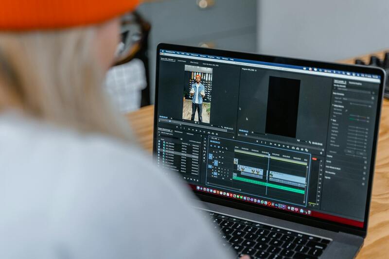
Post-Production and Image Optimization
Once the aerial images have been captured, the next crucial step involves meticulous editing to ensure each photograph maximizes its visual impact. A comprehensive post-processing workflow begins with color correction, where adjustments are made to balance exposure, contrast, and saturation. This step ensures that the colors are vibrant yet natural, accurately representing the property and its surroundings. Fine-tuning brightness and shadows helps highlight architectural details and landscape features that might otherwise be understated in raw footage.
Image sharpness and clarity are also enhanced through high-resolution editing, providing crisp visuals that stand out online and in promotional materials. Noise reduction can be applied to eliminate graininess caused by low-light conditions during flight, ensuring the images are clean and professional-looking.
Image Sizing and Formatting for Marketing
Optimizing images for specific platforms involves resizing and formatting files to meet technical requirements without compromising quality. For online listings, high-resolution images should be compressed efficiently to enable quick loading times without losing detail, which can impact how potential buyers perceive the property. Different digital channels may require varying aspect ratios; understanding these specifications ensures that images appear correctly across all devices and platforms.
Strategic Use of Visual Elements
Overlaying strategic graphics, such as property area boundaries or key features, can further enhance the informational value of aerial images. This is particularly useful in marketing brochures or interactive virtual tours, where additional context helps prospective buyers visualize the layout and scope of the property. Consistency in style and branding across all images supports a cohesive and professional presentation, reinforcing the credibility of the listing.
Maintaining Ethical Standards in Presentation
It's vital to uphold honest representation by ensuring that editing does not distort the actual appearance of the property. Enhancements should aim to showcase the property at its best while maintaining transparency and trustworthiness with potential clients. Authenticity in visual marketing fosters confidence and encourages serious inquiries, ultimately strengthening the reputation of the real estate agent or agency involved in the sale.
Post-Processing and Image Optimization
Effective post-production techniques are essential to maximize the visual impact of aerial property imagery. This process involves careful editing to enhance clarity, color accuracy, and overall image quality while preserving the integrity of the original shot. Adjustments to contrast, brightness, and sharpness can bring out details in both expansive landscape views and intricate architectural features. High dynamic range (HDR) imaging techniques may be employed to balance the exposure between bright skies and shadowed areas, ensuring that the property stands out prominently within the composition.
Once the raw images are refined, optimization for various platforms is crucial. Different online mediums impose specific requirements regarding image resolution, aspect ratio, and file size. For example, high-resolution images suited for website galleries should be compressed to facilitate faster loading times without sacrificing detail. Engaging in proper image formatting ensures that potential buyers experience crisp, clear visuals whether browsing on desktops, tablets, or smartphones. It also maintains consistency across marketing materials, creating a cohesive visual narrative that strengthens the property's appeal.
Overlay graphics can further augment aerial photographs by illustrating property boundaries, land use zones, or key amenities. Such visual aids assist prospective buyers in understanding the property's scope and distinctive features, thereby easing their decision-making process. When integrated seamlessly, these elements contribute to a polished presentation that emphasizes professionalism and attention to detail.
Maintaining Authenticity and Ethical Representation
While editing enhances visual appeal, it is vital to ensure that the images accurately reflect the physical characteristics of the property. Subtle adjustments should not distort the property's appearance, as transparency fosters trust among viewers. Authentic visual representations align with industry standards, helping to generate qualified inquiries and sustaining the credibility of the marketing campaign. Clear, honest imagery ultimately builds confidence and encourages serious interest from prospective buyers or investors.
Emerging Trends and Technologies in Aerial Property Photography
In the dynamic realm of aerial property photography, technological advancements continually reshape the scope of possibilities and elevate the quality of imagery delivered to clients. Staying at the forefront of these innovations ensures that professionals can produce compelling visuals that effectively showcase real estate assets, attracting potential buyers and investors alike.
Integration of Drone Technology with Advanced Imaging Systems
Modern drones equipped with high-resolution cameras, thermal imaging, and hyper-spectral sensors are transforming how aerial imagery is captured. These devices enable detailed documentation of large properties, complex land features, and outdoor amenities, providing a comprehensive visual narrative that static images alone cannot. The integration of stabilized gimbals ensures smooth footage, reducing distortions caused by wind or drone movement, thus capturing crisp, clear visuals suited for marketing materials and virtual tours.
Use of Artificial Intelligence and Machine Learning
Artificial intelligence (AI) and machine learning algorithms are now being employed to automate image processing and enhancement. Intelligent software can analyze raw footage, correct color imbalances, improve contrast, and even stitch panoramic views seamlessly. These tools not only expedite post-production workflows but also ensure consistency in image quality. Moreover, AI-driven analytics can provide insights into the most effective visual angles, helping photographers optimize their shooting strategies for maximum impact.
Real-Time and 3D Mapping Technologies
Emerging tools allow for real-time rendering and 3D modeling of properties using aerial data. Photogrammetry techniques convert overlapping images into detailed three-dimensional models, enabling virtual walkthroughs that offer prospective buyers an immersive experience. These technologies facilitate precise measurement of property boundaries, terrain features, and topographical variations, enhancing the informational value of aerial imagery. Such capabilities are particularly advantageous in showcasing large estates or properties with complex landscaping.
Advancements in Software for Image Management and Distribution
The proliferation of cloud-based platforms streamlines the management, storage, and distribution of aerial photographs. These systems enable real-time sharing with clients, integration into virtual tour platforms, and optimized delivery for various digital displays. Customizable dashboards facilitate feedback collection and analysis, ensuring continuous improvement in image capture strategies. As a result, agencies can maintain a competitive edge by offering visually striking, versatile, and easily accessible property visuals.