Importance of Aerial Photography in Real Estate Marketing
In the highly competitive real estate market, captivating visuals are essential to stand out. Aerial photography offers a unique vantage point that ground-level images cannot achieve, showcasing properties from an elevated perspective. This technique allows potential buyers to see the full scope of a property, including the layout, landscaping, and surrounding environment, which enhances their appreciation of its value.
High-quality aerial images can dramatically improve a property’s online listing, drawing more attention and attracting a larger pool of prospective buyers. This increased visibility often translates into faster sales and better offers. Because aerial photos can highlight features such as spacious backyards, proximity to amenities, and attractive scenic views, they serve as powerful tools to communicate the property's full potential.
From a marketing standpoint, aerial photography adds a layer of professionalism and sophistication to real estate listings. It helps establish credibility and trust, demonstrating that the seller or agent has invested in premium visual content. This approach aligns with the expectations of modern buyers who increasingly rely on high-quality digital imagery when making purchasing decisions.

Moreover, aerial photos can reveal previously unnoticed details or issues, providing transparency and aiding buyers in their decision-making process. For developers and investors, aerial imagery is invaluable for showcasing property development projects or land plots in context, highlighting accessibility, topography, and surrounding infrastructure.
Utilizing acknowledged and professional aerial photography methods ensures that listings are visually compelling and compliant with established standards. When executed correctly, aerial photography not only elevates the aesthetic appeal of real estate marketing efforts but also significantly increases engagement and conversion rates, leading to a more efficient sales process.

Types of Aerial Photography for Real Estate
When it comes to capturing comprehensive visuals of properties, various methods of aerial photography are available, each offering unique advantages tailored to different real estate needs. The most common types include drone photography, traditional helicopter or airplane shoots, and specialized imaging techniques such as HDR aerial shots.
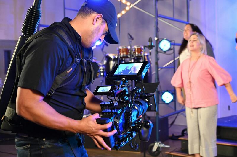
Drone photography has become the preferred choice for many real estate professionals due to its accessibility, cost-effectiveness, and versatility. Drones can easily maneuver around a property to capture dynamic angles and detailed shots from various heights, often reaching spots that would be difficult or intrusive with larger aircraft. This method allows for high-resolution images and videos that highlight the property’s exterior, landscaping, and surrounding neighborhood features.
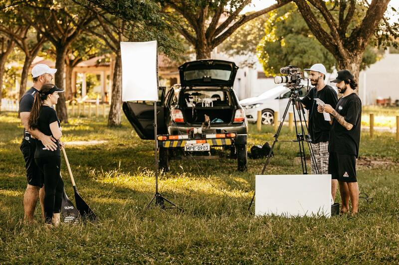
Traditional aerial shoots conducted via helicopters or small airplanes are still relevant, especially for larger properties, sprawling estates, or commercial developments. These methods provide broader coverage and can deliver uniform, high-quality images suited for expansive land or complex developments. Although more costly, these approaches often deliver a cinematic quality that enhances the overall presentation of luxury listings.
Advanced imaging techniques such as HDR (High Dynamic Range) aerial photography help improve the quality of images by capturing multiple exposures to better handle challenging lighting conditions. This ensures that every detail—from shadowed areas to bright highlights—is accurately represented, creating visually striking images that attract potential buyers.
Each method should be selected based on the specific goals of the campaign, property size, and budget constraints, with professional guidance ensuring optimal results. Proper selection and execution of these approaches contribute significantly to the effectiveness of real estate visual marketing strategies.
Legal and Safety Considerations in Aerial Photography
Executing aerial photography for real estate demands rigorous adherence to established safety protocols and operational standards. Ensuring the safety of crew members, property occupants, and bystanders is paramount during shooting sessions. This involves comprehensive risk assessments prior to any flight, meticulous planning of flight paths, and secure management of all equipment used during the shoot.
Operators are required to maintain up-to-date certifications and adhere to strict guidelines that govern the operation of unmanned aerial vehicles (UAVs). These standards encompass altitude restrictions, airspace clearances, and location-specific operational procedures. Proper authorization from relevant authorities often involves acquiring permits that outline the scope, timing, and safety measures for drone flights in specific areas.
Maintaining situational awareness and monitoring weather conditions are critical components to prevent accidents or equipment damage. Adverse weather, such as high winds, rain, or fog, can significantly impact image quality and safety. Conducting weather checks well in advance of the shoot ensures optimal conditions and minimizes risks associated with unforeseen weather changes.
Professional aerial photographers often collaborate with licensed operators who have extensive experience managing these safety protocols. This partnership guarantees that all aspects of the shoot—from equipment setup to flight execution—are handled with precision, reducing liability concerns and ensuring a smooth capture process.
Additional safety measures include conducting pre-flight checks on all UAV components, establishing clear communication channels among team members, and ensuring that emergency procedures are in place. Such due diligence not only protects everyone involved but also guarantees that the imagery captured meets high professional standards, ultimately enhancing the marketing efforts for real estate properties.
Types of Aerial Photography for Real Estate
Different methods of aerial photography serve various marketing needs and project specifications. The most common approaches include drone-based photography, helicopter filming, and fixed-wing aircraft imaging, each offering unique advantages and suitable scenarios for real estate professionals.
Drone aerial photography is the most accessible and versatile method in modern real estate marketing. Utilizing remotely operated UAVs, drones provide high-resolution images and videos from multiple angles, including top-down shots, oblique perspectives, and dynamic video tours. These technologies enable capturing intricate property details, surrounding landscapes, and neighborhood features with exceptional clarity and stability.
Helicopter or small aircraft photography, while generally more expensive and logistically complex, affords wider coverage and higher altitude images, ideal for showcasing large properties or extensive land parcels. These methods are especially useful when targeting commercial real estate developments, sprawling estates, or properties located in areas with challenging drone operation restrictions.
Each type of aerial photography is selected based on project scope, property size, and desired visual effects. Professional operators often employ advanced stabilization equipment, high-definition cameras, and specialized flight planning techniques to maximize image quality and safety during the shoot.
Incorporating various aerial imaging techniques allows real estate listings to stand out in competitive markets. Property developers and agents leverage these visual assets to craft compelling narratives about their listings, emphasizing property features that might be less noticeable from the ground. This strategic use of aerial imagery not only attracts more viewers but also helps facilitate quicker sales by providing a comprehensive view of the property and its surroundings.
Legal and Safety Considerations in Aerial Photography
Observing proper procedures and complying with established guidelines is essential for ensuring the safety of all participants and the protection of property during aerial photography sessions. This involves thorough planning for each shoot, including weather assessments and flight path evaluations, to mitigate risks associated with adverse conditions or unforeseen obstacles.
Employing certified professionals skilled in aerial operations further enhances safety. These experts utilize advanced equipment such as GPS-guided flight systems, obstacle avoidance technology, and fail-safe protocols to maintain control and respond promptly to any unexpected developments. Proper training and adherence to industry standards ensure that flights are conducted within safe operational parameters, reducing the potential for accidents or property damage.
Additionally, it is important to assess the operational environment, paying particular attention to airspace restrictions and proximity to populated areas. Conducting a detailed site survey before the shoot helps identify potential hazards, such as power lines, tall structures, or restricted zones, allowing for strategic planning that minimizes risk.
Adhering to regulations regarding flight altitude, camera operation, and privacy considerations is crucial when capturing aerial images. This includes maintaining proper distances from individuals and private properties, especially in densely populated or sensitive areas, to respect privacy and avoid disruptions.
Maintaining comprehensive documentation of flight plans, permits, and safety checks contributes to accountability and transparency. Regularly reviewing safety protocols and updating procedures ensures continuous compliance with best practices and helps in adapting to any evolving regulations.
By prioritizing safety and operational integrity, real estate professionals can leverage aerial imagery effectively while safeguarding all stakeholders involved in the process. This responsible approach builds trust and reinforces the credibility of the services offered.
Legal and Safety Considerations in Aerial Photography
Executing aerial photography for real estate purposes necessitates meticulous attention to operational guidelines that uphold safety standards and adhere to acceptable practices. It is vital to secure the appropriate clearances prior to any flight to ensure that all activities are coordinated with relevant authorities and airspace management entities. Conducting a thorough site survey before the shoot is essential; this involves evaluating potential hazards such as power lines, tall structures, dense foliage, and restricted zones. This proactive approach enables the planning of flight paths that avoid obstacles and minimize risk to property and personnel.
Operational safety extends to optimizing flight parameters, including maintaining appropriate altitudes and distances from property boundaries and private residences. This not only safeguards privacy but also diminishes the chances of interference with other airspace users or incidents with third parties. Utilizing modern unmanned aerial systems (UAS) equipped with fail-safe mechanisms, such as automatic return-to-home functions, further enhances safety during flights.

Documentation plays a critical role in maintaining operational integrity. This includes keeping comprehensive records of flight plans, obtained permits, safety checks, and crew credentials. Regular updates of safety protocols, staff training, and equipment maintenance are key to ensuring ongoing adherence to current best practices. These measures reinforce accountability, support transparency, and help mitigate unforeseen risks during aerial photography sessions.
Operational Environment and Ethical Considerations
It is also important to consider the privacy implications associated with aerial imaging. While capturing high-quality visuals, operators should maintain a respectful distance from private properties and avoid intruding on personal spaces. Strategic planning of shot angles and altitudes can help achieve compelling visuals while safeguarding individual privacy.
Operators must stay informed about any airspace restrictions, temporary flight restrictions (TFRs), or other regulatory guidelines that may influence flight operations. Collaboration with local authorities or air traffic control agencies ensures that flights are conducted within approved parameters, fostering safe interactions with other airspace users and local communities.
Technology and Continuous Compliance
Advanced technology, including GPS-enabled flight controllers and real-time monitoring systems, supports safe and compliant aerial photography practices. Regularly reviewing regulatory updates and industry standards ensures that operational procedures evolve in alignment with technological advances and regulatory requirements, reinforcing responsible practice and customer confidence in the services provided.
Utilizing Drone Technology and Satellite Imagery for Accurate, Market-Ready Visuals
In contemporary real estate marketing, the deployment of drone technology and satellite imagery offers a comprehensive approach to capturing high-quality aerial photos that elevate property presentations. These advanced imaging methods facilitate detailed, expansive visuals that not only highlight property features but also provide context within the surrounding environment, making listings more engaging and informative for prospective buyers.
Unmanned Aerial Vehicles (UAVs), commonly known as drones, are widely used for their maneuverability and ability to capture dynamic perspectives. They enable operators to access hard-to-reach areas safely and efficiently, ensuring that every aspect of a property, from landscaping to architectural details, is documented with precision. Utilizing drones equipped with high-resolution cameras ensures images showcase properties in their best light, emphasizing unique attributes that appeal to potential clients.
Satellite imagery complements drone footage by providing large-scale views that situate properties within broader geographic regions. This perspective is particularly advantageous for properties with extensive acreage, land development projects, or those located in rural areas. Satellite images can illustrate terrain features, access routes, and the relationship to nearby amenities, offering a comprehensive view that aids in decision-making processes.
Protocols for Aerial Data Collection and Post-Processing
Adopting structured protocols during aerial data collection ensures the consistency, accuracy, and quality of images. Prior to flight, detailed planning encompasses selecting optimal angles, altitudes, and times of day to capture ideal lighting conditions and minimize shadows. Flight paths are meticulously mapped to cover all necessary perspectives without redundancy, adhering to safety guidelines and airspace restrictions.
Post-processing involves several crucial steps, including color correction, image stitching, and editing to enhance clarity and visual impact. Advanced software tools allow for the creation of stitched mosaics, 3D models, and virtual walkthroughs which are becoming increasingly integral in marketing efforts. These processed visuals can be integrated into online listings, virtual tours, and various promotional campaigns to maximize reach and engagement.
Furthermore, archiving high-resolution aerial images ensures ongoing marketing flexibility. Updated imagery can be reused for seasonal campaigns, redevelopment plans, or to demonstrate neighborhood growth, providing continuous value and relevance within marketing strategies.
Maintaining Precision and Compliance in Aerial Image Acquisition
Operating with precision involves regular calibration of aircraft and camera equipment to maintain optimal image quality. Continuous training for flight operators ensures familiarity with evolving technologies, safety standards, and operational best practices. This ultimately optimizes flight efficiency while safeguarding the interests of both clients and the surrounding community.
In addition, integrating real-time monitoring systems helps oversee flight paths during operations, enabling immediate adjustments to avoid potential issues such as transient airspace restrictions or unforeseen obstacles. Employing georeferential data during the capture process enhances the spatial accuracy of images, providing reliable data for mapping, analysis, and presentation purposes.
Maintaining a record of flight logs, equipment maintenance schedules, and operational procedures supports ongoing compliance and accountability. Such documentation not only facilitates excellent service delivery but also fosters confidence among clients who depend on precise, trustworthy visuals for their marketing endeavors.
Legal and Safety Considerations in Aerial Photography
When engaging in aerial photography for real estate, it is essential to adhere to established protocols that prioritize safety, privacy, and operational efficiency. All aerial imaging activities should be conducted with proper authorization from relevant authorities to ensure the flight operations are compliant with local airspace regulations. Implementing comprehensive risk assessments prior to any flight mission helps identify potential hazards such as obstacles, weather conditions, or nearby restricted zones, allowing for proactive planning and mitigation.
Furthermore, employing well-maintained equipment and trained personnel is key to reducing operational risks. Flight crews should be thoroughly familiar with aircraft handling, emergency procedures, and safety standards. Use of certified unmanned aircraft systems (UAS) or manned aircraft must align with operational guidelines to minimize airborne incidents. Continuous weather monitoring during flights is also vital to avoid adverse conditions that could compromise safety or image quality.

It's equally important to respect the privacy rights of property owners and bystanders. Aerial photography should be conducted with sensitivity to privacy boundaries, and images should be captured in a manner that respects the community’s expectations. Utilizing dedicated flight paths and designated flight zones minimizes disturbances and ensures a smooth workflow.
Choosing a Miami Aerial Photography Production Agency
Partnering with an experienced aerial photography provider in Miami involves evaluating their compliance standards, technical expertise, and safety record. Reputable agencies possess the necessary certifications, insurance coverage, and state-of-the-art equipment to deliver high-quality visuals without compromising safety or operational integrity. They should also offer comprehensive planning services, including flight path simulations and contingency strategies, to guarantee efficient project execution.
By ensuring all personnel are trained and that operational procedures adhere to industry standards, clients can be confident their real estate marketing initiatives are supported by reliable, high-value imagery. This careful approach helps secure the best results while maintaining a safe environment for all involved parties.