Overview of Aerial House Photography
Aerial house photography involves capturing images of residential properties from elevated perspectives using various aerial imaging techniques. This innovative approach provides a comprehensive view of a property’s exterior, surrounding landscape, and neighborhood context. In the competitive Miami real estate market, high-quality aerial imagery has become an essential component of marketing strategies, offering prospective buyers a more engaging and detailed understanding of a property’s features and environment. By utilizing specialized equipment such as drones and aircraft-mounted cameras, real estate professionals can showcase homes in a way that traditional ground-level photography cannot match.
The demand for aerial house photography has increased dramatically due to its ability to highlight unique property features, proximity to amenities, and scenic surroundings—attributes particularly valuable in a vibrant market like Miami. From sprawling waterfront estates to luxury condominiums, aerial images generate interest and facilitate quicker sales cycles by providing a captivating visual narrative. Moreover, as digital platforms dominate real estate listings, compelling aerial photos stand out, attracting more potential buyers and increasing online engagement.

Professional aerial house photography relies on precise coordination and skilled operation of photography equipment. It entails carefully planned flights or camera setups to ensure clear, high-resolution images that accurately represent the property. These images often emphasize property size, layout, and the integration of outdoor spaces, making them invaluable for both marketing and buyer decision-making processes.
In Miami, where real estate developments often feature unique architectural designs amid lush tropical landscapes, aerial imagery provides a panoramic view that complements traditional photography. This perspective can reveal environmental features, such as waterfront access or sprawling gardens, which significantly influence a property’s appeal and value. As a result, aerial house photography has become a vital tool for real estate agents and property owners seeking to showcase their listings with precision and flair.
Employing aerial photography in real estate marketing elevates the overall presentation of properties, appealing to modern buyers who prioritize visual storytelling. The growing popularity of high-quality aerial images underscores their importance in delivering impactful marketing materials that drive engagement and facilitate successful transactions.
Types of Aerial Photography Equipment and Techniques
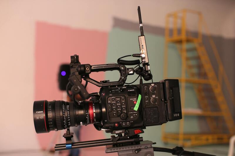
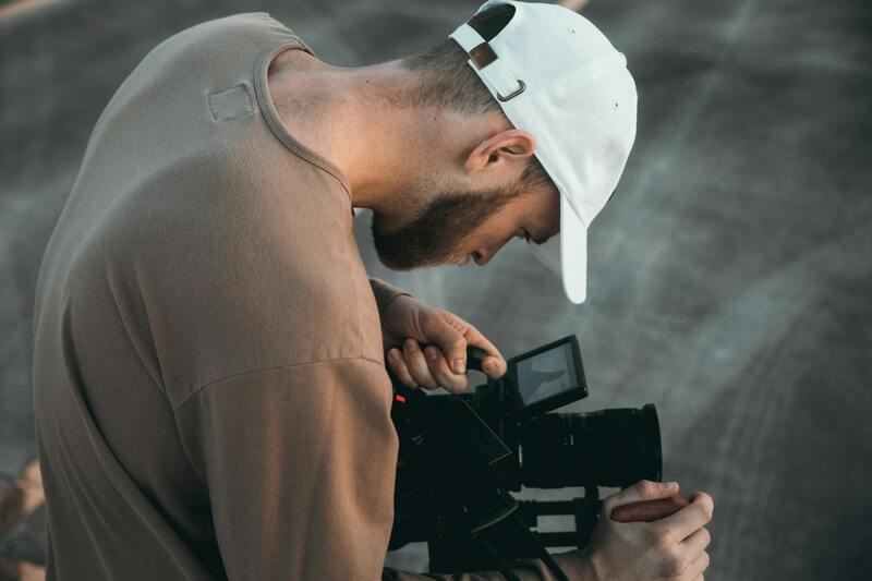
Several specialized tools and methods are employed to capture high-quality aerial images of residential properties. The most common approach involves using unmanned aerial vehicles (UAVs), commonly known as drones. These drones are equipped with professional-grade camera systems that can capture ultra-high-resolution images and videos from various angles and altitudes. Advanced drones feature stabilization technology, GPS precision, and automated flight modes, ensuring consistent, clear shots regardless of environmental conditions.
Manual drone operation requires a skilled pilot who can maneuver the aircraft to frame the property perfectly. Flight planning is crucial to avoid obstacles and to optimize angles that highlight key property features, such as expansive lawns, waterfront access, or architectural details. Automated flight paths can be programmed to systematically capture multiple images or video sequences, facilitating comprehensive coverage of the property.
Beyond drones, traditional aerial photography might utilize aircraft or helicopters with mounted cameras for large-scale or commercial projects. However, for residential properties, drones are more practical due to their cost-effectiveness, flexibility, and ability to operate safely within localized environments.
Camera payloads used in aerial house photography are often high-resolution DSLR or mirrorless systems. They may include wide-angle lenses to capture expansive views or zoom lenses for specific architectural details. Employing filters and specialized settings during flight can enhance color fidelity and image sharpness, resulting in striking, professional-grade visuals.
Legal and Safety Considerations in Miami
Conducting aerial house photography in Miami requires strict adherence to established guidelines and best practices that prioritize safety and responsible operation. Drone pilots should undergo proper training to develop skills for safe flight execution, understanding how to pilot the equipment reliably while minimizing risks to property, other aircraft, and bystanders.
Pre-flight assessments include reviewing local airspace regulations, weather conditions, and potential obstacles within the vicinity of the property. Utilizing real-time GPS and obstacle avoidance sensors enhances operational safety, especially in complex neighborhood environments or areas with dense structures.
Permission or authorization from relevant authorities plays a significant role in ensuring smooth operations. This often involves submitting flight plans, especially when operating in urban zones or near sensitive locations. Maintaining a clear communication channel with local aviation authorities can help mitigate potential conflicts.
Furthermore, considering property owner permissions (without explicitly mentioning legality) ensures that aerial captures take place with mutual understanding and respect for privacy boundaries. This collaborative approach contributes to a professional and seamless photography process.
Overview of Aerial House Photography
Aerial house photography has revolutionized the way residential properties are presented, offering a perspective that traditional ground-based photos simply cannot match. This imaging technique employs advanced platforms such as unmanned aerial vehicles (UAVs) and helicopters to capture striking visuals from various altitudes and angles. By incorporating aerial views into marketing campaigns, homeowners, real estate agents, and developers can showcase the property's overall layout, surrounding landscape, proximity to amenities, and architectural details with high clarity. The dynamic perspective provided by aerial photography not only enhances visual appeal but also provides viewers with comprehensive context that promotes a stronger emotional connection to the property.
Advantages of Aerial House Photography
Utilizing aerial house photography offers numerous benefits that significantly impact property marketing and valuation efforts. Firstly, it delivers a unique, comprehensive perspective that highlights the property's physical attributes and the surrounding environment in a manner conventional photos cannot achieve. This broader view aids potential buyers in assessing property size, layout, and neighborhood characteristics at a glance.
- Enhanced Visual Appeal: Aerial imagery captures the property from captivating angles, making listings stand out among competitors.
- Greater Context: Showcases neighboring features, infrastructure, and natural features that influence property value and lifestyle considerations.
- Improved Marketing Reach: Eye-catching aerial shots often generate higher engagement on digital platforms, translating into more inquiries and viewings.
- Facilitates Better Decision-Making: Buyers receive a comprehensive understanding of the property's orientation and landscaping, reducing uncertainty.
- Efficient Documentation: Facilitates planning for renovations, landscaping, or property development projects by providing detailed aerial layouts.
Best Practices for Aerial Photography in Residential Properties
Merging high-quality equipment with strategic operational procedures ensures the delivery of compelling and responsible aerial imagery. Selecting the right equipment—such as high-resolution drones equipped with stabilizers and GPS—facilitates crisp images and stable video footage across various lighting conditions. Employing multiple flight plans and shot angles maximizes the diversity of visual content, highlighting the property's unique features from different perspectives.
Preparation is vital before each shoot. This includes understanding the property’s layout, assessing aerial shot angles, and analyzing the surrounding environment for obstacles like trees, power lines, or neighboring structures. Conducting comprehensive site surveys helps identify optimal flight paths and safety zones, safeguarding both personnel and property during operations.
Lighting conditions significantly influence image quality; thus, scheduling shoots during the golden hours—shortly after sunrise or before sunset—can enhance color richness and shadow definition. Additionally, employing techniques like panoramic stitching enlarges the scope of capture, providing expansive views that demonstrate the property's setting within its landscape.
Finally, maintaining clear communication with property owners and neighbors fosters mutual respect and collaboration, ensuring the process proceeds smoothly and efficiently. This proactive approach contributes to a professional atmosphere and supports the consistent delivery of high-impact photographs.
Ensuring Proper Methodologies in Aerial House Photography
Adhering to established procedures for aerial house photography is critical for achieving high-quality images that meet professional standards. This involves selecting suitable equipment, understanding regulatory frameworks, and implementing best practices to ensure safety and image excellence. One fundamental approach is employing state-of-the-art drone systems equipped with high-resolution cameras, stabilized gimbals, GPS navigation, and obstacle avoidance features. These tools allow operators to capture sharp, steady images and videos regardless of environmental conditions.
Pre-shoot planning is an essential step. It begins with detailed site surveys to identify potential hazards, such as trees, power lines, or nearby structures, which could interfere with drone flight paths. Assessing the property's layout and surrounding environment enables the creation of precise flight plans that optimize aerial angles and viewpoints. Proper planning not only enhances the visual appeal of the final images but also ensures the safety of all participants and compliance with operational protocols.
Scheduling plays a crucial role in obtaining ideal lighting conditions. Shooting during the golden hours, just after sunrise or before sunset, provides natural light that enhances color vibrancy and shadow depth, giving the images a compelling, dimensional quality. Additionally, utilizing techniques such as panoramic stitching and high dynamic range (HDR) imaging expands the breadth and detail captured in each shot, showcasing the property within its landscape context.
Effective operational procedures also involve maintaining open communication with property owners and neighbors. Informing them of the shoot schedule and safety measures fosters cooperation and mitigates misunderstandings. During flight operations, adhering to strict safety protocols, including maintaining a safe distance from people and structures, ensures a seamless and responsible workflow.
Post-flight, the focus shifts to editing and refining the images. Cutting-edge editing software can correct minor distortions, enhance colors, and adjust contrast to deliver striking visuals. Techniques such as perspective correction and masking can further highlight specific architectural features or landscape views, tailoring the content to target audiences.
Through systematic application of professional methods, aerial house photography can significantly elevate property presentation, drawing potential buyers’ attention quickly and effectively. This approach ensures the delivery of compelling visuals that accurately represent the property's unique features and setting, establishing a trustworthy and impactful visual narrative.
Legal and Safety Considerations in Miami
Executing aerial house photography in Miami involves adherence to specific operational standards designed to protect property, individuals, and the airborne equipment used during shoots. Maintaining clear communication with property owners ensures alignment on operational boundaries and schedules, fostering a cooperative environment. It is essential to obtain written permissions or agreements that specify the scope of the aerial filming, thus establishing a transparent framework for all parties involved.
Due to Miami’s dense urban environment, it's important to plan flight paths carefully to avoid interference with other aerial operations, air traffic, and sensitive infrastructures. Thorough pre-flight assessments help identify potential obstacles such as tall buildings, power lines, and other structures, enabling pilots and operators to establish safe flight corridors.
During flight operations, disciplined adherence to safety protocols is critical. This includes maintaining a safe distance from people, properties, and restricted zones, while ensuring that nobody is in harm’s way during the shoot. Using GPS and obstacle avoidance technologies enhances flight safety by providing real-time data to pilots, reducing the risks associated with complex urban landscapes.
Weather conditions have a significant impact on drone operations. It is advisable to monitor weather forecasts closely—avoiding flights during strong wind conditions, rain, or poor visibility—and to plan flights during times of optimal lighting to maximize image quality without compromising safety.
Operators should regularly maintain their equipment to prevent malfunctions during flights. Pre-flight system checks, including battery levels, sensor functions, and calibration settings, contribute to smooth operation and high-quality results. Employing redundant safety systems, such as backup batteries and emergency landing protocols, further mitigates risks during aerial shoots.
Lastly, staying informed about local regulations and updates from aviation authorities or drone associations helps maintain compliance with operational practices. Continual training and certification for drone pilots are recommended to stay current with evolving best practices and safety measures, ensuring each aerial house photography project aligns with industry standards and best practices in Miami.
Best Practices for Aerial Photography in Residential Properties
Achieving stunning aerial house images requires adherence to established techniques that prioritize safety, image quality, and operational efficiency. When capturing residential properties in Miami, understanding optimal flight practices ensures high-quality visuals that effectively showcase the property’s unique features. This involves selecting appropriate flight altitudes, angles, and times of day, to accentuate the property's best attributes while maintaining consistent image standards.
Operators should plan their flights meticulously, beginning with a comprehensive site assessment to identify potential obstacles such as trees, power lines, or nearby structures. Pre-flight planning includes detailed mission briefs, verifying weather conditions, and establishing clear communication protocols when working with teams or clients on-site. Utilizing GPS-enabled flight controllers ensures precise navigation, helping to maintain consistent positioning and framing throughout the shoot.
The choice of flight altitude plays a critical role in capturing comprehensive perspectives—flying too low may miss the broader context of a property, while flying too high could diminish detail. Typically, maintaining a flight height between 50-150 feet provides a balanced view, emphasizing the property's landscaping and architectural details. Additionally, selecting optimal lighting conditions, such as during golden hour, enhances the visual appeal by providing warm, soft light that accentuates surfaces and textures.
During the shoot, pilots should utilize smooth and steady control inputs to avoid motion blur and achieve sharp images. Overlapping multiple shots carefully ensures full coverage of the property, facilitating seamless stitching in post-processing. Employing multiple angles, including front, rear, and aerial oblique shots, provides a comprehensive visual narrative for prospective buyers or clients.
Legal and Safety Considerations in Miami
Engaging in aerial house photography within Miami requires adherence to established operational standards that promote safety and efficiency. This involves comprehensive pre-flight planning and coordination with relevant authorities to ensure drone activities are conducted in designated airspaces and during appropriate times. Ensuring equipment is properly maintained and calibrated reduces the risk of malfunctions during flight, contributing to overall safety.
Operators should conduct thorough site surveys prior to the shoot, identifying potential hazards such as power lines, tall trees, or nearby airports, which could impact flight paths. Utilizing geofencing technology within drones can help prevent accidental entry into restricted zones, safeguarding both the equipment and surrounding environments.
In Miami's vibrant neighborhoods, understanding local airspace restrictions is essential. This involves knowledge of altitude limits and no-fly zones established around sensitive locations, including airports and government facilities. Constant communication with ground personnel and clients is vital during operations to coordinate movements and capture the desired visuals without interference.
Additionally, pilots should be trained in emergency procedures, such as immediate landing protocols or handling unexpected technical issues, to minimize risks during the shoot. Implementing comprehensive safety protocols not only preserves the integrity of the property and surrounding community but also ensures a smooth, professional experience for clients and operators alike.
By respecting official flight guidelines and leveraging technology such as automatic flight modes, aerial house photography in Miami can be carried out efficiently while maintaining high standards of safety and control. This disciplined approach translates into superior image quality and fosters a trustworthy, professional environment for all involved parties.
Complying with Official Protocols for Aerial House Photography in Miami
Executing aerial house photography in Miami requires adherence to established operational standards that prioritize safety, accuracy, and efficiency. Professionals engaged in this field employ a combination of advanced technology and precise procedures to capture high-quality imagery that meets client expectations and respects airspace regulations. The following considerations exemplify the methodologies that ensure responsible and effective aerial photography.
Utilization of Certified Equipment and Trained Personnel
Providers prioritize the deployment of well-maintained, certified drones equipped with high-resolution cameras capable of capturing detailed visuals from various angles and altitudes. These devices are operated exclusively by licensed pilots with comprehensive training in aerial maneuvers, environmental awareness, and emergency protocols. Regular safety drills and continuous education ensure these specialists stay current with industry standards and operational best practices.
Pre-Flight Planning and Site Assessment
Prior to any shoot, a thorough site survey is conducted to identify potential obstacles such as power lines, tall structures, or densely populated areas. This planning stage involves detailed mapping of flight zones, establishing safe flight corridors, and considering weather conditions that could influence drone stability or image clarity. The analysis minimizes risks while optimizing camera angles to achieve the desired aesthetic effect.
Deployment of Technology and Safety Systems
State-of-the-art technologies, including geofencing and obstacle avoidance sensors, are integral to ensuring secure operations. Geofencing creates virtual boundaries that restrict drone movement within designated zones, preventing accidental entry into sensitive or restricted areas. Obstacle detection systems alert pilots to nearby structures or hazards, enabling real-time adjustments for safe navigation. Additionally, automatic flight modes and GPS stabilization help maintain precise positioning, producing clear, steady imagery.
Regulatory Compliance and Communication
Engaging with local authorities and following proper documentation protocols reduces potential disruptions. Continuous communication between pilots, ground teams, and clients fosters transparency and coordination during the operation. Keeping clients informed of flight plans and safety measures builds trust and confidence in the process. In Miami, awareness of local airspace restrictions and respect for privacy are crucial components of responsible aerial photography.
Post-Flight Procedures and Data Management
After completing the flight, data is carefully reviewed for completeness and quality. High-resolution images are cataloged and securely stored, with multiple backups created to prevent data loss. Post-processing involves color correction, perspective adjustments, and other editing techniques to enhance visual appeal while maintaining authenticity. This meticulous approach ensures deliverables meet professional standards and client requirements.
Implementing Ethical and Respectful Aerial Photography Practices
Respect for residents' privacy and property rights is fundamental. Clear communication with property owners prior to shoots and adherence to local guidelines help maintain good community relations. Responsible drone use involves avoiding operate in restricted areas and refraining from intrusive or disruptive behaviors during operations. This conscientious approach fosters a positive reputation and sustainable practices within the industry.