Overview of Drone Photography in Real Estate
Drone photography has transformed the way real estate professionals showcase properties, especially in vibrant markets like Miami. With the ability to capture stunning aerial views, drone imagery offers a comprehensive perspective that traditional photography cannot achieve. This innovative approach enhances marketing efforts by highlighting a property's unique features, surrounding amenities, and its position within the Miami skyline or waterfronts.
As Miami’s real estate market continues to flourish, the utilization of drone technology becomes increasingly prevalent. Aerial shots are particularly effective for highlighting large properties, luxury estates, commercial developments, and beachfront homes. These images not only attract potential buyers but also elevate the overall presentation of listings, making them stand out in a competitive environment.
The application of drone photography extends beyond mere visual appeal. It provides valuable context about property size, layout, and setting, delivering a comprehensive view that helps clients and investors make informed decisions. Besides marketing, drones are used for site surveys, development planning, and construction monitoring, further integrating aerial imagery into the real estate lifecycle.
Many Miami real estate agencies recognize the advantage of incorporating drone images and videos into their marketing strategies. This technology facilitates virtual tours, helps to attract a broader audience, and accelerates the sales process. In a city where waterfront and luxury properties are abundant, the ability to showcase such features from the sky has become a vital component in property promotion.
Equipment and Technology Used in Real Estate Drone Photography
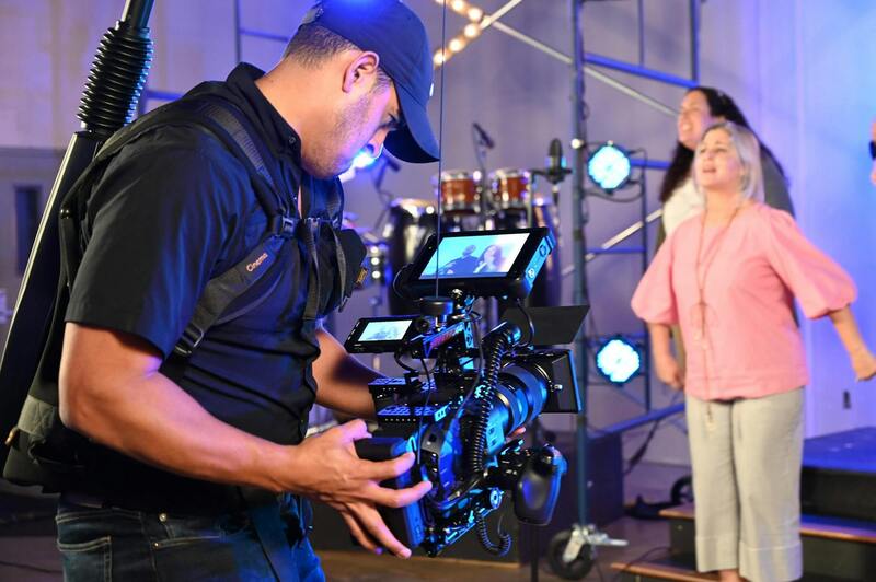
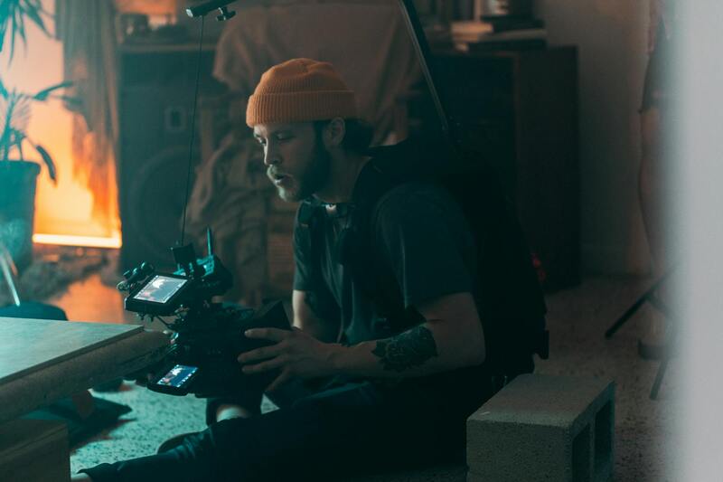
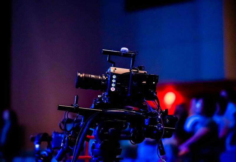
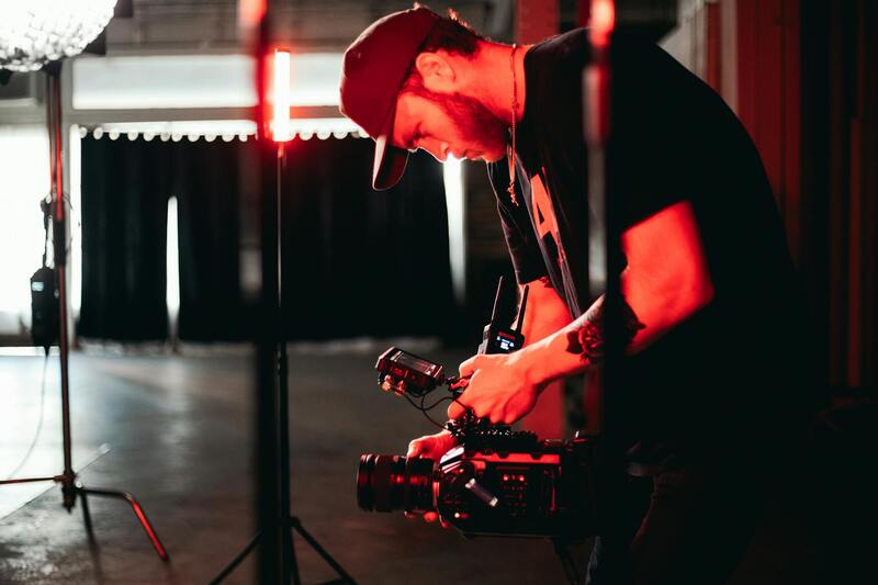
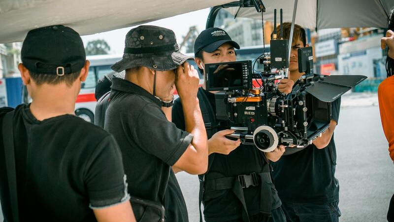
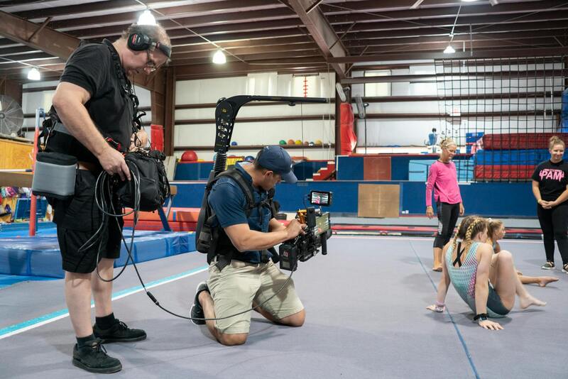
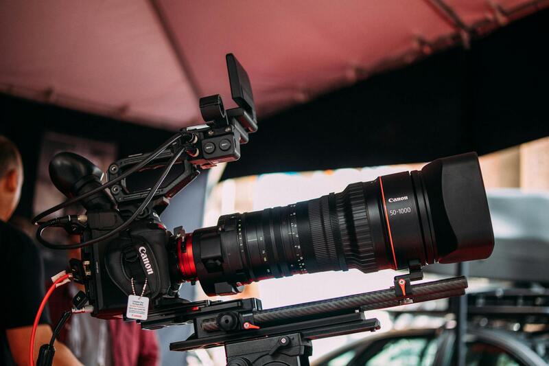
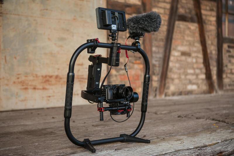
Implementing high-quality drone photography in the Miami real estate market requires sophisticated equipment and the latest technology. The core components include professional-grade drones equipped with high-resolution cameras capable of capturing detailed images and 4K or even higher video resolutions. These drones often feature gimbal stabilization systems, which ensure smooth, shake-free aerial footage, essential for creating professional listings that highlight a property's most attractive features.
When selecting the appropriate drone for real estate purposes, considerations include flight stability, battery life, payload capacity, and ease of operation. For instance, drones with extended flight times allow for comprehensive coverage of large properties without frequent battery swaps, while advanced GPS systems facilitate precise navigation and automated flight paths.
In addition to the drone hardware, professional-grade imaging software is employed during post-production. High dynamic range (HDR) processing, panoramic stitching, and color correction enhance the visual quality of images, ensuring that listings look vibrant and appealing. Advanced editing tools also allow for the integration of virtual staging and 3D modeling, offering potential buyers immersive experiences of properties from afar.
Furthermore, remote controllers with intuitive interfaces, real-time data transmission capabilities, and integrated displays facilitate efficient and safe operation of drones during shoots. Many service providers in Miami utilize drones with obstacle avoidance sensors, biometric calibration, and automated flight plans, which contribute to consistent, safe filming operations.
Modern real estate drone photography also leverages supplementary accessories, such as additional lenses for specialty shots, remote lighting setups for interior or low-light conditions, and portable storage solutions to handle the large file sizes generated during filming. Such technology integration enables comprehensive coverage of Miami's diverse properties, from towering skyscrapers to sprawling waterfront estates, ensuring every detail is captured with clarity and depth.
Equipment and Technology Used in Real Estate Drone Photography
The success of drone-based real estate photography hinges on the selection of precise, reliable equipment that delivers high-resolution imagery and versatile shooting capabilities. Modern drones utilized for property imaging are equipped with advanced stabilization systems, ensuring crisp visuals even in challenging weather conditions or complex flying environments.
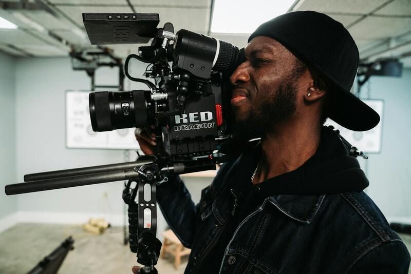
Key components include professional-grade cameras with high dynamic range (HDR), wide-angle lenses for capturing expansive property views, and sensor technology that enhances image clarity. Cameras are often mounted on gimbals—mechanical stabilization mounts—that counteract drone movement for smooth, jitter-free footage. Some drones also feature interchangeable lenses to adapt to diverse property sizes and styles, offering options for wide panoramas or detailed close-ups.
Accessories such as external lighting units enable videographers to illuminate interior spaces or highlight exterior features in dim lighting conditions. Remote control systems with ergonomic designs, coupled with intelligent flight modes—like waypoint navigation, orbit, and terrain following—maximize efficiency during shoots. Additionally, obstacle avoidance sensors, equipped on many high-end drones, automatically detect and circumvent structures or trees, minimizing flight risks and ensuring the safety of the equipment.
Large-capacity, portable storage devices, such as SSD drives or external hard drives, are essential for managing the substantial data files generated during high-resolution filming. Power management accessories, including extra batteries and quick-charging stations, enable extended shooting sessions without interruption. These technological tools allow Miami real estate professionals to capture comprehensive and visually compelling property representations with precision and consistency.
Legal and Regulatory Considerations
Implementing drone photography in the real estate sector requires adherence to a structured framework of procedures and standards designed to ensure safety, privacy, and operational excellence. Real estate professionals and drone operators must follow prescribed guidelines for airspace use, flight altitude, and operational distances to prevent interference with manned aircraft and to maintain controlled environments. Employing certified flight plans and obtaining necessary permissions for aerial imaging ensures compliance with established standards.
Operational safety is further enhanced through meticulous pre-flight planning, including comprehensive site assessments to identify potential obstacles and sensitive areas. This proactive approach safeguards not only the drone equipment but also any individuals present at the property or in adjacent locations. Proper risk management practices, such as establishing no-fly zones around public spaces or private properties, are essential components of responsible drone usage.
Maintaining detailed records of flight logs, maintenance routines, and pilot certifications fosters transparency and accountability. Employing instruction manuals and training programs certified by authoritative bodies helps ensure that operators possess the necessary skills for complex aerial tasks. These off-the-shelf procedures and protocols support black-and-white compliance while enabling innovative and creative visual solutions that elevate real estate marketing efforts.
Equipment and Technology Used in Real Estate Drone Photography
Incorporating advanced equipment ensures the production of high-quality visual content that accurately showcases properties. Certified drone platforms are equipped with high-resolution cameras, often boasting 4K or higher video capabilities and cinematic-grade sensors capable of capturing crystalline images under varying lighting conditions. Gimbaled stabilization mechanisms work in tandem with these cameras, allowing steady shots even across challenging terrains.
Additional tools such as external illumination units are employed to highlight architectural details or enhance interior shots in dimly lit environments. Remote control systems designed with ergonomic precision facilitate seamless maneuvering during complex flight paths, while intelligent flight modes—like automated orbit, waypoint navigation, and terrain following—enable consistent results with minimal pilot intervention.
Obstacle avoidance sensors embedded in sophisticated drone models detect nearby structures or vegetation, reducing the risk of accidental collision. For data management, high-capacity storage devices such as SSDs or rugged external drives are essential to archive large files and facilitate quick transfers for editing. Power management accessories, including additional batteries and portable charging stations, support prolonged shooting sessions, preventing disruptions due to power depletion.
Legal and Regulatory Considerations
Conducting effective real estate drone photography in Miami requires adherence to established operational protocols that prioritize safety, privacy, and responsible use of airspace. Professionals operating drone equipment must familiarize themselves with local guidelines to ensure smooth and compliant shoots. This includes securing appropriate flight permits for specific areas, especially those with heightened security or sensitive surroundings.
Operators are expected to maintain clear communication with local authorities when planning flights within urban environments or involving large gatherings near residential communities. Conducting pre-flight risk assessments helps identify potential obstacles like power lines, nearby buildings, or dense vegetation, which can interfere with drone navigation. Regular maintenance checks of the drone's mechanical and electronic systems are crucial to guarantee optimal performance during shoots.
Additionally, understanding weather conditions—such as wind speeds, humidity levels, and fluctuating temperatures—allows operators to determine the safest times to fly, minimizing risks associated with unpredictable weather. Respecting the privacy rights of property owners and residents remains paramount; this involves avoiding intrusive shots and focusing on legitimate angles that present the property attractively without infringing on personal spaces.
To support compliance, many professional drone services employ flight management software that tracks no-fly zones and automatically alerts pilots about restricted areas. Furthermore, maintaining detailed records of flights, including permits obtained, flight paths, and safety procedures followed, creates a transparent workflow aligned with industry best practices.
Equipment and Technology Used in Real Estate Drone Photography
Selecting the right equipment is crucial for capturing high-quality images that effectively showcase a property's unique features. Modern real estate drone photography relies on advanced drones equipped with high-resolution cameras capable of capturing detailed imagery from varying altitudes and angles. These cameras often include features such as gimbal stabilization, ensuring steady shots even in turbulent air conditions, and wide-angle lenses that provide expansive views of the property and its surroundings.
Multirotor drones are commonly preferred for their maneuverability and ease of operation, particularly in confined spaces or urban environments where precise control is necessary. Flight controllers integrated into these drones utilize GPS and GLONASS systems to facilitate stable hovering and accurate positioning, enabling photographers to execute complex flight paths with consistency.
Battery technology also plays a vital role, as longer flight times extend the range of shots that can be captured in a single session. Many professional setups incorporate multiple batteries to ensure uninterrupted shooting. In addition, remote controllers with digital displays provide operators with real-time feedback on battery status, GPS signal strength, and camera settings, allowing for precise adjustments during flight.
Software solutions are indispensable for planning and executing successful drone flights. Mission planning tools integrated with mapping capabilities help determine optimal flight paths, altitude, and angles, while no-fly zone databases assist in avoiding restricted airspaces. Post-flight data processing software enables photographers to stitch images seamlessly, create 3D models, or generate virtual tours that enhance property listings.
Ongoing technological innovations continue to enhance the capabilities of real estate drone photography. These include obstacle avoidance sensors that prevent collisions during flight, LA-based camera systems offering superior low-light performance, and AI-powered flight algorithms that optimize image capture based on environmental conditions. Investing in the latest equipment ensures real estate agents can deliver standout visuals that attract potential buyers and elevate their marketing strategies.
Equipment and Technology Used in Real Estate Drone Photography
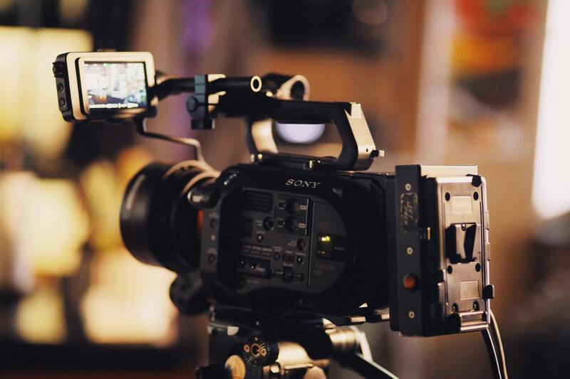
To achieve stunning visuals that effectively showcase properties, professionals in real estate drone photography rely on an advanced array of equipment and technology. The core component of any successful shoot is a reliable drone equipped with high-resolution cameras capable of capturing sharp, detailed images from various altitudes and angles. These drones typically feature stabilized gimbals that minimize vibrations and shakes, ensuring crystal-clear imagery even in challenging weather conditions or during complex maneuvers.
Modern drone models used in real estate emphasize flight stability, battery efficiency, and safety features. Intelligent navigation systems with GPS and GLONASS integration assist pilots in maintaining precise positioning, especially when capturing panoramic or aerial views that demand accuracy. Additionally, obstacle avoidance sensors are increasingly prevalent, allowing drones to detect and navigate around objects such as trees, power lines, or building structures without manual intervention, thereby reducing the risk of accidents or damage.
The cameras themselves play a pivotal role in the quality of the final imagery. Many drones deployed for real estate purposes incorporate professional-grade sensors capable of capturing 4K or higher resolution videos and stills. Some models include adjustable apertures, extensive ISO ranges, and wide dynamic ranges, which accommodate various lighting conditions and enable vibrant, true-to-life visuals with minimal post-processing. Lenses with wide fields of view help encompass entire property landscapes or impressive aerial facades, adding polish to marketing materials.
Battery technology is another critical aspect, as prolonged flight times expand the scope of shots that can be captured during a single session. Qualified operators often carry multiple batteries, ensuring extended operational periods and seamless transitions between flights. Digital remote controllers equipped with high-resolution screens provide real-time telemetry, camera framing, and environmental feedback, empowering pilots with the clarity needed for meticulous shot composition.
Complementing hardware is a suite of specialized software tools that facilitate mission planning, data processing, and post-production enhancements. Mapping and flight planning applications help determine optimal flight paths, set altitude parameters, and identify restricted zones, ensuring compliance and safety. After capturing images and videos, editing software enables real estate professionals to refine visuals, stitch together panoramas, or create immersive virtual tours that captivate potential buyers.
As technological innovations continue to evolve, UAV manufacturers focus on making drones smarter, safer, and more capable. Features like obstacle sensors, low-light performance enhancements, AI-powered flight assistance, and automated flight modes continually push the boundaries of what is achievable in real estate photography. Armed with the latest equipment and software, Miami-based real estate agents can elevate their property presentations to attract more interest and facilitate quicker sales.
Advanced Post-Production Techniques for Real Estate Drone Photography
Post-production is a critical phase in real estate drone photography, transforming raw footage into polished visuals that captivate potential buyers. High-quality editing not only enhances the aesthetic appeal of images but also ensures consistency across property listings, thereby strengthening a real estate agent’s professional brand. This process involves various techniques aimed at optimizing exposure, color accuracy, perspective correction, and visual storytelling.
Color Grading and Exposure Adjustment
Adjusting color balance and exposure levels helps in presenting properties in their best light. For instance, slight warmth can evoke a welcoming ambiance, while cool tones might emphasize modernity. Ensuring uniform brightness and contrast across images prevents discrepancies that could distract viewers. Advanced editing software enables precise control over these parameters, allowing real estate professionals to highlight key features of each property effectively.
Perspective Correction and Image Stitching
Drone-photographed images sometimes require perspective correction to rectify distortions caused by wide-angle lenses or camera angles. Correcting these distortions ensures walls and structural lines appear straight, enhancing overall credibility. Additionally, panoramic images or virtual tours benefit from stitching multiple shots seamlessly, creating comprehensive views that immerse potential buyers and provide detailed insight into the property layout.
Highlighting Property Features
Selective editing techniques like dodging and burning can emphasize architectural details, landscaped gardens, or unique features of a property. This guided visual flow captures viewer attention and guides it toward the property's most appealing aspects. Additionally, adding labels or annotations digitally can provide context for viewers, making it easier to understand the property's layout or features.
Creating Virtual Tours and 3D Renderings
Post-production tools enable the conversion of drone footage into immersive virtual tours, which have become an indispensable element of modern real estate marketing. 3D mapping and virtual reality integrations allow potential buyers to explore properties remotely, providing a comprehensive understanding of space and layout from anywhere. These virtual assets enhance engagement, potentially reducing the time on the market and increasing buyer confidence.
Quality Control and Compliance
Final editing also plays a role in quality control, ensuring all visuals meet professional standards before presentation. This includes checking for artifacts, glitches, or inconsistent lighting. By meticulously refining each image or video, real estate professionals reinforce their commitment to quality and attention to detail, which can positively influence client perception.
Enhancing Marketing Strategies
Well-edited visuals form the core of compelling marketing campaigns. High-quality images can be integrated into a range of media, including online listings, social media, virtual staging, and real estate presentations. They serve as a powerful tool to capture interest quickly and foster emotional connections, making the property more memorable to prospective buyers.
Ensuring Ethical Representation
While editing is crucial, maintaining honesty is equally important. The aim is to accurately represent the property’s features and condition without misleading viewers. Responsible post-production practices uphold the integrity of the listing, which builds trust and credibility in competitive markets like Miami.
Implementing Effective Workflow Management
Streamlining the post-production process is essential for meeting tight deadlines and maximizing productivity. Using dedicated project management tools helps organize editing tasks, track progress, and coordinate with clients. Establishing standardized procedures for color correction, perspective adjustment, and virtual tour creation ensures consistency across multiple listings, reinforcing a professional image.