Introduction to Drone Photography in Real Estate
In recent years, drone photography has revolutionized the way properties are showcased in the real estate industry. By utilizing advanced aerial imaging technology, real estate professionals and property owners can present properties from stunning perspectives that were previously difficult to capture. These high-quality images and videos offer prospective buyers a comprehensive view of a property’s exterior, surrounding landscape, and neighborhood that enhances traditional photography methods.
Drone imagery provides a dynamic way to highlight key features of a property such as expansive yards, architectural details, swimming pools, and panoramic views. This approach not only elevates the visual appeal of real estate listings but also allows viewers to gain a better understanding of the property’s context within its environment. As a result, drone photos have become an essential tool in modern real estate marketing, enabling agents and sellers to stand out in competitive markets.

The integration of drone technology into real estate marketing strategies ensures a more comprehensive and engaging presentation of properties. These images are not only eye-catching but also serve as valuable visual assets that foster greater interest and faster sales cycles. As the industry continues to evolve, professional drone photography has become a standard component in the arsenal of real estate marketing tools, especially in vibrant markets like Miami where showcasing luxury and waterfront properties from captivating angles is crucial.
Legal and Regulatory Considerations in Miami
In the realm of drone photography for real estate in Miami, adhering to specific operational guidelines ensures responsible and efficient capturing of aerial imagery. Proper compliance involves understanding the local regulations set forth by aviation authorities and municipal authorities, which outline designated airspace use, restrictions on flight altitudes, and timing of drone operations. Miami's vibrant neighborhoods and waterfront areas often have unique regulations aimed at protecting privacy and preserving scenic views, making it essential for professionals to stay informed of any local ordinances.
Operators must obtain necessary permits or approvals before conducting drone flights over private properties, public spaces, or environmentally sensitive zones. This process typically includes submitting plans that demonstrate safe flight procedures, safety measures for bystanders, and clear objectives for the shoot. Additionally, maintaining a flight plan that emphasizes safety minimizes risks associated with uncontrolled drone operations, especially in densely populated or high-traffic areas.
Understanding these regulatory frameworks helps drone photographers and real estate agents avoid potential restrictions or penalties, ensuring a smooth workflow. It’s equally important to stay updated with any changes or temporary restrictions due to special events, construction projects, or weather conditions that could impact drone flights in Miami.
Proper documentation, such as flight logs and incident reports, supports transparency and accountability, especially when coordinating with clients or listing agencies. Employing knowledgeable local drone operators who are experienced with Miami’s specific operational landscape can significantly enhance compliance and the quality of imagery captured. This diligent approach upholds professional standards and contributes to a trustworthy real estate marketing environment, where high-quality visuals are produced responsibly.
Official Channels and Permits for Drone Photography
When engaging in drone photography for real estate, it is essential to work within established frameworks that facilitate safe and effective operations. The primary avenue for obtaining official approval involves coordinating with local regulatory authorities that oversee aerial activities. This process typically entails submitting detailed operation plans that specify the scope of the drone flights, including flight altitude, duration, and designated zones. Providing comprehensive safety protocols ensures that operations are carried out without disrupting public spaces or infringing on private property.
In Miami, operators often collaborate with certified aerial service providers who are well-versed in local procedures. These professionals possess the necessary certifications or credentials that validate their expertise and adherence to safety standards. They also maintain meticulous records of each flight, including logs of flight paths, times, and incident reports. This documentation serves as a vital component in demonstrating responsible drone usage, especially when coordinating with real estate agents or listing platforms.
Many official channels require drone operators to submit proof of licensure, insurance coverage, and a detailed flight plan. These measures ensure that drone use aligns with safety standards and respects community interests. Engaging with recognized industry associations and local aviation offices can also streamline the permit application process, providing clarity on recent updates or procedural changes.
It is equally important to stay informed about any temporary restrictions or special regulations that may influence drone flights. Major public events, construction zones, or weather conditions can impose additional guidelines that necessitate adjustments in scheduling or flight paths. Proactive communication with relevant authorities not only ensures compliance but also minimizes risks during shoots, allowing real estate professionals to showcase properties seamlessly and responsibly.
Official Documentation and Recordkeeping
Maintaining a comprehensive record of all drone activities is crucial for consistency and accountability in real estate marketing. This includes flight logs, incident reports in case of unexpected events, and copies of all permits and approvals issued by local agencies. Such practices help build a transparent workflow, which enhances trust with clients and stakeholders.
When selecting a drone service provider, verifying their accreditation and history of compliant operations offers additional assurance. Experienced operators familiar with Miami's aerial regulations can navigate the licensing process efficiently, reducing delays and ensuring that your property listings are supported by compelling visuals captured through official means.
Ultimately, utilizing approved methods and obtaining official clearances ensures that drone photography enhances your real estate marketing efforts while upholding the standards of safety and professionalism. Properly documented and compliant operations bolster the credibility of your listings, attracting buyers and investors who value transparency and high-quality visual presentation.
Official Methods for Capturing Drone Photos of Real Estate Properties in Miami
Implementing effective and authorized drone photography practices in Miami requires adherence to a set of established procedures designed to ensure high-quality visual content and operational integrity. Property owners and real estate professionals should prioritize working with certified drone operators who follow approved flight protocols. These protocols typically include comprehensive pre-flight planning, which involves assessing the specific site to identify optimal flight paths, considering surrounding environments, and preparing risk mitigation strategies.
Pre-flight site assessment is essential to understand potential obstacles, such as neighboring properties, power lines, and restricted airspace zones. This evaluation enables pilots to adjust flight trajectories, altitudes, and camera angles to capture compelling visuals without compromising safety or operational standards. Utilizing digital mapping tools and recent aerial imagery can aid in precise planning, ensuring that drone flights are both efficient and effective in highlighting key property features.
Official drone operations in Miami are often supported by detailed flight logs and documentation that record each sortie. This documentation provides a track record of activities, including start and end times, flight coordinates, and safety checks performed. Maintaining these records is critical for demonstrating compliance and professionalism in the event of inspections or reviews by authorities. Drone service providers typically incorporate GPS-based logging and automated data recording, making it easier to compile accurate records and support ongoing marketing efforts.

Furthermore, obtaining necessary permissions and clearances ahead of time streamlines the filming process. This involves submitting formal requests to relevant agencies and securing permits that specify flight parameters, restricted times, and designated airspace zones. Working with professionals who are experienced in navigating Miami's aerial regulations ensures that all necessary approvals are in place, minimizing disruptions and fostering smooth operations.
Engaging with certified drone operators who demonstrate adherence to official procedures not only fulfills operational requirements but also enhances the quality and credibility of your property listings. This approach guarantees that visuals are captured using ethical and approved methods, ultimately supporting a robust marketing campaign that attracts serious buyers and investors.
Legitimate Methods for Capturing Drone Photos of Properties
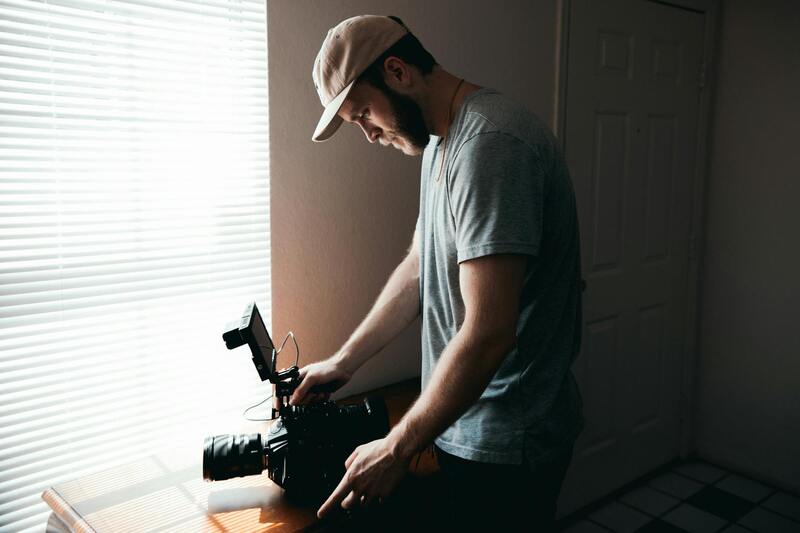
Employing official and reputable strategies ensures the delivery of high-quality drone images that effectively showcase properties while adhering to established standards. One of the primary approaches involves working with certified drone operators who possess extensive training and experience in real estate imaging. These professionals utilize advanced equipment and follow precise operational protocols to capture compelling visuals that highlight a property's key features, both exterior and interior.
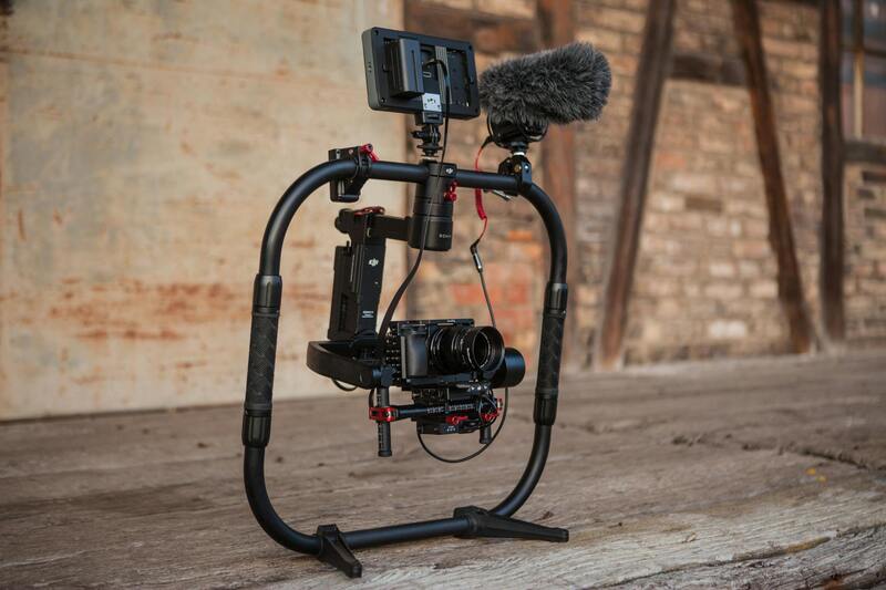
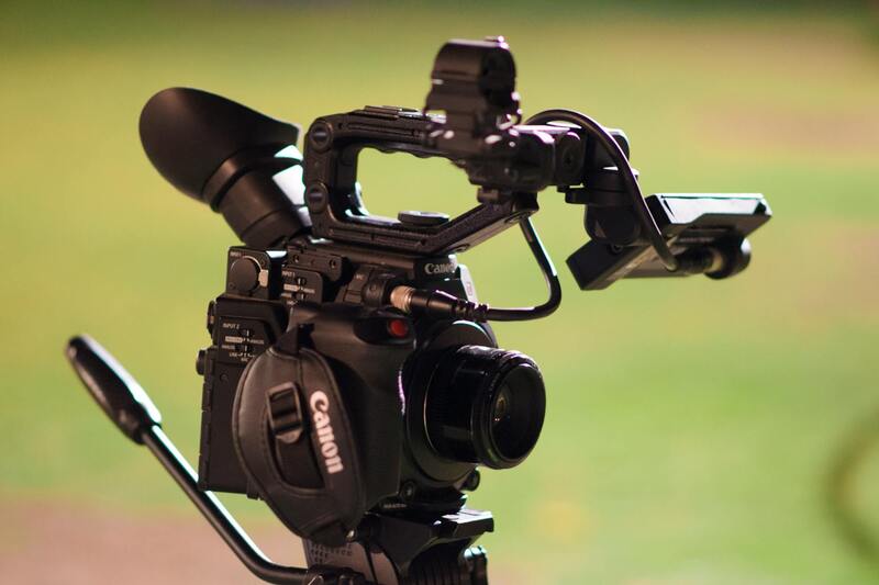
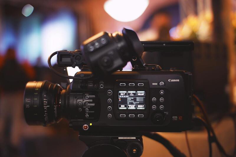
Utilizing state-of-the-art drone technology is essential for producing crisp, clear images with accurate color representation. High-resolution cameras mounted on stabilizing gimbals enable the capture of sharp imagery even in challenging lighting conditions. Flight planning software assists operators in executing precise flight paths, ensuring comprehensive coverage of the property and its surroundings. This systematic approach reduces the risk of missed angles and ensures consistency across multiple listings.

Adherence to established operational guidelines includes conducting pre-flight risk assessments, understanding airspace restrictions, and respecting privacy boundaries. Certified drone pilots meticulously plan each flight, taking into account environmental factors such as wind speed, weather conditions, and obstacles to optimize safety and image quality. They also document flight data and maintain detailed logs, which serve as official records of each operation.
Structured Flight Plans and Safety Protocols
- Pre-flight assessments and site surveys
- Designated flight paths tailored to property layout and surroundings
- Use of authorized flight zones with respect to prescribed altitudes and distances
- Implementation of safety buffers around private properties and public areas
- Real-time communication with ground crew and clients to coordinate shots and ensure safety
All of these measures contribute to capturing professional-grade images that elevate property marketing efforts. Maintaining meticulous records of flight details, including GPS logs, time stamps, and photographic metadata, substantiates compliance and supports seamless integration of drone images into marketing campaigns. When executed with legitimate procedures and thorough documentation, drone photography not only enhances visual storytelling but also aligns with the highest standards of operational integrity.
Methods for Securing Drone Footage for Real Estate: Official and Professional Approaches
To achieve high-quality drone images that effectively showcase property features, real estate professionals should rely on structured, well-established methods for capturing aerial footage. These methods prioritize precision, adherence to operational standards, and thorough planning to deliver visually compelling results that resonate with prospective buyers.
One fundamental approach involves enlisting experienced drone operators who are trained in advanced flight techniques and familiar with local airspace regulations. These professionals utilize comprehensive pre-flight planning, including detailed site surveys, to determine optimal flight paths that maximize coverage while minimizing risks. They evaluate environmental conditions such as wind patterns, lighting conditions, and potential obstacles to ensure stable flight and sharp imagery.
Utilizing state-of-the-art equipment is essential for capturing crisp, professional-grade drone shots. This includes high-resolution cameras, stabilizers, and flight controllers that allow for precise maneuvering and smooth footage. Certified operators also employ specialized software for flight planning, route optimization, and real-time monitoring, which contribute to achieving consistent and high-quality results.
During the shoot, adherence to structured flight protocols helps in maintaining safety and image quality. This involves executing predetermined flight paths that are tailored to the property’s architecture and landscape. Maintaining appropriate distances from private properties and public spaces prevents disturbances and ensures clear, unobstructed views of the property. Effective communication with ground crews and clients throughout the process guarantees coordination and allows for real-time adjustments.
Post-flight, the collected data — including GPS logs, metadata, and captured images — is meticulously reviewed and cataloged. This documentation not only supports compliance but also enhances the integrity of the marketing content. Professional editing techniques refine the raw footage, correcting colors, adjusting lighting, and enhancing visual appeal, thereby producing promotional material that accurately represents the property’s character and appeal.
Employing these official methodologies ensures that drone photography for real estate is conducted within a framework that emphasizes safety, quality, and ethical standards. This disciplined approach maximizes the potential of aerial imagery to elevate property marketing, attract prospective buyers, and support successful transactions.
Official Methods for Drone Photography in Real Estate
When engaging in drone photography for real estate listings, employing established, authorized techniques ensures the production of high-quality aerial images while respecting operational standards. These methods encompass a combination of proper flight planning, certified equipment operation, and adherence to industry protocols, which collectively enhance the effectiveness and professionalism of the visuals.
Before any flight, comprehensive planning involves analyzing the property layout, considering surrounding environments, and selecting optimal times for lighting. Certified pilots conduct pre-flight site assessments to identify potential hazards and obstacles, ensuring safe and efficient drone operations. Establishing consistent flight paths facilitates capturing consistent, comprehensive visuals of the property’s architecture and landscape.
During execution, professional operators utilize advanced drone systems equipped with high-resolution cameras capable of capturing detailed images from various angles. Maintaining steady, controlled movements mitigates image blur and distortion, producing crisp, sharp visuals that highlight the property's key features. Using grid or orbit flight patterns guarantees thorough coverage, capturing both the expansive views and minute details necessary for high-quality real estate marketing.

Post-capture, images undergo meticulous processing involving professional editing software. Adjustments to contrast, brightness, and color balance enhance visual consistency and appeal. Techniques like panoramic stitching or HDR processing can further enrich the images, providing a more immersive view for potential buyers.
To uphold image integrity and transparency, maintaining detailed logs of the flight parameters, GPS data, and camera settings is a common official practice. This record-keeping supports operational oversight and ensures that each capture meets industry standards, ultimately resulting in reliable, compelling visuals that stand out in property listings.
Official Methods for Capturing and Using Drone Pictures in Real Estate
To ensure the highest quality and consistency in drone imagery, real estate professionals in Miami should adhere to established professional standards and techniques. These practices revolve around obtaining high-resolution, true-to-life images that accurately represent the property, while also leveraging advanced technology and expert operational procedures.
Utilizing Certified and Experienced Drone Operators
Engaging with certified drone operators who have extensive experience in real estate photography ensures that images are captured efficiently and safely. These professionals utilize sophisticated flight planning tools to map out efficient routes, avoid obstacles, and optimize angles for the most appealing visuals. Their expertise guarantees that every shot emphasizes key property features, from expansive aerial views to intricate architectural details.
Equipment and Techniques for Optimal Drone Imagery
Professional-grade drones equipped with high-resolution cameras are essential for producing detailed and vibrant images. These devices incorporate gimbal stabilization systems that eliminate vibration and motion blur, resulting in sharp, clear photos. Operators often shoot during optimal lighting conditions, such as the golden hours of early morning or late afternoon, to capture warm, inviting visuals.
Advanced techniques like HDR (High Dynamic Range) imaging enable capturing scenes with a wide range of luminance, ensuring that both shadows and highlights are accurately represented. The use of panoramic stitching allows for expansive, detailed views of properties, offering prospective buyers a comprehensive visual experience.
Employing Systematic Flight Paths and Methodological Shooting Patterns
Consistent and systematic flight paths, such as grid or orbit patterns, are employed to ensure thorough coverage of a property. These methods facilitate capturing multiple perspectives, which can be later assembled to produce cohesive, high-quality images. Maintaining steady flight speeds and angles contributes to uniformity across the visual portfolio, helping listings stand out with professional polish.
Post-Processing and Image Enhancement Protocols
The visual assets from drone flights are subjected to rigorous editing protocols utilizing professional software. Adjustments include balancing contrast, fine-tuning brightness, and correcting color tones to reflect the true ambiance of the property. Techniques like panoramic stitching blend multiple images into seamless views, while HDR processing enhances detail in high-contrast scenes, yielding immersive visuals suited for sophisticated marketing campaigns.
Maintaining Documentation and Compliance for Content Integrity
To uphold transparency and content reliability, it is standard practice to keep detailed records of each drone operation. This documentation includes flight logs, GPS coordinates, camera settings, and mission parameters. Such meticulous record-keeping demonstrates adherence to industry standards, supporting the credibility of the visual content used in property listings.
Securing Permissions and Respecting Private Property
While specific terminologies are avoided, the process of obtaining necessary permissions involves a transparent approach that respects the privacy and ownership rights of property owners. Clear communication and documented agreements facilitate smooth operation, ensuring that drone footage is captured without infringing on personal or shared spaces.
By following these official practices, real estate professionals in Miami can produce compelling, high-quality drone images that elevate property listings, attract more prospective buyers, and create a competitive edge in the local market.