Importance of Drone Photography in Real Estate Marketing
In the highly competitive real estate market of Miami, showcasing properties through engaging visual content has become essential for attracting prospective buyers. Drone photography offers a distinctive advantage by capturing stunning aerial perspectives that traditional ground-level images cannot provide. These high-altitude shots highlight the property's exterior features, surrounding landscape, neighborhood amenities, and unique architectural details, delivering a comprehensive view that entices potential buyers and helps listings stand out.
Professional drone photos enhance the visual appeal of property listings by providing a sense of scale and spatial awareness. This is particularly beneficial for larger estates, waterfront properties, or homes with expansive outdoor spaces. Prospective buyers can better understand the property's layout, layout flow, and land features without needing to visit the location physically. As a result, high-quality drone images not only increase engagement but also reduce the number of unqualified inquiries, streamlining the sales process.
The strategic use of drone photos demonstrates a property’s unique selling points in a visually compelling manner. For Miami real estate, known for its luxurious waterfront properties and vibrant neighborhoods, aerial imagery can capture expansive waterfront views, lush landscaping, swimming pools, and outdoor living spaces that attract discerning buyers. Additionally, drone photography can assist in marketing properties located in scenic or hard-to-access areas by providing comprehensive visual coverage that traditional methods may not effectively convey.
Furthermore, consistent use of high-quality drone visuals can elevate a real estate brand, establishing a reputation for professional, innovative marketing. Buyers and agents alike appreciate listings that incorporate dynamic, professionally captured imagery, as it reflects a commitment to quality and a thorough presentation of the property. As the real estate industry evolves, integrating drone photos into marketing strategies is no longer an option but a necessity for comprehensive property promotion.
Ultimately, implementing drone photography into real estate marketing enhances advertisement effectiveness, fosters immediate emotional connections, and builds trust in the property’s presentation. It offers a competitive edge by delivering imagery that captures the imagination, setting listings apart in Miami’s dynamic real estate marketplace.
Legal and Regulatory Considerations for drone use in Miami
Utilizing drone photography effectively in Miami's real estate market requires adherence to established operational standards that ensure safety and professionalism. Operators must verify that their drone equipment is properly registered and maintained to meet the high standards expected in commercial real estate marketing. Compliance with specific flight protocols, such as maintaining safe distances from private property and avoiding restricted airspace, is critical to prevent disruptions or incidents during photo shoots. Furthermore, obtaining necessary clearances for drone operations in populated or sensitive areas is essential. This often involves planning flight paths meticulously to avoid interference with local air traffic and respecting designated no-fly zones established around critical infrastructure or nature preserves. Operators should also stay informed about evolving policies related to drone flight, especially in regions with dense urban settings like Miami. Maintaining detailed flight logs and safety checklists can support accountability and professionalism in every project. By integrating these practices, real estate professionals can leverage drone technology confidently, delivering superior visual content while respecting the operational environment. Having a comprehensive understanding of the local airspace rules helps streamline the planning process and minimizes potential disruptions, making drone use a seamless aspect of property marketing campaigns. The emphasis on operational safety and procedural adherence ensures that the impressive visuals produced serve as a trustworthy and effective marketing tool.
Official and Methods for Achieving High-Quality Drone Photos for Real Estate
Securing premium drone images for real estate sales involves adhering to designated operational standards that ensure safety, quality, and compliance. Professionals employ a combination of authorized equipment, certified operators, and meticulous planning to deliver superior visual content that enhances property listings.
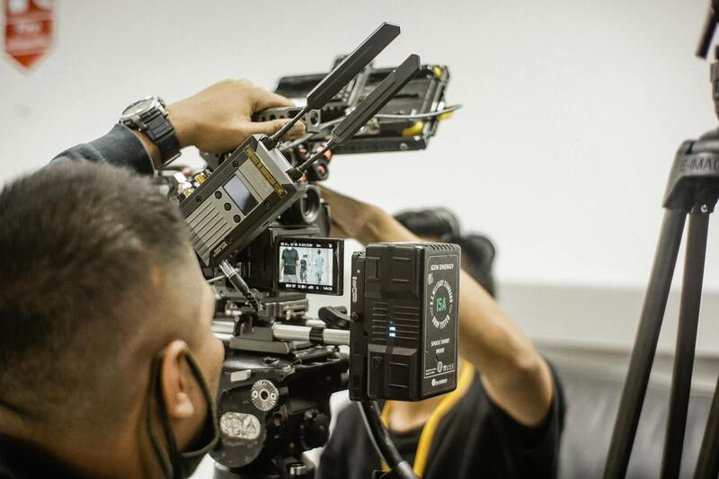
The foundation of effective drone photography lies in the use of advanced, certified drone hardware capable of capturing high-resolution imagery. These drones typically feature stabilized cameras, GPS-assisted flight controls, and automated flight modes, which facilitate precise positioning and smooth imaging. Choosing equipment that meets industry standards guarantees crisp, professional visuals that showcase a property’s best features.
Operators undertake rigorous training to ensure they can operate drones within the parameters of approved flight practices. This training emphasizes not only technical proficiency but also an understanding of airspace management, environmental considerations, and safety protocols. Certified operators are well-versed in executing complex flight plans that optimize angles and perspectives, bringing a property's unique characteristics to life.
Pre-flight planning is integral to the process. This includes conducting thorough site assessments to identify optimal shooting angles, lighting conditions, and potential obstacles. By obtaining official approval for flight paths, operators can minimize risks and ensure clearances are in place, particularly in densely populated or restricted zones.
Employing authorized flight planning tools and adhering to published maps and no-fly zone data facilitates compliance with regional guidelines and enhances safety. This practice further supports the procurement of necessary permits when required by official bodies, reinforcing the professionalism of the operation and assuring clients of the commitment to quality and legality.
Furthermore, integrating high-end editing software allows professionals to refine raw images, adjusting lighting, sharpness, and color balance to produce visually compelling listings. This combination of legitimate operational procedures and post-production enhancement ensures that each image adheres to the highest standards, captivating prospective buyers and elevating the property's marketability.
By relying solely on certified equipment, trained operators, and authorized processes, real estate agents can ensure that every drone photo executed within their marketing campaigns is not only striking but also compliant with official guidelines. The investment in legitimate methods bolsters credibility, fosters trust with clients, and results in more impactful property presentations that stand out in competitive markets like Miami.
Equipment and Technology for Real Estate Drone Photography
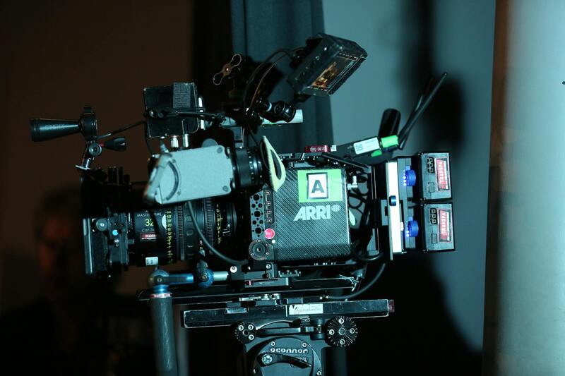
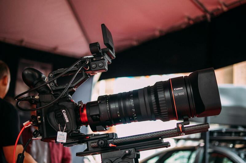
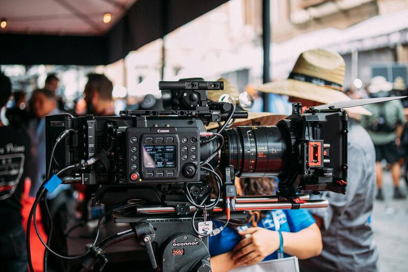
Choosing the right equipment is fundamental to producing standout drone photos for real estate. High-quality drones equipped with advanced stabilization systems ensure smooth, distortion-free images. These platforms often feature GPS-enabled flight controls, which facilitate precise navigation and positioning, crucial for capturing comprehensive views of properties and their surroundings. In addition, the integration of high-resolution cameras with large sensors significantly enhances image clarity, detail, and color accuracy, enabling potential buyers to visualize properties with exceptional realism.
Professional-grade cameras used in drone photography typically support interchangeable lenses, giving operators the flexibility to select focal lengths suited for wide-angle shots of entire estates or detailed close-ups of architectural features. For real estate applications, a combination of wide and ultra-wide lens options often proves most effective in showcasing both property exteriors and interior spaces through aerial perspectives.
Battery life and flight stability are additional critical factors. Advanced drone models offer extended flight durations, allowing for comprehensive coverage of large properties without interruption. Moreover, compatibility with remote sensing and obstacle avoidance sensors enhances operational safety and precision, helping operators to navigate complex environments confidently and keep ground-based obstacles at bay during flights.
Modern software integration plays an indispensable role in drone photography workflows. Pre-flight planning tools enable detailed mission setup, including altitude, waypoints, and camera angles, ensuring consistent and thorough coverage. Post-flight data processing software provides advanced editing capabilities, allowing professionals to fine-tune images, adjust exposure, and correct distortions to achieve optimal visual results.
Incorporating the latest technological innovations in drone equipment ensures high-quality output aligned with modern marketing expectations. Selecting suitable drones and corresponding camera systems tailored for real estate needs enhances the effectiveness of visual storytelling, ultimately attracting more viewers and potentiating faster property sales in vibrant markets like Miami.
Official Procedures for Drone Deployment in Miami Real Estate Photography
Utilizing drone technology for capturing real estate images demands adherence to established operational procedures to ensure safety and quality. Prospective drone operators and real estate professionals must implement protocols bridging technical capabilities with local standards. Prior to flights, comprehensive planning involves verifying airspace conditions, weather forecasts, and the specific flight path. Pre-mission assessments should include reviewing the property's layout to determine optimal flight altitudes and camera angles, thereby maximizing coverage while minimizing risks.
Depending on the scope of the project, obtaining necessary permissions from relevant authorities or property owners is essential. This process typically involves submitting a detailed flight plan that emphasizes safety measures, flight times, and operational boundaries, ensuring that drone activities integrate smoothly within the local environment. Additionally, considering the proximity to busy air traffic corridors or sensitive zones, such as parks or private estates, influences operational planning to adhere to prescribed flight corridors and altitude restrictions.

Selection of Drone Equipment Aligned with Official Guidelines
Choosing appropriate drone hardware and camera systems plays a vital role in compliance and image quality. High-quality, stabilized multi-rotor drones equipped with state-of-the-art imaging sensors are preferred for real estate purposes, ensuring clarity and detail in aerial shots. These drones often feature automated flight modes, GPS-enabled navigation, and obstacle avoidance sensors, which help maintain precise flight paths within permitted zones, reducing risks during operation.
It is advisable to utilize drones capable of adhering to predefined altitude thresholds and maintaining consistent distance from structures, aligning with operational standards. Extended flight times are advantageous for large properties or complex layouts, reducing the need for multiple repositionings. Detailed pre-flight calibration and regular maintenance of equipment, coupled with adherence to the prescribed safety and operational parameters, help ensure the seamless execution of professional projects.
Operational Considerations for Effective Drone Use
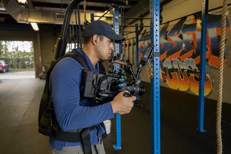
Effective drone operation in real estate imagery production involves more than just equipment selection. Structuring a safe flight operation requires a detailed flight plan that aligns with environmental conditions, property layout, and airspace management. Operators should conduct pre-flight inspections, including battery checks, sensor calibration, and obstacle assessments, to ensure the drone’s optimal performance during the shoot.
During flight, maintaining visual line-of-sight and monitoring the drone's behavior via remote pilot stations ensures real-time awareness of the drone's position, preventing unintentional intrusions into restricted zones or risky situations. Post-flight procedures include data backup, review, and initial processing to confirm the completeness of captures and identify any gaps for potential re-flights.
Official and Legitimate Methods for Drone Photography in Miami
To maximize the impact of drone photos for real estate, it is essential to employ approved and trustworthy methods of operation that adhere to local standards. These methods ensure the safety of both the operator and the public, as well as the quality of the captured images, contributing to a professional presentation that elevates property listings.
One primary method involves utilizing certified drone operators who have undergone comprehensive training and are familiar with Miami’s specific operational guidelines. These professionals possess the expertise to plan flights meticulously, considering factors such as airspace restrictions, weather conditions, and property-specific requirements. Employing certified operators not only guarantees skillful handling of the equipment but also aligns with established best practices for responsible drone use.
The use of approved flight planning software is another critical aspect. These tools assist in creating detailed flight paths that optimize coverage, minimize flight time, and avoid no-fly zones. They incorporate up-to-date maps and regulations, providing real-time feedback on potential obstacles or restrictions. This strategic planning helps in capturing comprehensive, high-quality images efficiently.
In addition, consistent pre-flight checks are vital. These checks include verifying battery levels, sensor calibration, and ensuring obstacle avoidance systems are functional. Maintaining current firmware updates on the drone enhances safety and performance, reducing the likelihood of technical issues during shoots.
Post-flight procedures such as systematic data management and backup are equally important. Proper organization of images ensures quick integration into marketing materials and facilitates seamless editing workflows. This methodical approach guarantees that only the best-quality footage is used to showcase properties.
Aircraft maintenance is another essential component. Regular inspections and servicing of the drone equipment prevent malfunctions and prolong operational efficiency. When combined with adherence to operational parameters like altitude restrictions and flight speed, these practices uphold high standards in real estate photography.
Employing such official procedures ensures that drone photography is conducted responsibly, delivering impressive visuals that attract prospective buyers, while maintaining a reputation for professionalism and safety within the Miami real estate market.
Legal and Regulatory Considerations for Drone Use in Miami
In Miami, the use of drones for real estate photography necessitates adherence to specific operational standards and guidelines. Registered operators are required to obtain certification from relevant authorities, ensuring they possess the knowledge to fly drones safely and responsibly. This includes understanding no-fly zones, altitude restrictions, and privacy considerations to prevent disturbances in residential and commercial areas.
Pre-flight planning is crucial, which involves assessing weather conditions, locating optimal flight paths, and identifying obstacles that could interfere with drone operation. Utilizing official airspace maps and real-time flight restriction notifications helps in maintaining compliance and avoiding inadvertent infringements on restricted zones.
Implementing strict flight protocols during shoots minimizes risks of property damage, personal injury, or flight interruptions. Maintaining clear communication with clients and team members ensures that all parties are aware of the flight plan and safety measures. Additionally, operators should keep detailed logs of flight activities, including locations, times, and equipment used, fostering transparency and accountability in the process.
Regular equipment inspections and updates also support compliance. Firmware updates enhance drone safety features and stability, while routine maintenance reduces technical failures mid-flight. Employing professional-grade equipment with integrated obstacle avoidance and GPS stabilization ensures high-quality imagery while adhering to operational standards.
Many local municipalities and agencies also publish guidelines for drone operations, emphasizing the importance of respecting privacy rights and avoiding interference with manned aircraft. Maintaining a respectful distance and avoiding flying over crowds or private properties without permission contributes to harmonious relations within the community. By following these official procedures, real estate professionals enhance their reputation, ensuring a smooth integration of drone technology into their marketing strategies.
Overall, professional drone operations in Miami are reinforced through proper licensing, diligent planning, and rigorous adherence to rules. This disciplined approach results in high-quality, legally compliant imagery that showcases properties effectively while fostering trust among clients and the community.
Legal and Regulatory Considerations for drone use in Miami
Operating drones for real estate purposes within Miami involves adherence to a set of officially established procedures designed to ensure safe and responsible use. These protocols encompass obtaining necessary certifications, such as drone operator licenses, which demonstrate compliance with local and federal standards. Registration of the drone itself with relevant authorities is often mandatory, particularly for devices exceeding specific weight thresholds, ensuring accountability during flights.
When planning aerial shoots, operators must submit flight plans that detail the intended locations, times, and altitudes, aligning with prescribed safety margins. Conducting pre-flight risk assessments helps to identify potential hazards, including nearby structures, power lines, or busy public areas. Keeping comprehensive logs of all flight activities—covering GPS coordinates, weather conditions, and equipment used—supports transparency and accountability in every project.
Consistent maintenance and calibration of drone equipment are vital components of compliant operation. Regular inspections help detect wear and tear, while firmware updates keep safety features current and improve performance. Employing professional-grade drones equipped with obstacle avoidance, GPS stabilization, and fail-safe mechanisms minimizes risks during flights, particularly over complex property landscapes.
Following established airspace rules involves maintaining appropriate distances from airports and manned aircraft, avoiding flying over crowds or private property without explicit permission, and refraining from capturing images that could infringe on privacy rights. Many official guidelines emphasize respecting community standards and local ordinances, which contribute to fostering positive relations with residents and authorities alike.
It is crucial for real estate professionals to stay informed about any updates or changes to drone operation policies within Miami. Regular training and certification renewals help operators stay current with evolving requirements. By incorporating these structured procedures into their workflows, real estate agencies can confidently leverage drone technology, ensuring high-quality visuals are produced responsibly and effectively.